1989 aerial photograph key map
- PUB-: PD 2578
- Item
- May 1989
Part of City publications collection
3 results with digital objects Show results with digital objects
1989 aerial photograph key map
Part of City publications collection
[Block outline plans showing building perimeters]
Part of City publications collection
Includes: Fairview (1974, 1978), False Creek Basin (1987, view A), False Creek Basin (1987, view B), Grandview-Woodland local area (1982), Hastings Sunrise (n.d.), Kensington N.I.P. area (1977), Kitsilano (1974), [Marpole] (n.d.), Marpole (n.d.), Mount Pleasant (n.d.), [Mount Pleasant] (1982), Riley Park N.I.P. area (1976), [Shaughnessy] (n.d.), Strathcona (n.d.).

City of Vancouver : land use 1984
Part of City publications collection
Item is a map showing types of residential, commercial, industrial, and recreational land use in Vancouver.

Part of City publications collection
Part of City publications collection
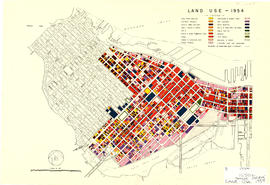
Item is a map showing land use for single family, two family. and multiple family dwellings, tourist courts and cabins, hotels, offices and other commercial uses, stores, parking and commercial lots, service stations, warehouses and storage yards, light industrial, heavy industrial, public and semi-public buildings, public utilities, schools, open spaces, and railroads and docks.
Part of City publications collection
Part of City publications collection
Part of City publications collection
Zoning sectional maps : including landscape setbacks and building lines
Part of City publications collection