![[Wooden structures and equipment next to stream]](/uploads/r/null/a/4/a4452e61e0c184a2f02aa47f71e3993060d891e255351caa117c4f5dfe2a729d/e1f7eeb2-a768-4a93-a888-1c624e4b0484-A04826_142.jpg)
[Wooden structures and equipment next to stream]
![[Winch and other equipment on partially cleared hillside next to stream]](/uploads/r/null/e/b/eb3a96fa99d7181ff135f9d0fbeebbbb09183021f6ea49251ebb32952766408f/7e69b736-8956-43ff-8a4a-751335b13ad1-A04825_142.jpg)
[Winch and other equipment on partially cleared hillside next to stream]
![Where the engine left the track 3 miles above Keefers [at Grasshopper trestle bridge]](/uploads/r/null/9/3/939dc62933962fdc80144e5e9ce01cc8cf0d38206027515a39d32bb66857530e/6f6faa78-1cee-42ad-b14e-609fca1657a3-A25454_142.jpg)
Where the engine left the track 3 miles above Keefers [at Grasshopper trestle bridge]
![Wagon Road looking down [Fraser River]](/uploads/r/null/d/3/d31f33f3f68e921c25dc34269c92a6bbaa05550c337ff84c66b4e5640adc5d0d/6dbaba4f-967d-4271-857e-3299e25f0212-A19680_142.jpg)
Wagon Road looking down [Fraser River]
![[Views of] Little Qualicum Falls, Vancouver Island](/uploads/r/null/c/3/c3bfd3ab42c5135d18ea82a298041d4c817cc59be2e43d6c9fceccbb3cfd9382/b093279c-d2bd-4407-b0f3-c13525069f21-A06926_142.jpg)
[Views of] Little Qualicum Falls, Vancouver Island

View toward Lytton from grade 2 miles below
View on Ottertail River
![[View of Vermillion River in Kootenay National Park]](/uploads/r/null/c/8/c8c364673e8a2c868a3312f032dd999c535c7afcb0dbe8035ae094b950e597c1/5a6c5f94-1058-4309-8353-804ffaa118f1-A34133_142.jpg)
[View of Vermillion River in Kootenay National Park]
![[View of unidentified mountains]](/uploads/r/null/e/f/efb1697a6051b77827fc10445a5769fb9851b88bcc80ba829643174b0c3896fa/ce89e2ee-33cf-4cfe-9c4d-797b9ce64013-A50478_142.jpg)
[View of unidentified mountains]
![[View of the Thompson River east of Lytton]](/uploads/r/null/b/5/b57bdc9554f4c089b187d1c5f5b233acbf931272e64dad2a0b54dd28040149cf/21978601-2e31-4d42-983f-3d601c619e55-A33843_142.jpg)
[View of the Thompson River east of Lytton]
![[View of the Oak Street, B.C. Electric and Middle Arm bridges]](/uploads/r/null/8/d/8d4f4dea792a3128229aecfd55a12d3a3432476462ad8cd9991e1ebb16cae075/62c52137-d9af-48bd-a8bc-2a12293b382d-A24441_142.jpg)
[View of the Oak Street, B.C. Electric and Middle Arm bridges]
![[View of the Marpole rail and highway bridges]](/uploads/r/null/3/9/39d081635b9fd32192951910755276ab7921e8ca55e3206da51189c0b65a8080/015c04a5-11d7-4d15-95ab-e794ef8e9f32-A24442_142.jpg)
[View of the Marpole rail and highway bridges]
![[View of the Fraser River and Hope Mountain]](/uploads/r/null/2/b/2b2b39eaeb5e45208b13e02bd5e8574cea233047ebebbe08b8e85d258da6a469/a09129e9-56fe-44c1-9b3d-dd9af1ef3612-A31717_142.jpg)
[View of the Fraser River and Hope Mountain]
![[View of the C.P.R. Salmon River (Nahatlat) Bridge]](/uploads/r/null/0/9/097a0f7bb11951a512d36f2776cccf3f322ae5d5463104dfedbef9b6a2d8a333/50b2ea02-5c7b-4a3d-9ae4-f4b97debb757-A26914_142.jpg)
[View of the C.P.R. Salmon River (Nahatlat) Bridge]
![[View of suspension bridge near Spuzzum]](/uploads/r/null/1/7/17226c8f9fc5f664ee13d2ee521c49eda9a2fa5bc7a8d333b6e5ba0e9fee8712/512f6a3c-cb3f-4bae-ac80-632d0295ef92-A26802_142.jpg)
[View of suspension bridge near Spuzzum]
![[View of rocks blocking the salmon run at Hell's Gate]](/uploads/r/null/c/f/cf3334eb6d4d84c802639d8230199c85c76ace3e3620e7b0aab2185a4456ed3f/778fd93b-e458-47c3-82ce-6567ffe56fe3-A26846_142.jpg)
[View of rocks blocking the salmon run at Hell's Gate]
![[View of river bank and the mouth of the Indian River]](/uploads/r/null/5/7/57a6e8943fe56edf1c972fc1d8656c0d837ab9f77b754bad48b955356fa7a000/55e777d0-b314-49b5-96eb-b3ed75f83ca8-A63532_142.jpg)
[View of river bank and the mouth of the Indian River]
![[View of river]](/uploads/r/null/f/c/7/fc742a9e6d8ea21d4e9d67909bf3120c86459ffafbc1916bab9243537a4a64d9/9255d015-0ec2-4f13-84b5-dd14e561a80c-CVA260-1114_142.jpg)
[View of river]
![[View of Oak Street, Marpole rail and highway and Middle Arm bridges]](/uploads/r/null/4/1/4199f99a2a9078cbea68581cb0c930996461009cc1719feede4e449ea5a2379d/94cbe073-4e30-45d0-baea-1b0cb58d69b4-A24443_142.jpg)
[View of Oak Street, Marpole rail and highway and Middle Arm bridges]
![[View of] mountains taken from train](/uploads/r/null/3/1/a/31add336c955d17ceb8029a02b5878f5d551c4ea1dc9a3b163c783593a503ad6/78deef0a-80fe-46d2-8c0b-731e4d4c93e4-CVA260-1637_142.jpg)
[View of] mountains taken from train
![[View of houses on the shore of the Fraser River]](/uploads/r/null/b/1/b1d1f5181fbc2c678f873cc1c60e655ceef8a5a89b89824a7a95e37f011c2c2d/86fe2b94-5f5c-47d8-ab73-6092fe2d4917-A03875_142.jpg)
[View of houses on the shore of the Fraser River]
![[View of Hell's Gate]](/uploads/r/null/2/f/2fdf4fa5f2dd7e7537a8b7942a8f36ef4df55aa37ee3e9b7e4e0e9ba1b2c2b04/47b402d5-cfe3-453c-97f5-e5d8ceeb72f1-A33642_142.jpg)
[View of Hell's Gate]
![[View of Harrison River near Harrison Hot Springs]](/uploads/r/null/9/4/94b928746a578d840c93a737853290befdee31bf36e4d7bba6a178fb2a7e02fa/b6ef2abc-d969-4772-a06a-00f038150bdd-A60333_142.jpg)
[View of Harrison River near Harrison Hot Springs]
![[View of] Fraser Canyon [and River]](/uploads/r/null/2/8/28e9aec4f23f713eca8b4d1f8223ba4322de4b8b6b9b5c3f159df842b02b60cb/3b5d80a4-df70-44e9-a806-be893e3c0b12-A14541_142.jpg)
[View of] Fraser Canyon [and River]
![[View of Cayoosh and Seton Creeks and Ample Mountain near Lillooet]](/uploads/r/null/5/7/57181e6ec6ec75550f5d52bf724b69c60ab23fb3e184c18707445f8ec0d83316/e07e6929-4ef7-44e8-8cd8-1259f4fc8030-A33603_142.jpg)
[View of Cayoosh and Seton Creeks and Ample Mountain near Lillooet]
![[View of buildings and bridge on the Fraser River]](/uploads/r/null/7/4/74051ac09bcab916e8a33c90775599c7e10609ccb2b17e11f0ad4048ebc599f0/07aab44f-1ec3-42c5-ac04-310d54c11cc6-A03874_142.jpg)
[View of buildings and bridge on the Fraser River]
![[View of a stream]](/uploads/r/null/1/7/174b6340e1b5afc241eeff8b60db572609019d8740fe546ebf3f5986ee949f65/8209c34b-adaa-481b-b1b3-8e610f2886af-A36256_142.jpg)
[View of a stream]

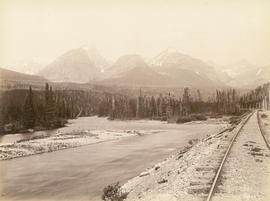
View of a river with mountains in the background
![[View of a powerhouse on the Illicillawaet River]](/uploads/r/null/7/0/706632d3b13dbcbc9e02110652a6e158c0fe0cea7d8195270edeaae2a74d330f/ab00bccd-229b-4018-8e11-356d3089e276-A26810_142.jpg)
[View of a powerhouse on the Illicillawaet River]
![[View of a crew attempting to unblock the salmon run at Hell's Gate]](/uploads/r/null/a/f/af15d7018703d571391ed510d7c83964274b8c1816e39958d75250dff26d5652/75b6a81f-65c1-465f-8d0e-1134c397f2de-A26847_142.jpg)
[View of a crew attempting to unblock the salmon run at Hell's Gate]
![[View of a canyon from a C.P.R. train]](/uploads/r/null/e/9/e949ed24fbba41ac9599b565d20e487e2fb05725e1138ade99a6b4f85a477dae/4cd01f99-3e8c-47f2-a83b-c4d15060cd4b-A33117_142.jpg)
[View of a canyon from a C.P.R. train]

View from rocks above Fraser Bridge
![[View from] P.G.E. [Railway of the] Fraser River Canyon](/uploads/r/null/5/a/5a4b4ea0f1a5c8248cebd14a9e76626bd64e612e69070364c48ce4588e64dbaa/968596ce-9e92-4866-a6d4-bb3faa2800e8-A76298_142.jpg)
[View from] P.G.E. [Railway of the] Fraser River Canyon

View four miles east of Revelstoke
![[View across the Cheakamus River towards the mountains]](/uploads/r/null/f/b/2/fb2061514c29a05992f19857b6f81130406e8e49b0f039ba1607da10e2abf45e/0c5e67cf-f039-436a-ac05-61fde899cc78-CVA260-121_142.jpg)
[View across the Cheakamus River towards the mountains]
![[View across the Cheakamus River towards the mountains]](/uploads/r/null/1/b/f/1bfc2f2ef13384f07cb3188d763be1fdedb24c025cfadcb556fd2db050e60758/15df1a1f-017d-495e-a246-9d9b2251e04d-CVA260-122_142.jpg)
[View across the Cheakamus River towards the mountains]

Vedder River
![[Various sites in the Rocky mountains]](/uploads/r/null/2/7/27fc60badd08d42091596cb56f0d74aa6fc6269f2a08409224263c5e0ba34121/e25f932c-c2b9-4f26-9a51-74fdbd5fa0c0-A08097_142.jpg)
[Various sites in the Rocky mountains]

Upper Falls, Kootenay River, B.C.
![[Unidentified slough]](/uploads/r/null/e/4/3/e43221da962edf794dce91eee88b14bdd6a9d52d131e959ac065740f79e20755/854a8714-e582-4485-8219-af340b47203a-CVA260-1120_142.jpg)
[Unidentified slough]
![[Unidentified settlement beside a river]](/uploads/r/null/0/c/f/0cf03c243d0e847a9c80fd3862ce47e9c24fa2b6661d8c71d003b75708f81a68/8c2304b0-e69d-4058-999c-53e229cbe8c7-CVA260-1838_142.jpg)
[Unidentified settlement beside a river]
![[Unidentified river valley in dry belt of interior]](/uploads/r/null/b/b/bba069a1122515612a5375b0e8293c4c3af39a16377a3e1dabdec96ef695047c/12fe30b0-15b6-479d-8930-1d24384154c5-A50006_142.jpg)
[Unidentified river valley in dry belt of interior]
![[Unidentified river through canyon]](/uploads/r/null/7/1/9/719ed0634b0e31b09015fe33c6bbc54bfe23388cbb866f7924dc01055e6ccaeb/0e6ae1fb-13c5-4925-bca4-c2f4d793ecf1-CVA260-1100_142.jpg)
[Unidentified river through canyon]
![[Unidentified river]](/uploads/r/null/7/c/7c465b50b08cfd44562abb76b326c4efd82b3a673e847a8c02767c311953734d/ef224504-23a8-4f79-8acd-6a3fb737a663-A19634_142.jpg)
[Unidentified river]
![[Unidentified river]](/uploads/r/null/c/5/4/c54a0cae65f81585c918313941e7ee1ff73d399bca8a684417488af85b1fcade/78072837-abd4-45eb-bbe5-cfc28c774f2c-CVA260-1108_142.jpg)
[Unidentified river]
![[Unidentified river]](/uploads/r/null/4/8/3/48395d67a8bbac8cd687f3641a99af4c541b87f707afb9cfc801adc328548b6f/178c1f6c-9fc9-4cc6-bfe6-f4ce639378e3-CVA260-1111_142.jpg)
[Unidentified river]
![[Unidentified river]](/uploads/r/null/4/3/43c76914528b5028b8df887555e3b9ab5d9313175072c95841bbf9dee71ba782/fe0b94e1-31a0-45f6-9f8e-ed3002cc87dc-A19635_142.jpg)
[Unidentified river]
![[Unidentified river]](/uploads/r/null/2/e/7/2e717f377f23cfef4de23ac8e46b7365f1e9d712ddf2098584e0d7235eec246b/061d620a-72f3-45fd-a505-fa0b89905588-CVA260-1841_142.jpg)
[Unidentified river]
![[Unidentified river]](/uploads/r/null/f/4/3/f43a2a2352479b03d0b2c7acf37adae2dff82fb88d9cd1708070508eefbf6135/c0be83c6-555c-4434-a2c4-b0f4720bc81d-CVA260-1101_142.jpg)
[Unidentified river]
![[Unidentified river]](/uploads/r/null/1/8/a/18a9f5eabea9013b82f14fb9355b00ae43663c3694d51918392aa414a97d9da6/1545d823-f856-47ca-bb5a-a2355e40d6fe-CVA260-1104_142.jpg)
[Unidentified river]