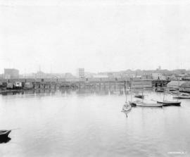
![Live aboard boats Van[couver] Harbour](/uploads/r/null/1/8/18256dcc44ce8ee821cf0596c7b8cfaed9f1e50d760af6088adfd6323d878b3d/d92aa9ea-8969-4fc4-bfd4-3996a829c822-A59826_142.jpg)
Live aboard boats Van[couver] Harbour
- COV-S511---: CVA 780-804
- Item
- Feb. [19]77
Part of City of Vancouver fonds
Photograph also shows buildings downtown
199 results with digital objects Show results with digital objects
Live aboard boats Van[couver] Harbour
Part of City of Vancouver fonds
Photograph also shows buildings downtown
![Marina, Vanc[ouver] Harbour](/uploads/r/null/0/4/04033fe768c44267a675e5e6c027d7483b671d817668ff5ef3ee4a281ea1be9b/12f48c6c-adff-414f-b6b8-439ccdcf73a4-A59827_142.jpg)
Part of City of Vancouver fonds
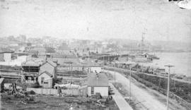
![C.N.R. Pier at Main St[reet] view to East](/uploads/r/null/c/d/cdbc948a1e80a0e86f7c055d1d00d5de4b7775b1a0619918a019cbffeec949e3/908433d2-8391-4308-ace0-d850830623f1-A59832_142.jpg)
C.N.R. Pier at Main St[reet] view to East
Part of City of Vancouver fonds
![Streets [102 of 139]](/uploads/r/null/d/8/d8b236429fc8eb17b46493c92394e634ddf55b224a219ac6b47f8bb76d404712/bdd3015c-3ef6-40be-8c22-1e40fec3f447-A64345_142.jpg)
Part of City of Vancouver fonds
Image shows the bay in Stanley Park with birds.
![Burrard Viaduct Construction [1 of 10]](/uploads/r/null/2/7/2788a9638050d7cbfc021e29977d956f423fe6048bb7c29c035ea57bda6dd66c/5df17b4f-3ebf-4f8d-ac21-de11bd89033f-A66652_142.jpg)
Burrard Viaduct Construction [1 of 10]
Part of City of Vancouver fonds
Building of Burrard Viaduct with Coal Harbour in the background, including part of Deadman's Island and a floating fuel station on the left and the mountains beyond.
![Burrard Viaduct Construction [8 of 10]](/uploads/r/null/1/5/1576a1835424b279c464d30bda8a38c8692e090e5ddb14622b234bf70994bea0/fe0c75df-a5b8-4c9b-a0f8-ab257e381e57-A66672_142.jpg)
Burrard Viaduct Construction [8 of 10]
Part of City of Vancouver fonds
Image shows view of ramp west of Burrard.
![Burrard Viaduct Construction [10 of 10]](/uploads/r/null/1/f/1feb3308ec3074da234277c232c771cbc21268c6c18cb278a844a9bc4fce07f4/cb3c6a4b-0bc3-4517-a35a-ed34c7f38768-A66674_142.jpg)
Burrard Viaduct Construction [10 of 10]
Part of City of Vancouver fonds
Image shows Dunsmuir Tunnel north portal.

Aerial photo, oblique, CPR docks in foreground, looking south Granville Street at centre
Item is a photograph of the Vancouver waterfront, looking southwest down Burrard Street, showing the waterfront and downtown Vancouver, including Waterfront Station, Hotel Vancouver, Marine Building, Burrard Bridge, Granville Street Bridge, and the city beyond.

Vancouver, B.C. from Deck of Incoming Steamer
![Trade and Convention Centre [3 of 6]](/uploads/r/null/4/f/4f29433598246fbd85ec24377fa71080d3cde6a9f51153e58d9e02f79d226bc1/63e44a4b-061c-4a5d-a3ac-146ba1e94814-A66832_142.jpg)
Trade and Convention Centre [3 of 6]
Part of City of Vancouver fonds
![Trade and Convention Centre [5 of 6]](/uploads/r/null/a/4/a4ef9e4fb8a3c90de09aaff32ed6f173ff12948c5620b6cec0ac022d5bffdfc3/108d1650-8a33-4f81-a824-f9ada351c9fa-A66834_142.jpg)
Trade and Convention Centre [5 of 6]
Part of City of Vancouver fonds
Image shows partial view of the Trade and Convention Centre.
![Waterfront Viaduct Construction [2 of 11]](/uploads/r/null/7/b/7b508cf464ba9a0e863b133b981b8e0d0a08898814b8ac078fd77e612b8afb9d/a992aab2-7ffe-404a-8f8c-0a4449a62da2-A66657_142.jpg)
Waterfront Viaduct Construction [2 of 11]
Part of City of Vancouver fonds
Photograph shows the Canadian Pacific Railway Station.
![Waterfront Viaduct Construction [4 of 11]](/uploads/r/null/c/c/cc6ef3e507425de63a30a19f97105563e03d4def386679da3c430530f518a2b5/6fe8d857-5ba7-4162-8da7-d67370ff2225-A66659_142.jpg)
Waterfront Viaduct Construction [4 of 11]
Part of City of Vancouver fonds
Photograph shows a view looking east on Cordova Street, the Canadian Pacific Railway Station and the Woodward's tower.
![Waterfront Viaduct Construction [6 of 11]](/uploads/r/null/c/c/ccc82e693fbbf4e30d77fb2748e694474b24cbbf25b24776cba5a19d7124dd97/c22197ef-965f-46c9-a97c-cf2c99ed450b-A66661_142.jpg)
Waterfront Viaduct Construction [6 of 11]
Part of City of Vancouver fonds
![Waterfront Viaduct Construction [8 of 11]](/uploads/r/null/7/d/7d5aa6e7c4b7e86721688fe63368eb0db52f69e9765d74719ae3d323772163c2/e4cd15d2-143d-4efc-bec9-b76b0b0a29c7-A66663_142.jpg)
Waterfront Viaduct Construction [8 of 11]
Part of City of Vancouver fonds
![[Distant view of Vancouver from the water]](/uploads/r/null/c/7/c75d1d5531d3158899d39ef431aed51a206558453d7853a0dc9b55c108b4a24c/9717d680-7228-4d3a-bba0-95f373c577d6-A23888_142.jpg)
[Distant view of Vancouver from the water]
Part of Major Matthews collection

Part of Major Matthews collection
Panaoramic view showing C.P.R. Pier D and Downtown in the background
Part of Major Matthews collection
Photograph shows the waterfront between Columbia Street and Carrall Street including shacks on floats, the Oppenheimer warehouse, a C.P.R. trestle, the Dunn-Miller Block, the Sunnyside Hotel and Andy Litton's boats
Part of Major Matthews collection
Photograph shows a view looking west along Alexander Street

Part of Major Matthews collection
![[Looking east from the bluff near the foot of Howe Street]](/uploads/r/null/5/5/5537f72daeab55074b4c663dae9afe1b2868ad2b8a27bfabce92ba0e2cd35f10/17cdbde0-bfd0-48c0-8592-1e430be93907-A43309_142.jpg)
[Looking east from the bluff near the foot of Howe Street]
Part of Major Matthews collection
Photograph shows part of the C.P.R. wharf, the proposed C.P.R. station site and Princess Louise tree in the background
![[Looking north across False Creek from 8th Avenue between Alder Street and Spruce Street]](/uploads/r/null/b/f/bfbfdda073909ac3a8b7fe81c7d8a986770772ac8fdcfef25af14dca17a87a19/d7b8ac67-cd53-4df6-a8a2-3c59dcd146d8-A43223_142.jpg)
[Looking north across False Creek from 8th Avenue between Alder Street and Spruce Street]
Part of Major Matthews collection
Panoramic view showing Yaletown and the Fader Brothers sawmill
![[View of Vancouver from Brockton Point]](/uploads/r/null/f/a/faccb7ffd8899c4575efbc7fe8526b052ad52e140d1082bc00fa5a5d1597f7ea/be2271a1-9a6b-42f5-b151-9b6fa29ce75f-A43379_142.jpg)
[View of Vancouver from Brockton Point]
Part of Major Matthews collection
Photograph shows an Imperial Oil Company gasoline scow
![[View of Vancouver waterfront from Burrard Inlet]](/uploads/r/null/8/6/867ebe14148c0b2fe1ca7ae884388a496e86eae663438a52522b816fac615f38/5b082462-c342-442f-8086-6e698bbd22e1-A08330_142.jpg)
[View of Vancouver waterfront from Burrard Inlet]
Part of Major Matthews collection
Photograph negative shows, side by side, two photograph prints of ships and buildings at waterfront. J.S. Matthews' notes with print or negative in Archives.
![[View of Downtown from the harbour]](/uploads/r/null/6/0/60145febe38e6832df08142338a24df3c4ab5727db53fcfce085325410d536b2/cd6f4150-c595-4b60-86cd-046e48c8fdf8-A43306_142.jpg)
[View of Downtown from the harbour]
Part of Major Matthews collection
Photograph shows the Marine Building and the Hotel Vancouver
![[View of rooftops and buildings northeast of Granville and Georgia Streets]](/uploads/r/null/a/3/a3e9d2479ff68c1c91db1f6fec01a0aa88fa9c31b79c65c12f61a1ff3f6d4b53/05c17b9b-d39d-4c64-8a37-bff8e26363de-A07929_142.jpg)
[View of rooftops and buildings northeast of Granville and Georgia Streets]
Part of Major Matthews collection
![[View of Spratt's Oilery]](/uploads/r/null/3/1/317c76a2e0072e40347023a1723d05688215452eec607e96e71c43c077ff9e63/7150ded4-cdbe-4238-9398-066acbca1cb8-A24570_142.jpg)
Part of Major Matthews collection

Part of Major Matthews collection
Panoramic view from Burrard Inlet showing the World (Sun) Tower under construction

Part of Major Matthews collection
Photograph shows a southwest view from Hastings Sawmill wharf
![[Canadian Pacific Railway yard, Pier D, ships and waterfront]](/uploads/r/null/4/0/40723795358f5b22b8659eaf69c6e435c53d5fedc4f43e3c463ae96b8700c6f1/47c6f457-b958-4bb6-af35-0e56071bab26-A63442_142.jpg)
[Canadian Pacific Railway yard, Pier D, ships and waterfront]
Part of Major Matthews collection
Photograph also shows a vehicle ferry crossing the inlet.
![[Eastern view of Vancouver's waterfront]](/uploads/r/null/e/6/e6c8b31b7f9fdcdb39ea15c2f8c416643495406655370ab1b0674baefc887af3/c5f54d6e-fafc-4db5-840f-ee6af9f443ec-A43370_142.jpg)
[Eastern view of Vancouver's waterfront]
Part of Major Matthews collection
Oblique view showing Ballantine Pier, Buckerfields, the Second Narrows (cantilever) Bridge and the North Shore in the background

Photograph shows railway cars, waterfront buildings, docks, ships, and Stanley Park and the North Shore in the background.
![[View of downtown Vancouver and waterfront from above, showing Marine Building under construction]](/uploads/r/null/8/6/86680d24afa6725e26cf86f7f036e9815677dd146b76bc60b8f6ca6d82e69d2c/3adf3f30-5dd9-4268-871f-b68de7c89733-A02521_142.jpg)
[View of downtown Vancouver and waterfront from above, showing Marine Building under construction]
Photograph shows buildings, waterfront, and part of Stanley Park, looking north west.

Looking up Harbour from Stanley Park
Part of Walter E. Frost fonds
![Old Granville Bridge [being demolished]](/uploads/r/null/a/c/acad946ba127693849963e9a8d02ea3fa1bd3356e372885756474042193b0202/5ce65475-ac21-4c3f-9280-715aab4fdc06-A21670_142.jpg)
Old Granville Bridge [being demolished]
Part of Walter E. Frost fonds
Photograph shows Granville Island, Watkins-Winram Ltd., Spear and Jackson Ltd., Tyee Machinery Co. Ltd., and part of the new Granville Bridge.
![S.S. Somersetshire [at dock]](/uploads/r/null/e/0/e021c47990e4da874be2f06d4a04be1c361b442147e4534f0914ded6528554af/5896fd8d-c71c-402f-b490-8b3269deec55-A30198_142.jpg)
Part of Walter E. Frost fonds
![Sea Island, mouth of [north arm of] Fraser River at Marpole, photos taken for R.M. Grauer](/uploads/r/null/b/0/b0f85e3b55b528e064c69c84c4614d3565eddcaf364a1b4aaafb7768ae1f73c7/3e38bd07-1db6-45a8-8894-a3bed3d5034d-A01180_142.jpg)
Sea Island, mouth of [north arm of] Fraser River at Marpole, photos taken for R.M. Grauer
Part of Stuart Thomson fonds
![Sea Island, mouth of [north arm of] Fraser River at Marpole, photos taken for R.M. Grauer](/uploads/r/null/6/1/61d7efb9b6bc26f862a433aaba5a5e683c5b39f036e21f47da1a53bbdfae8cbc/b769a960-aee3-4cf7-be77-4c24708e0ab7-A01181_142.jpg)
Sea Island, mouth of [north arm of] Fraser River at Marpole, photos taken for R.M. Grauer
Part of Stuart Thomson fonds
Nine O'clock Gun, Stanley Park
Part of City of Vancouver fonds
item show the Nine O'clock Gun and plaque in Stanley Park, Vancouver.
![Prototype LRT Vehicle [9 of 11]](/uploads/r/null/0/2/026e9914a0e11340fd75e67af7d7f7ff71c2de03832f88226475593465ab4686/802a92fe-ae18-482d-b98e-2a6b81133b14-A64317_142.jpg)
Prototype LRT Vehicle [9 of 11]
Part of City of Vancouver fonds
![Miscellaneous [100 of 130]](/uploads/r/null/9/6/96c1c4dd25b6c7ba6a6479652806ad75cfe399d921c9b767bb0a128fdf932a6d/8abff136-b7ad-47bd-b4f5-0ee521b9b288-A67532_142.jpg)
Part of City of Vancouver fonds
![Miscellaneous [102 of 130]](/uploads/r/null/c/2/c2f4499f0e77383c330e21ed2f341200fa771698e5a42ef58229230e3ffa00ef/28190a65-a694-431a-b5a9-90d2046a600f-A67534_142.jpg)
Part of City of Vancouver fonds
![Miscellaneous [118 of 130]](/uploads/r/null/5/7/57403a1f4476c4a743cde572f646f29ae76d74f0efe6c90a7b2b5c5a33013fd9/3849ebe1-cc8a-4342-826c-f8c2a4387bd5-A67550_142.jpg)
Part of City of Vancouver fonds
Item is a photograph showing Coal Harbour with the Shell marine fuel dock in the foreground and a cruise ship, a float plane and downtown buildings in the background.
![S.S. Frederich Luckenbach [at dock]](/uploads/r/null/e/4/e47504edaca749971383f41c2bbee4349166f08feef4cee824ee75a9d55d1702/730a68eb-7dbf-4536-8048-128515f008ae-A29460_142.jpg)
S.S. Frederich Luckenbach [at dock]
Part of Walter E. Frost fonds
![S.S. Manila Maru [at dock]](/uploads/r/null/9/7/97329115d37a2178a7bce3df325e4703e1468308523de2bb28b07197c99e0fd2/e426e5c5-ea33-481e-9e03-010c4f5d0ed9-A29762_142.jpg)
Part of Walter E. Frost fonds
![S.S. Nitinat [at dock]](/uploads/r/null/1/e/1e1d42a9b107a917273527f4e20da13aaaeb913040ada5e4352bb8290e16e8b7/18e323bf-0a39-4ee1-aa1c-5c9a97c7dda4-A29860_142.jpg)
Part of Walter E. Frost fonds
![Barge [and] Vancouver sky line](/uploads/r/null/8/f/8ff5d35b3ba17768ab38a2181b76e469ae277a943e748f46685af78cff5f884c/625c0fa9-676a-4da5-b3b7-d8b8b671cdfd-A05485_142.jpg)
Barge [and] Vancouver sky line
![[Four-man scull on the south side of Coal Harbour]](/uploads/r/null/7/4/744e726d588f513165ad995487dd0f77c7775283b7e27264647633458baa6751/a738f7dd-187a-41ee-8be2-f4d7f812aeb8-A20577_142.jpg)
[Four-man scull on the south side of Coal Harbour]
Part of James Luke Quiney fonds
![[Vancouver waterfront]](/uploads/r/null/4/2/4286d0ce78b827ead4cf9932ce4251ffb03e68e8387f85f3a39b1dca8203d12b/ca304de4-b1ce-43fa-9bdb-0c9ad361e644-A20506_142.jpg)
Part of James Luke Quiney fonds
![[View of Vancouver from Brockton Point looking south east]](/uploads/r/null/5/9/59153f2e3f846b9d04c3b891521678d16878ad94fd5799f9580eea052045a694/4d51cea1-fc5b-43f2-ac1a-69fc3c2412f9-A20572_142.jpg)
[View of Vancouver from Brockton Point looking south east]
Part of James Luke Quiney fonds