
- AM1594-: MAP 1059
- Item
- 1968
Part of City of Vancouver Archives technical and cartographic drawing collection
Item is a map in the form of an aerial photograph which has been annotated to show landmarks, tourist sites and trails in Stanley Park.
263 results with digital objects Show results with digital objects
Part of City of Vancouver Archives technical and cartographic drawing collection
Item is a map in the form of an aerial photograph which has been annotated to show landmarks, tourist sites and trails in Stanley Park.

Part of City of Vancouver Archives technical and cartographic drawing collection
Map is a City Engineering Department base map of Vancouver, showing city blocks and Canadian Pacific, Canadian National and Great Northern Railway lines. Parks, golf courses, hospitals, schools, theatres and other structures are identified. "Metric Vancouver" and "Guide Map 15" appear in the bottom right corner of the map.

Part of City of Vancouver Archives technical and cartographic drawing collection
Map is a City Engineering Department base map of Vancouver, showing city blocks and Canadian Pacific, Canadian National and Great Northern Railway lines. Parks, golf courses, hospitals, schools, theatres and other structures are identified. "Guide Map 15" appears in the bottom right corner of the map.

Part of City of Vancouver Archives technical and cartographic drawing collection
Item is a copy of a map of Vancouver which has been hand annotated. The annotations appear to relate to proposed revisions to the street network, including major streets to be widened and new major street connections.
Vancouver (B.C.). Engineer's Office

Sheet 4 : Slocan Street to Boundary Road and Seventh Avenue to Seventeenth Avenue
Part of City of Vancouver Archives technical and cartographic drawing collection
Item is a section showing the area from Slocan Street to Boundary Road and Seventh Avenue to Seventeenth Avenue. Includes streets and roads, blocks, lots, legal descriptions, railways, parks and schools.

Sheet 5 : Slocan Street to Boundary Road and Seventeenth Avenue to Twenty-ninth Avenue
Part of City of Vancouver Archives technical and cartographic drawing collection
Item is a section showing the area from Slocan Street to Boundary Road and Seventeenth Avenue to Twenty-ninth Avenue. Includes streets and roads, blocks, lots, legal descriptions, railways, parks, schools and the Vancouver Preventorium (for tuberculosis patients).
Vancouver (B.C.). Office of the City Engineer

Sheet 7 : Clark Drive to Slocan Street and Seventh Avenue to Eighteenth Avenue
Part of City of Vancouver Archives technical and cartographic drawing collection
Item is a section showing the area from Clark Drive to Slocan Street and Seventh Avenue to Eighteenth Avenue. Includes streets and roads, blocks, lots, legal descriptions, railways, parks and schools. Some annotations have been made in green ink.
Vancouver (B.C.). Office of the City Engineer

Sheet 13 : Ontario Street to Clark Drive and First Avenue to Sixteenth Avenue
Part of City of Vancouver Archives technical and cartographic drawing collection
Item is a section showing the area from Ontario Street to Clark Drive and First Avenue to Sixteenth Avenue. Includes streets, roads, blocks, lots, legal descriptions, railways, parks and schools. Includes B.C. Electric Railway car barns.
Vancouver (B.C.). Office of the City Engineer

Sheet 14 : Main Street to Knight Street and Fifteenth Avenue to King Edward Street
Part of City of Vancouver Archives technical and cartographic drawing collection
Item is a section showing the area from Main Street to Knight Street and Fifteenth Avenue to King Edward Street. Includes streets and roads, blocks, lots, legal descriptions, parks, schools and businesses.
Vancouver (B.C.). Office of the City Engineer

Sheet B : Imperial Street to Trutch Street and waterfront to Fourth Avenue
Part of City of Vancouver Archives technical and cartographic drawing collection
Item is a section showing the area from Imperial Street to Trutch Street and waterfront to Fourth Avenue. Includes streets, roads and sewers; blocks, lots and legal descriptions; and parks and schools. Map shows Jericho Air Station and crown leases.
Vancouver (B.C.). Office of the City Engineer

Sheet C : University Endowment Lands to Imperial Street and Fourth Avenue to Sixteenth Avenue
Part of City of Vancouver Archives technical and cartographic drawing collection
Item is a section showing the area from the University Endowment Lands to Imperial Street and Fourth Avenue to Sixteenth Avenue. Includes streets, roads, blocks, lots, legal descriptions, parks and schools.
Vancouver (B.C.). Office of the City Engineer

Sheet D : Imperial Street to Trutch Street and Fourth Avenue to Sixteenth Avenue
Part of City of Vancouver Archives technical and cartographic drawing collection
Item is a section showing the area from Imperial Street to Trutch Street and Fourth Avenue to Sixteenth Avenue. Includes streets and roads; blocks; lots and legal descriptions; and parks, schools and golf courses.
Vancouver (B.C.). Office of the City Engineer

Sheet F : Wallace Street to Trafalgar Street and Sixteenth Avenue to Twenty-seventh Avenue
Part of City of Vancouver Archives technical and cartographic drawing collection
Item is a section showing the area from Wallace Street to Trafalgar Street and Sixteenth Avenue to Twenty-seventh Avenue. Includes streets, roads, blocks, lots, legal descriptions, parks and schools.
Vancouver (B.C.). Office of the City Engineer

Part of City of Vancouver Archives technical and cartographic drawing collection
Item is a section showing the area from the University Endowment Lands to Wallace Street and Twenty-ninth Avenue to Thirty-eighth Avenue. Includes streets, roads and sewers; blocks, lots and legal descriptions; and parks and schools.
Vancouver (B.C.). Office of the City Engineer

Sheet U : Churchill Street to Cambie Street and Forty-ninth Avenue to Park Drive
Part of City of Vancouver Archives technical and cartographic drawing collection
Item is a section showing the area from Churchill Street to Cambie Street and Forty-ninth Avenue to Park Drive. Includes streets and roads; blocks, lots and legal descriptions; and parks and golf courses.
Vancouver (B.C.). Office of the City Engineer

Sheet W : Fraser River to French Street and Fifty-ninth Avenue to Seventy-first Avenue
Part of City of Vancouver Archives technical and cartographic drawing collection
Item is a section showing the area from Fraser River to French Street and Fifty-ninth Avenue to Seventy-first Avenue. Includes streets and roads; blocks, lots and legal descriptions; and parks and golf courses.
Vancouver (B.C.). Office of the City Engineer

Sheet 1 : Cambie Street to Carolina Street and Sixteenth Avenue to Twenty-eighth Avenue
Part of City of Vancouver Archives technical and cartographic drawing collection
Item is a section showing the area from Cambie Street to Carolina Street and Sixteenth Avenue to Twenty-eighth Avenue. Includes streets, roads, blocks, lots, legal descriptions, parks, nurseries and schools.
Vancouver (B.C.). Office of the City Engineer

Sheet 7 : Cambie Street to St. George Street and Thirty-seventh Avenue to Forty-eighth Avenue
Part of City of Vancouver Archives technical and cartographic drawing collection
Item is a section showing the area from Cambie Street to St. George Street and Thirty-seventh Avenue to Forty-eighth Avenue. Includes streets, roads, blocks, lots, legal descriptions, parks, cemeteries, and schools.
Vancouver (B.C.). Office of the City Engineer

Sheet 9 : Fleming Street to Carlton Street and Thirty-seventh Avenue to Forty-eighth Avenue
Part of City of Vancouver Archives technical and cartographic drawing collection
Item is a section showing the area from Fleming Street to Carlton Street and Thirty-seventh Avenue to Forty-eighth Avenue. Includes streets, roads, blocks, lots, legal descriptions, parks and schools.
Vancouver (B.C.). Office of the City Engineer

Sheet 11 : Cambie Street to St. George Street and Forty-seventh Avenue to Fifty-eighth Avenue
Part of City of Vancouver Archives technical and cartographic drawing collection
Item is a section showing the area from Cambie Street to St. George Street and Forty-seventh Avenue to Fifty-eighth Avenue. Includes streets, roads, blocks, lots, legal descriptions, golf courses, parks and schools.
Vancouver (B.C.). Office of the City Engineer

Sheet 18 : Vivian Street to Boundary Road and Sixty-fifth Avenue to Fraser River
Part of City of Vancouver Archives technical and cartographic drawing collection
Item is a section showing the area from Vivian Street to Boundary Road and Sixty-fifth Avenue to Fraser River. Includes streets, roads and railway lines; blocks, lots and legal descriptions; and parks, schools and golf courses.
Vancouver (B.C.). Office of the City Engineer

Sheet 13 : Fleming Street to Carlton Street and Forty-seventh Avenue to Fifty-ninth Avenue
Part of City of Vancouver Archives technical and cartographic drawing collection
Item is a section showing the area from Fleming Street to Carlton Street and Forty-seventh Avenue to Fifty-ninth Avenue. Includes streets, roads, blocks, lots, legal descriptions, parks and schools.
Vancouver (B.C.). Office of the City Engineer

Sheet S.V. 15 : Dawson Street to Boundary Road and Foster Avenue to Fiftieth Avenue
Part of City of Vancouver Archives technical and cartographic drawing collection
Item is a section showing the area from Dawson Street to Boundary Road and Foster Avenue to Fiftieth Avenue. Includes streets, roads, blocks, lots, legal descriptions, parks and schools. Annotations in pencil.
Vancouver (B.C.). Office of the City Engineer

Sheet 1 : Slocan Street to Boundary Road and Triumph Street to Burrard Inlet
Part of City of Vancouver Archives technical and cartographic drawing collection
Item is a section showing the area bound by Slocan Street, Boundary Road, Triumph Street and the waterfront. Includes streets, roads, railways, blocks, lots, legal descriptions, quit claims, leases, parks and businesses along the waterfront.
Vancouver (B.C.). Office of the City Engineer

Sheet 11 : Carrall Street to Clark Drive and waterfront to Keefer Street
Part of City of Vancouver Archives technical and cartographic drawing collection
Item is a section showing the area from Carrall Street to Clark Drive and waterfront to Keefer Street. Includes streets and roads, blocks, lots, legal descriptions, railways, parks, schools, freight sheds, warehouses, piers and businesses along the waterfront.
Vancouver (B.C.). Office of the City Engineer

Sheet 12 : Ontario Street to Clark Drive and Keefer Street to Second Avenue
Part of City of Vancouver Archives technical and cartographic drawing collection
Item is a section showing the area from Ontario Street to Clark Drive and Keefer Street to Second Avenue. Includes streets, roads, blocks, lots, legal descriptions, railways, parks and schools. Includes Terminal Avenue and land used by the Great Northern Railway and the Canadian National Railway. Annotations in pencil.
Vancouver (B.C.). Office of the City Engineer

Sheet F : Wallace Street to Trafalgar Street and Sixteenth Avenue to Twenty-seventh Avenue
Part of City of Vancouver Archives technical and cartographic drawing collection
Item is a section showing the area from Wallace Street to Trafalgar Street and Sixteenth Avenue to Twenty-seventh Avenue. Includes streets and roads; blocks, lots and legal descriptions; and parks and schools.
Vancouver (B.C.). Office of the City Engineer

Part of City of Vancouver Archives technical and cartographic drawing collection
Item is a section showing the area from the University Endowment Lands to Wallace Street and Twenty-seventh Avenue to Thirty-eighth Avenue. Includes streets, roads and sewers; blocks, lots, and legal descriptions; and parks and schools.
Vancouver (B.C.). Office of the City Engineer

Sheet L : Trafalgar Street to Granville Street and Nanton Avenue to Thirty-eighth Avenue
Part of City of Vancouver Archives technical and cartographic drawing collection
Item is a section showing the area from Granville Street to South Cambie Street and Twenty-seventh Avenue to Thirty-eighth Avenue. Includes streets, roads, blocks, lots, legal descriptions, parks, golf courses and schools. Annotations in pencil.
Vancouver (B.C.). Office of the City Engineer

Sheet M : Granville Street to South Cambie Street and Twenty-seventh Avenue to Thirty-eighth Avenue
Part of City of Vancouver Archives technical and cartographic drawing collection
Item is a section showing the area from Granville Street to South Cambie Street and Twenty-seventh Avenue to Thirty-eighth Avenue. Includes streets, roads, blocks, lots, legal descriptions, parks, hospitals, golf courses, reservoirs and government buildings.
Vancouver (B.C.). Office of the City Engineer

Sheet U : Churchill Street to Cambie Street and Forty-ninth Avenue to Park Drive
Part of City of Vancouver Archives technical and cartographic drawing collection
Item is a section showing the area from Churchill Street to Cambie Street and Forty-ninth Avenue to Park Drive. Includes streets, roads, blocks, lots, legal descriptions, parks and golf courses.
Vancouver (B.C.). Office of the City Engineer

Sheet X : South West Marine Drive to Ash Street and Fifty-ninth Avenue to Seventy-first Avenue
Part of City of Vancouver Archives technical and cartographic drawing collection
Item is a section showing the area from South West Marine Drive to Ash Street and Fifty-ninth Avenue to Seventy-first Avenue. Includes streets, roads, blocks, lots, legal descriptions, parks and schools.
Vancouver (B.C.). Office of the City Engineer

Sheet S.V. 2 : Cambie Street to St. George Street and Twenty-eighth Avenue to Thirty-eighth Avenue
Part of City of Vancouver Archives technical and cartographic drawing collection
Item is a section showing the area from Cambie Street to St. George Street and Twenty-eighth Avenue to Thirty-eighth Avenue. Map shows streets, roads, blocks, lots and legal descriptions and the locations of parks, schools, reservoirs and Mountainview Cemetery. Annotations in pencil.
Vancouver (B.C.). Office of the City Engineer

Sheet S.V. 4 : Ash Street to St. George Street and Fifty-first Avenue to Sixty-third Avenue
Part of City of Vancouver Archives technical and cartographic drawing collection
Item is a section showing the area from Ash Street to St. George Street and Fifty-first Avenue to Sixty-third Avenue. Includes streets, roads, blocks, lots, legal descriptions, parks, golf courses, hospitals and schools.
Vancouver (B.C.). Office of the City Engineer

Sheet 62 : Cypress Street to Oak Street and Forty-ninth Avenue to Forty-first Avenue
Part of City of Vancouver Archives technical and cartographic drawing collection
Item is a section showing the area from Cypress Street to Oak Street and Forty-ninth Avenue to Forty-first Avenue. Includes streets, blocks, lots and legal descriptions, and the locations of parks and schools.
Vancouver (B.C.). Engineering Services

Sheet 10 : Clark Drive to Nanaimo Street and Frances Street to Burrard Inlet
Part of City of Vancouver Archives technical and cartographic drawing collection
Item is a section showing the area from Clark Drive to Nanaimo Street and Frances Street to Burrard Inlet. Includes streets, blocks, lots and legal descriptions, and the locations of parks and a juvenile detention home.
Vancouver (B.C.). Engineering Services

Sheet 14 : Cassiar Street to Boundary Road and Pender Street to Eton Street
Part of City of Vancouver Archives technical and cartographic drawing collection
Item is a section showing the area from Cassiar Street to Boundary Road and Pender Street to Kitchener Street. Includes streets, blocks, lots and legal descriptions, and the locations of parks and retirement homes. Also shown are streets and blocks in the area from Boundary Road to Carleton Avenue in Burnaby.
Vancouver (B.C.). Engineering Services

Sheet 20 : Main Street to Clark Drive and Great Northern Way to Prior Street
Part of City of Vancouver Archives technical and cartographic drawing collection
Item is a section showing the area from Main Street to Clark Drive and Great Northern Way to Prior Street. Includes streets, blocks, lots and legal descriptions, and the locations of parks, railways and railway yards.
Vancouver (B.C.). Engineering Services

Sheet 25 : Blanca Street to Jericho Beach and Fourth Avenue to Locarno Beach
Part of City of Vancouver Archives technical and cartographic drawing collection
Item is a section showing the area from Blanca Street to Jericho Beach and Fourth Avenue to Locarno Beach. Includes streets, blocks, lots and legal descriptions, and the locations of parks and beaches.
Vancouver (B.C.). Engineering Services

Sheet 31 : Oak Street to Main Street and Sixteenth Avenue to Fourth Avenue and False Creek
Part of City of Vancouver Archives technical and cartographic drawing collection
Item is a section showing the area from Oak Street to Main Street and Sixteenth Avenue to Fourth Avenue and False Creek. Includes streets, blocks, lots and legal descriptions, and the locations of parks, schools and railways.
Vancouver (B.C.). Engineering Services

Sheet 38 : Nanaimo Street to Rupert Street and Twenty-second Avenue to Grandview Highway
Part of City of Vancouver Archives technical and cartographic drawing collection
Item is a section showing the area from Nanaimo Street to Rupert Street and Twenty-second Avenue to Grandview Highway. Includes streets, blocks, lots and legal descriptions, and the locations of parks, schools and a preventorium (TB hospital).
Vancouver (B.C.). Engineering Services

Sheet 41 : Ontario Street to Inverness Street and Twenty-eighth Avenue to Sixteenth Avenue
Part of City of Vancouver Archives technical and cartographic drawing collection
Item is a section showing the area from Ontario Street to Inverness Street and Twenty-eighth Avenue to Sixteenth Avenue. Includes streets, blocks, lots and legal descriptions, and the locations of parks and schools.
Vancouver (B.C.). Engineering Services

Sheet 42 : Oak Street to Ontario Street and Twenty-eighth Avenue to Sixteenth Avenue
Part of City of Vancouver Archives technical and cartographic drawing collection
Item is a section showing the area from Oak Street to Ontario Street and wenty-eighth Avenue to Sixteenth Avenue. Includes streets, blocks, lots and legal descriptions, and the locations of parks and schools.
Vancouver (B.C.). Engineering Services

Sheet 49 : Arbutus Street to Oak Street and Thirty-third Avenue to Laurier Avenue
Part of City of Vancouver Archives technical and cartographic drawing collection
Item is a section showing the area from Arbutus Street to Oak Street and Thirty-third Avenue to Laurier Avenue. Includes streets, blocks, lots and legal descriptions, and the locations of parks and schools.
Vancouver (B.C.). Engineering Services

Part of City of Vancouver Archives technical and cartographic drawing collection
Item is a section showing the area from Nanaimo Street to Doman Street and Joyce Street and Forty-ninth Avenue to Forty-first Avenue. Includes streets, blocks, lots and legal descriptions, and the locations of parks and schools.
Vancouver (B.C.). Engineering Services

Sheet 59 : Quebec Street to Inverness Street and Forty-seventh Avenue to Thirty-seventh Avenue
Part of City of Vancouver Archives technical and cartographic drawing collection
Item is a section showing the area from Quebec Street to Inverness Street and Forty-seventh Avenue to Thirty-seventh Avenue. Includes streets, blocks, lots and legal descriptions, and the locations of parks, schools and Mountainview Cemetery.
Vancouver (B.C.). Engineering Services
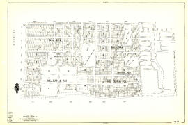
Sheet 77 : Kerr Street to Greenall Avenue and Southeast Marine Drive to Asquith Avenue
Part of City of Vancouver Archives technical and cartographic drawing collection
Item is a section showing the area from Kerr Street to Greenall Avenue and Southeast Marine Drive to Asquith Avenue. Includes streets, blocks, lots and legal descriptions, and the location of parks.
Vancouver (B.C.). Engineering Services
![[Sheet 7 : Burrard Street to Main Street and Georgia Viaduct to Burrard Inlet]](/uploads/r/null/c/d/cd235086cbaf81487b8784fb32b6ef913f4fe27305678cd1961adf506324c250/8f72f6bd-1013-48ad-a56c-e6269cb6f5a8-MAP339_142.jpg)
[Sheet 7 : Burrard Street to Main Street and Georgia Viaduct to Burrard Inlet]
Part of City of Vancouver Archives technical and cartographic drawing collection
Item is a sectional map of a portion of Vancouver showing the area from Burrard Street to Main Street and Georgia Viaduct to Burrard Inlet. Includes streets, blocks, lots and legal descriptions, and the locations of parks, beaches, schools, theatres, post office and Canadian Pacific Railway yards and piers.
![[Sheet 9 : Main Street to Clark Drive and Prior Street to Burrard Inlet]](/uploads/r/null/c/a/ca4b4713bea0118fec812e6258afe5c1efa039db74073214703001a47b00f122/5e0d243a-99ae-42aa-8bb3-4a1abe9e1209-MAP339_142.jpg)
[Sheet 9 : Main Street to Clark Drive and Prior Street to Burrard Inlet]
Part of City of Vancouver Archives technical and cartographic drawing collection
Item is a sectional map of a portion of Vancouver showing the area from Main Street to Clark Drive and Prior Street to Burrard Inlet. Includes streets, blocks, lots and legal descriptions, and the locations of parks, schools, railways and piers along the waterfront.
[Sheet 20 : Main Street to Clark Drive and Great Northern Way to Prior Street]
Part of City of Vancouver Archives technical and cartographic drawing collection
Item is a sectional map of a portion of Vancouver showing the area from Main Street to Clark Drive and Great Northern Way to Prior Street. Includes streets, blocks, lots and legal descriptions, and the locations of parks, railways and railway yards.