![[East facing cityscape view of] Water St[reet and West Cordova Street]](/uploads/r/null/4/c/4ce1044a578de08f6b0c6694f11dab01ef1134bd26eacefa6b31b9eccd465ead/e75dbf34-7999-40e0-be07-94dd0603fa79-A59644_142.jpg)
[East facing cityscape view of] Water St[reet and West Cordova Street]
- COV-S511---: CVA 780-772
- Item
- May [19]75
Part of City of Vancouver fonds
6048 results with digital objects Show results with digital objects
[East facing cityscape view of] Water St[reet and West Cordova Street]
Part of City of Vancouver fonds

Part of City of Vancouver fonds
Photograph also shows buildings downtown including the Harbour Centre (555 West Hastings Street)
![[Street in Kitsilano]](/uploads/r/null/9/9/995b64e959c5d0a2bd16b4ad59feda2f735201ac7a9d2440b83b0ff59c9015f7/26acbbfe-74dd-4783-b448-a76b1f679dc7-A58952_142.jpg)
Part of City of Vancouver fonds
Photograph also shows houses

Part of City of Vancouver fonds
Photograph also shows a Richmond Transfer truck.

1000 block Nelson Street, Burrard-Thurlow, north side, view northwest
Part of City of Vancouver fonds

1200 block Nelson Street, Bute-Jervis, view west
Part of City of Vancouver fonds

1300 block Nelson Street, Jervis-Broughton, view southeast
Part of City of Vancouver fonds
1700 block Nelson Street, Bidwell-Denman, view east
Part of City of Vancouver fonds
![Cambie and 12th [Avenue] taken looking south west from the City Hall](/uploads/r/null/a/9/a95f8048b04d26c3060361b361c2b136bb58d850bbddd32cf9f2dc465086b275/92b1e557-98de-4bde-b1e7-944c3db510dd-A43707_142.jpg)
Cambie and 12th [Avenue] taken looking south west from the City Hall
Part of City of Vancouver fonds
Photograph shows the corner of the Imperial Oil gas station lot and the Blink Bonny apartments at 2825 Cambie Street and the house at 510 West 12th Avenue.
![[Granville Street at Robson Street, looking south]](/uploads/r/null/a/a/aa31b4fb329fc0a45fc4bf57eb1ba9577b8974130b3833b770e5a34f423e5bb2/67f9af08-68f0-415e-95e6-beed8a502406-A43709_142.jpg)
[Granville Street at Robson Street, looking south]
Part of City of Vancouver fonds
Photograph shows "Theatre Row".
![[Granville Street at Broadway, looking south]](/uploads/r/null/a/d/ad9fb3d4863318eb2af9936be53f2590f9885be4f79a66193f9ccc3f857a8c94/ad4447d5-b4e3-4378-a692-86d3e86a5a5f-A43711_142.jpg)
[Granville Street at Broadway, looking south]
Part of City of Vancouver fonds
Photograph shows the Aristocratic cafe and Jordans.
![[Granville Street at 11th Ave, looking south]](/uploads/r/null/b/0/b0b95d9b06cf45c97e2a41efb25abec88233f2d3fd8a49a08c95b8769c61bde4/7c7f2be8-6b05-439e-b609-a6224798fc49-A43713_142.jpg)
[Granville Street at 11th Ave, looking south]
Part of City of Vancouver fonds
Photograph shows the Stanley Theatre
![[One way traffic Seymour St. at Georgia Street, looking south]](/uploads/r/null/6/a/6ab5722dd80ce8659c50534737b97713ef7378106e8777583f6504275d6eb353/28fb7cc1-f428-4efb-9354-3631dfad7020-A43714_142.jpg)
[One way traffic Seymour St. at Georgia Street, looking south]
Part of City of Vancouver fonds
![[Seymour St. at Nelson St., looking east]](/uploads/r/null/6/7/674f17e26621bf88a01685886f3b90e9c81d8d4f7631a2430e620005b18466ff/7df56426-d3dd-4bfd-a460-566da7150ef1-A43720_142.jpg)
[Seymour St. at Nelson St., looking east]
Part of City of Vancouver fonds
Photograph shows Seymour Billiards.
![[800 E Hastings St]](/uploads/r/null/2/8/28ac1de86a0ec4e02f2ccaebd198f03b30e9d50715bfcf7843b57a82d6981417/14007932-5aa0-49f6-9caa-c7bb2c95c70a-A43722_142.jpg)
Part of City of Vancouver fonds
Photograph shows north side of the 800 Block of east Hastings Street as viewed from the southwest.
![[Hawkes Avenue at Hastings Street]](/uploads/r/null/4/3/4396259b55799a72f95a40de0cb3e84ce61fee05f34f430850ea64b1ae69c11b/d53216db-d489-4a3a-862e-f06decea401a-A43724_142.jpg)
[Hawkes Avenue at Hastings Street]
Part of City of Vancouver fonds
Photograph shows Buckshon's Pharmacy and the Rice Block at 404 Hawks Avenue
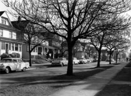
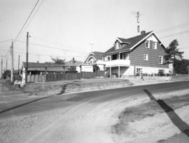
Puget Drive and Eddington Avenue - southeast corner - view southeast
Part of City of Vancouver fonds
Photograph shows 4662 Puget Drive
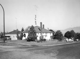
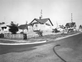
Eddington Drive, south side, from Paton Street to Haggarts Street
Part of City of Vancouver fonds
Photograph shows 2404 and 2406 Eddington Drive

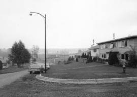
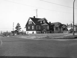
Haggart Street, east side, from 32nd Avenue to lane north - view south
Part of City of Vancouver fonds
Slocan Street, west side 3rd to 4th Avenues - viwe northwest
Part of City of Vancouver fonds
Photograph shows 2699 and 2687 East 4th Avenue
Slocan Street, west side, between 5th Avenue and lane south - view west
Part of City of Vancouver fonds
Photograph shows the rear of 2698 East 5th Avenue
Slocan Street, west side, 5th to 6th Avenues - view northwest
Part of City of Vancouver fonds
Photograph shows 2697 East 6th Avenue and the rear of 2698 East 5th Avenue
Slocan Street, west side, 5th to 6th Avenues - view southwest
Part of City of Vancouver fonds
Photograph shows 2698 and 2694 East 5th Avenue and a part of 2697 East 6th Avenue
![Abbott and Cordova [Streets looking] north](/uploads/r/null/8/a/8aab879fc7571cea390137d122ac3a89381071b678502757448c72f1fa930e4f/7cda2f7c-4836-4e9a-bb47-04f727a330f0-A42710_142.jpg)
Abbott and Cordova [Streets looking] north
Part of City of Vancouver fonds
![Abbott and Cordova [streets looking] east](/uploads/r/null/7/0/707fb0b0f3ba16b327f9d40a0a0a94b3f918509e20ac40ab413928d75ff1b6a8/c28af97b-ce7e-4953-b6ff-6e0979093ac1-A42711_142.jpg)
Abbott and Cordova [streets looking] east
Part of City of Vancouver fonds
Photograph shows Sissons Sporting Goods
![Abbott and Hastings [streets looking] north](/uploads/r/null/5/8/58a47efab97572b4c13cd6b981dd3dac02110898a57c7c528946196e79ba9346/863bf6d2-596f-499c-868a-28abd249fb85-A42714_142.jpg)
Abbott and Hastings [streets looking] north
Part of City of Vancouver fonds
Photograph shows Woodwards
![Alder [Street] and 6th [Avenue looking] west](/uploads/r/null/9/c/9c3510984925b6c73b0f03fe9efc1a5f0c4f319bc1012d03aa9caa3e5b60cb47/373b8340-f09c-4f8c-b47d-a21aa18ae822-A42723_142.jpg)
Alder [Street] and 6th [Avenue looking] west
Part of City of Vancouver fonds
![Alma [Street]and Broadway [looking] south](/uploads/r/null/4/d/4dafffe711c2871a06198b0ffd371738a92f41b9a756e865cf32b41bb712a733/f1a34532-ad4a-4a7f-a67d-e800c9132525-A42726_142.jpg)
Alma [Street]and Broadway [looking] south
Part of City of Vancouver fonds
![Alma [Street] and Broadway [looking] north](/uploads/r/null/f/e/fe19941ed63249d77fd1b5a19cf8c68f6469fc9a1fa766c7170f69506850e2d1/d27e2826-b62d-4fd1-aac2-de85149a4ae5-A42728_142.jpg)
Alma [Street] and Broadway [looking] north
Part of City of Vancouver fonds
![Main and Union [Streets looking] west](/uploads/r/null/e/b/eb84964dbf933c1442a61ec0968b329a7e271791ed535386b9f0a6643a914aac/80bdc5d8-5b0b-4ea9-bf2d-637b34a3c532-A44078_142.jpg)
Main and Union [Streets looking] west
Part of City of Vancouver fonds

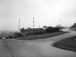
Dunsmuir Viaduct from Main Street
Part of City of Vancouver fonds
![Marine [Drive] and Jellicoe [Street looking] south](/uploads/r/null/6/7/6765fbe421d8f0fcef59fe26d9a75ea572daa0ff7630f92f8e8f08678369d9a5/5edd9472-e5f5-4965-9aad-3acd2a3c05d5-A44087_142.jpg)
Marine [Drive] and Jellicoe [Street looking] south
Part of City of Vancouver fonds
![Marine Drive and Jellicoe [Street looking] north](/uploads/r/null/3/d/3d074e0e80b78c888e81ad2ab0772f896fb2d87f2a57f93315e135a11683f08d/1bdee781-95eb-4eb5-9d1d-edf7389c86a8-A44088_142.jpg)
Marine Drive and Jellicoe [Street looking] north
Part of City of Vancouver fonds
![Marine and Angus[Drives] looking south](/uploads/r/null/c/b/cb1f36ee09b6132864d78af09efdeb37adf8617ce0feb70bc7d06644d8f5fb86/53f8a991-6359-4028-8132-9b98ebc4fc3e-A44091_142.jpg)
Marine and Angus[Drives] looking south
Part of City of Vancouver fonds
![Angus and Marine [Drives looking] east](/uploads/r/null/7/c/7c03071cc81761370b2f592a7f93deb606ffa87baae0c4b3ff1a63e24b63e169/49ac469d-a4fa-412e-a6a1-db2a066a471b-A44094_142.jpg)
Angus and Marine [Drives looking] east
Part of City of Vancouver fonds
![Angus and Marine [Drives looking] west](/uploads/r/null/8/1/811e714c755a5145d6f9ebf8c131d7acfd0d76a0e0b3ca222f1d69b8cc295d22/218531e6-65e4-4db5-925f-a3bee0b9976c-A44095_142.jpg)
Angus and Marine [Drives looking] west
Part of City of Vancouver fonds
![Marine [Drive] and 70th [Avenue looking] west](/uploads/r/null/3/5/35a4157a2ebccd9e112556d67f42acb681c842cd7084fb107db01b2683b28d1b/d70d2b0f-1a75-4fe2-b6e7-b9e3518596f7-A44103_142.jpg)
Marine [Drive] and 70th [Avenue looking] west
Part of City of Vancouver fonds
![Moberley [Road] and 6th [Avenue looking] west](/uploads/r/null/f/e/fe05afaf19cf8c1575b65911683a135a2f1903e7f649bd375057bba80e398326/eb040ea1-5d1e-4016-a9dd-9eb722bca801-A44109_142.jpg)
Moberley [Road] and 6th [Avenue looking] west
Part of City of Vancouver fonds
![Marine [Drive] and 41st [Avenue looking] east](/uploads/r/null/9/2/9295290dc76739cb2ca54e7bdb040c637cc703d3a692dd9055a60b02ff9bfcdc/fb404960-0fce-4148-bfb7-271e44273788-A44111_142.jpg)
Marine [Drive] and 41st [Avenue looking] east
Part of City of Vancouver fonds
![South East Marine [Drive] and Elliott [Street looking east]](/uploads/r/null/8/0/8088d1f97854cc1327942836bfe1999bc3e3648abcd3298e81b2455c5c82c026/dbe4a558-61f7-42df-a2d9-84aad38edda4-A44114_142.jpg)
South East Marine [Drive] and Elliott [Street looking east]
Part of City of Vancouver fonds
![South East Marine [Drive] and Elliott [Street looking west]](/uploads/r/null/5/b/5b531d02c7bd79035a4b40734aefc81f276b1009b9c53694c7646ba0074d3b92/6b433481-8757-4f23-9814-3772c55a2079-A44115_142.jpg)
South East Marine [Drive] and Elliott [Street looking west]
Part of City of Vancouver fonds
![South East Marine [Drive] and Elliott [Street]](/uploads/r/null/7/3/73ee2ded52277aa7be2f253a14ed8fce54642df0beb18f8763791c9f6b225237/b89343b0-59bc-4e28-9aca-5078acb024d0-A44119_142.jpg)
South East Marine [Drive] and Elliott [Street]
Part of City of Vancouver fonds
![Elliott [Street] and Marine [Drive looking] east](/uploads/r/null/1/4/14b2b17e83dc3aa61786994d06bd23fb75f5c10cc83bd5f8126fdd3545062e5a/0f9bdd73-3e3e-4b75-8d3c-cbe30a764de2-A44122_142.jpg)
Elliott [Street] and Marine [Drive looking] east
Part of City of Vancouver fonds
![McGill and Slocan [Streets looking] north](/uploads/r/null/c/3/c3272d40938f8197f26ea5c247f7ba542492f95ae331602eae62978940fc1f90/32dc65bc-f19b-4a4a-882a-089e51e47824-A44127_142.jpg)
McGill and Slocan [Streets looking] north
Part of City of Vancouver fonds
![McGill and Slocan [Streets looking] east](/uploads/r/null/c/2/c2a073e9ca361bf04a8705ed6f7e73e8bc24d9d5fa790df6273645b9c6a0c8bd/80a203f2-2ad4-4341-8b97-e90387f317f9-A44129_142.jpg)
McGill and Slocan [Streets looking] east
Part of City of Vancouver fonds
![Nanaimo and Hastings [Streets looking] east](/uploads/r/null/4/2/4277dd885fd35a7516f0ec6c916d53646e052b31145d0bebabff2d7b7362a76a/421cb517-8ee7-43a8-b6ed-3848f71d6f74-A44140_142.jpg)
Nanaimo and Hastings [Streets looking] east
Part of City of Vancouver fonds
![Nanaimo [Street] and Kingsway [looking] north](/uploads/r/null/2/5/2585376fed1c2542b3b194ebbf7ed615c8c9a113d4b53ffeff70af26fbcd2c99/a1c0cde3-fbc5-4841-b759-d67effa69418-A44143_142.jpg)
Nanaimo [Street] and Kingsway [looking] north
Part of City of Vancouver fonds
![Nanaimo [Street] and Broadway [looking] east](/uploads/r/null/2/6/2628a624a25e6c520d99577488c0e80df649937260c1beddad9eb25076d852ea/e83ca108-1737-419f-b058-c79bcec86c10-A44151_142.jpg)
Nanaimo [Street] and Broadway [looking] east
Part of City of Vancouver fonds
![Nanaimo [Street] and 1st [Avenue looking] south](/uploads/r/null/7/a/7a04509d33345233e8cfc457710578be3c67cb77fc6b4e1268bfa8bcb7dfd4dc/0d3fdbac-23e6-4256-afee-c748dc007fee-A44153_142.jpg)
Nanaimo [Street] and 1st [Avenue looking] south
Part of City of Vancouver fonds
![Oak [Street] and Broadway [looking] south](/uploads/r/null/c/b/cbba5b7775083151ea5354bee5259b9143f7e4f8691955d3c7e07e4548460ba2/9ef14bc0-0b73-418f-8c16-b2d213074f5f-A44160_142.jpg)
Oak [Street] and Broadway [looking] south
Part of City of Vancouver fonds