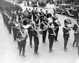
[View of Firemen's Band playing the funeral procession for Fireman Herbert E. Ellis, mortally injured on April 17, 1938]
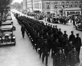
[View of funeral procession for Fireman Herbert E. Ellis, mortally injured on April 17, 1938. Funeral procession from Christ Church Cathedral with Firemen's Band]
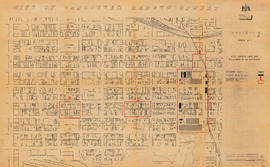
Sheet 10 : Clark Drive to Slocan Street and Burrard Inlet to Triumph Street
Sheet 8 : McLean Drive to Slocan Street and William Street to Seventh Avenue
Sheet 16 : Maple Street to Oak Street and False Creek to Sixteenth Avenue
Sheet 18 : Trutch Street to Maple Street and English Bay to Third Avenue
Sheet 21 : Burrard Street to False Creek and waterfront to Robson Street
Sheet 6 : Knight Street to Slocan Street and Eighteenth Avenue to Twenty-ninth Avenue
Sheet D : Imperial Street to Trutch Street and Fourth Avenue to Sixteenth Avenue
Sheet G : Trafalgar Street to Granville Street and Sixteenth Avenue to Nanton Avenue
Sheet X : Marine Drive to Ash Street and Fifty-ninth Avenue to Seventy-first Avenue
Sheet 6 : Craddock Street to Boundary Road and Twenty-ninth Avenue to Fortieth Avenue
Sheet 3 : Cambie Street to St. George Street and Twenty-seventh Avenue to Thirty-eighth Avenue
Sheet 13 : Fleming Street to Carlton Street and Forty-seventh Avenue to Fifty-ninth Avenue
Sheet 11 : Cambie Street to St. George Street and Forty-seventh Avenue to Fifty-eighth Avenue
Sheet 9 : Fleming Street to Carlton Street and Thirty-seventh Avenue to Forty-eighth Avenue
South west, south, and south east views from Hastings Viaduct
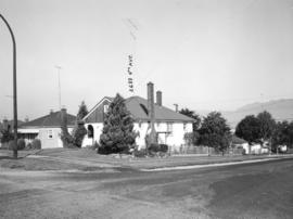
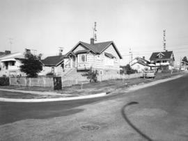
400 Block East Georgia Street
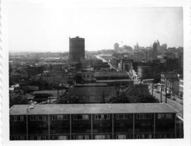
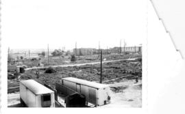
Old B.C. Electric Gas Plant from roof of McLean Park High-rise, looking east
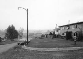
New McLean park in foreground, 700 block Keefer in background
Group of three photos; Looking north west from Georgia and Jackson; west from Georgia & Jackson and south east from Keefer & Dunlevy
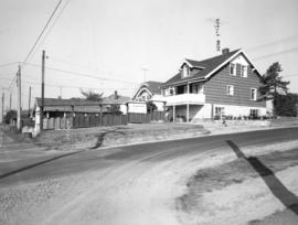
The west end of Block 86 [Keefer Street - south side]
Looking north towards Georgia Viaduct from Union Street
Looking south-west from Raymur Avenue
McLean Park with 700 Block Keefer in background
City of Vancouver redevelopment : project 1, area A-1 : City-owned land and buildings to be retained
City of Vancouver redevelopment : project 1, area A-1 : detailed plan of redevelopment
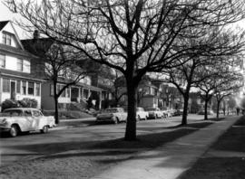
1000 block Nelson Street, Burrard-Thurlow, north side, view northwest
1200 block Nelson Street, Bute-Jervis, view west
1300 block Nelson Street, Jervis-Broughton, view southeast
1700 block Nelson Street, Bidwell-Denman, view east
Cambie and 12th [Avenue] taken looking south west from the City Hall
[Granville Street at Robson Street, looking south]
[Granville Street at Broadway, looking south]
[Granville Street at 11th Ave, looking south]
[One way traffic Seymour St. at Georgia Street, looking south]


![The west end of Block 86 [Keefer Street - south side]](/uploads/r/null/7/1/8/718449a61ef28d000997ee1b4ee269fef37aabc4b15790ac496d415a6878035c/1751ccf4-5686-4608-93fb-1a3262368ccb-CVA181-22_142.jpg)


![Cambie and 12th [Avenue] taken looking south west from the City Hall](/uploads/r/null/a/9/a95f8048b04d26c3060361b361c2b136bb58d850bbddd32cf9f2dc465086b275/92b1e557-98de-4bde-b1e7-944c3db510dd-A43707_142.jpg)
![[Granville Street at Robson Street, looking south]](/uploads/r/null/a/a/aa31b4fb329fc0a45fc4bf57eb1ba9577b8974130b3833b770e5a34f423e5bb2/67f9af08-68f0-415e-95e6-beed8a502406-A43709_142.jpg)
![[Granville Street at Broadway, looking south]](/uploads/r/null/a/d/ad9fb3d4863318eb2af9936be53f2590f9885be4f79a66193f9ccc3f857a8c94/ad4447d5-b4e3-4378-a692-86d3e86a5a5f-A43711_142.jpg)
![[Granville Street at 11th Ave, looking south]](/uploads/r/null/b/0/b0b95d9b06cf45c97e2a41efb25abec88233f2d3fd8a49a08c95b8769c61bde4/7c7f2be8-6b05-439e-b609-a6224798fc49-A43713_142.jpg)
![[One way traffic Seymour St. at Georgia Street, looking south]](/uploads/r/null/6/a/6ab5722dd80ce8659c50534737b97713ef7378106e8777583f6504275d6eb353/28fb7cc1-f428-4efb-9354-3631dfad7020-A43714_142.jpg)
![[Seymour St. at Nelson St., looking east]](/uploads/r/null/6/7/674f17e26621bf88a01685886f3b90e9c81d8d4f7631a2430e620005b18466ff/7df56426-d3dd-4bfd-a460-566da7150ef1-A43720_142.jpg)
![[800 E Hastings St]](/uploads/r/null/2/8/28ac1de86a0ec4e02f2ccaebd198f03b30e9d50715bfcf7843b57a82d6981417/14007932-5aa0-49f6-9caa-c7bb2c95c70a-A43722_142.jpg)
![[Hawkes Avenue at Hastings Street]](/uploads/r/null/4/3/4396259b55799a72f95a40de0cb3e84ce61fee05f34f430850ea64b1ae69c11b/d53216db-d489-4a3a-862e-f06decea401a-A43724_142.jpg)

![Abbott and Cordova [Streets looking] north](/uploads/r/null/8/a/8aab879fc7571cea390137d122ac3a89381071b678502757448c72f1fa930e4f/7cda2f7c-4836-4e9a-bb47-04f727a330f0-A42710_142.jpg)
![Abbott and Cordova [streets looking] east](/uploads/r/null/7/0/707fb0b0f3ba16b327f9d40a0a0a94b3f918509e20ac40ab413928d75ff1b6a8/c28af97b-ce7e-4953-b6ff-6e0979093ac1-A42711_142.jpg)
![Abbott and Hastings [streets looking] north](/uploads/r/null/5/8/58a47efab97572b4c13cd6b981dd3dac02110898a57c7c528946196e79ba9346/863bf6d2-596f-499c-868a-28abd249fb85-A42714_142.jpg)
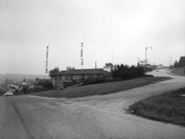
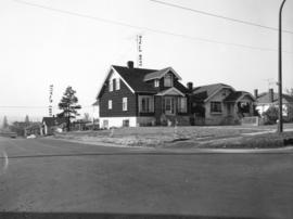
![Alder [Street] and 6th [Avenue looking] west](/uploads/r/null/9/c/9c3510984925b6c73b0f03fe9efc1a5f0c4f319bc1012d03aa9caa3e5b60cb47/373b8340-f09c-4f8c-b47d-a21aa18ae822-A42723_142.jpg)