
City of Vancouver, B.C. area map : Maple Street to Heatley Avenue and Burrard Inlet to 6th Avenue
- PUB-: PD 2103-: LEG1354.03
- Part
- 1990
Part of City publications collection
City of Vancouver, B.C. area map : Maple Street to Heatley Avenue and Burrard Inlet to 6th Avenue
Part of City publications collection

Part of City publications collection

Part of City publications collection

City of Vancouver, B.C. area map : Inverness Street to Boundary Road and 32nd Avenue to 54th Avenue
Part of City publications collection

Part of City publications collection

Part of City publications collection

Part of City publications collection

Part of City publications collection

Part of City publications collection

Part of City publications collection

Part of City publications collection


Part of City publications collection
Item is a map showing streets, building footprints, number of storeys, and street codes according to a system adopted by the Engineering Department in the mid-1960s.
Part of City publications collection
Item is a map showing streets, building footprints, number of storeys, topographic contour lines, and street codes according to a system adopted by the Engineering Department in the mid-1960s.

Part of City publications collection
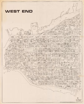
Item is a map showing streets, building footprints and number of storeys.

Part of City publications collection
Item is a map showing streets, building footprints and number of storeys.