
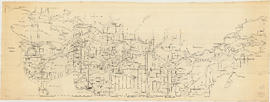
Map of Fraser Valley, British Columbia
- AM738-S1-: MAP 924
- Item
- [ca. 1932]
Item is a map showing trunk roads, main and local roads, and railway lines.
Map of Fraser Valley, British Columbia
Item is a map showing trunk roads, main and local roads, and railway lines.
Street map of the Fraser Valley
Item is a street map of the Lower Mainland and Fraser Valley from Vancouver to Chilliwack.

Part consists of a street map of the Lower Mainland and Fraser Valley from Vancouver to Chilliwack, a street map of New Westminster, a map of Vancouver and North Vancouver showing street names but not street lines, and text advertising the products and services of the Dominion Map and Blueprint Company.

Map of Fraser Valley ; Street map of New Westminster ; Map of Greater Vancouver transit lines
Part consists of a street map of the Lower Mainland and Fraser Valley from Vancouver to Chilliwack, a street map of New Westminster, a map showing transit lines in Greater Vancouver, and text advertising the products and services of the Dominion Map and Blueprint Company.

Part of City of Vancouver Archives technical and cartographic drawing collection
Part contains a street map of downtown Vancouver, a street map of Vancouver and the Fraser Valley, detail maps showing traffic interchanges corresponding to numbers on the Fraser Valley map, and general tourist information.

Part of City of Vancouver Archives technical and cartographic drawing collection
Part consists of a map showing major roadways in the Lower Mainland and the Fraser Valley from Vancouver to Chilliwack, and lists of Vancouver businesses, schools, public buildings, hospitals, bathing beaches, fire halls, and golf and country clubs. Part includes text advertising the products and services of the Dominion Map and Blueprint Company.