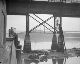
![[Buildings and bridge, 2 of 2]](/uploads/r/null/2/3/3/233119e90a202a70b6aaf8538578b58683dc17af05d65653af449d9b3aa593ea/28d287c7-9b0d-4bdd-a364-ac4123dd1f72-CVA1095-14683_142.jpg)
[Buildings and bridge, 2 of 2]
- COV-S644-: CVA 1095-14683
- Item
- Mar. 1969 - 1973
Part of City of Vancouver fonds
1503 results with digital objects Show results with digital objects
[Buildings and bridge, 2 of 2]
Part of City of Vancouver fonds
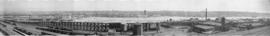
![[Buildings and bridge, 1 of 2]](/uploads/r/null/4/b/7/4b746d60a5edcad5541e0ec05bcd8d839b4335381479f366269d050f7f1df6b9/98aa5923-5c95-49ce-b711-4724c905436c-CVA1095-14682_142.jpg)
[Buildings and bridge, 1 of 2]
Part of City of Vancouver fonds

Aerial photo, vertical, False Creek, Fairview to Kits Point
Item is a photograph of False Creek, showing English Bay to W 16th Avenue, and from Maple Street to the Cambie Street Bridge. Includes the Burrard Street Bridge, the new Granville Bridge, the Cambie Bridge, and Granville Island.
![[Aerial view looking north over] Granville Island](/uploads/r/null/8/3/83f9be0a597100103c181fa4d68c68baa4a0802471126afafea3b7850103e12b/ea9e7fb6-7465-4fa6-8fa9-18923e3d9307-A49646_142.jpg)
[Aerial view looking north over] Granville Island
Oblique view showing the Granville Bridge and the new Granville Bridge under construction, the Kitsilano Trestle Bridge, of the Burrard Bridge and the industrial and undeveloped areas on the north and south sides of False Creek

Aerial photo, vertical, Marpole and junction of Fraser River, Bridgeport
Item is a photograph of Marpole and northern Richmond, looking north. The area photographed centres on the fork of the Fraser River at Sea Island, and runs from W 67th Avenue to Cambie Rd., and from the western most tip of Richmond Island to the west tip of Mitchell Island. Includes the Marpole Bridge and both Oak Street and Moray bridges under construction.

Aerial photo, oblique, CPR docks in foreground, looking south Granville Street at centre
Item is a photograph of the Vancouver waterfront, looking southwest down Burrard Street, showing the waterfront and downtown Vancouver, including Waterfront Station, Hotel Vancouver, Marine Building, Burrard Bridge, Granville Street Bridge, and the city beyond.

Part of Major Matthews collection
Photograph was exhibit 8 in the Ducharme murder case
[Side view of centre portion of Burrard Bridge]
![[East facing cityscape view of Kitsilano]](/uploads/r/null/9/d/9d09c63567e6331ed970e470005d4e500d48b5731459d17ac756c1c4f0af8606/8d5b2a25-0e5e-43bf-bb36-f9f945d0625b-A59251_142.jpg)
[East facing cityscape view of Kitsilano]
Part of City of Vancouver fonds
Photograph also shows the Granville Street Bridge and the Connaught (Cambie) Bridge.
![WHC APWA [American Public Works Association?] Presentation [27 of 32]](/uploads/r/null/d/7/d73e06bc8f651e7a9c601442d763af5c7d3fdf1750552e87986086a04c40605c/cd12ad9e-3fff-4cca-9c1b-b51fe6c9d367-A69002_142.jpg)
WHC APWA [American Public Works Association?] Presentation [27 of 32]
Part of City of Vancouver fonds
Item is a photograph showing the 1200 block of Powell Street at Clark Drive.
File consists of slides of images of Vancouver through the years, presumably collected and arranged (possibly by the Vancouver Public Library) for a Vancouver Centennial Commission presentation. The slides suggest that the presentation was given by Robert D'altroy. Slides were originally arranged in two carousels. Included with the slides is a notebook listing captions, subject matter and date of the image for each slide. A few of the slides date from the 1950s and 1960s; however, it appears that the majority of the slides were created at the time of the presentation, and many are likely copies of images held by the City of Vancouver Archives and/or the Vancouver Public Library. Slides 50, 56 and 78 from Carousel 1 are missing.
![[Aerial view of the] Granville Bridge, Vancouver, B.C.](/uploads/r/null/e/f/ef40e27e0b3c58f18f19df438e513becb7e6105a8a497edb4bf7d3fbb05b6aaa/5ca1aff0-f478-4792-bc6c-6aa0a5bd1dff-A32030_142.jpg)
[Aerial view of the] Granville Bridge, Vancouver, B.C.
Part of Major Matthews collection
Oblique view shows the Burrard bridge, Granville Island, Kitsilano trestle bridge, the old and new Granville bridges, downtown, Yaletown and north Fairview.
![[Aerial view of Vancouver]](/uploads/r/null/b/9/b973b9a4143a5316b02e728c35d99e383f27a3db21d8e20aa7bbb459780243bc/3ff38b56-6b36-4c17-bce1-329c97459d29-A66598_142.jpg)
Part of Major Matthews collection
Photograph shows Kitsilano, Kits Point, Kitsilano Beach, R.C.A.F. Equipment Depot, Kitsilano Pool, Burrard Bridge, C.P.R. Kitsilano Trestle, Granville Island, Granville Bridge, Cambie Bridge, False Creek, C.P.R. False Creek Yards, West End, Yaletown, Arbutus Ridge, Shaughnessy, South Cambie, Fairview, Mount Pleasant, Little Mountain Reservoir, Connaught Park, Quilchena Golf Course, Douglas Park, Shaughnessy Heights Golf Course, Queen Elizabeth Park, Royal Canadian Mounted Police Barracks, Shaughnessy Military Hospital, Hillcrest Park, Robertson & Hacket Sawmill, City Yard, West Coast Ship Builders and Athletic Park.
![[Aerial view of Burrard Inlet, Hastings-Sunrise, Burnaby and the District of North Vancouver]](/uploads/r/null/d/f/df7e11c97173ce0473c454f0a01569b641972f6efdc12bf192edbc42119542d6/6d72f89b-9b55-48c4-bef6-04eb2137f1d3-A66600_142.jpg)
[Aerial view of Burrard Inlet, Hastings-Sunrise, Burnaby and the District of North Vancouver]
Part of Major Matthews collection
Photograph shows Exhibition Park and P.N.E. Golf Course, Second Narrows Bridge, New Brighton Park, Callister Park, Burrard Inlet, Lynn Creek, Lynn Park, Seymour Creek, Vancouver Harbour Commissioners Railway, Inspected Shingles Ltd., Cascade Rock and Gravel Co. Ltd., Canadian Shingle Co. Ltd. (Capilano Timber Co. Ltd.), Alberta Pool Elevator, Columbia Grain Elevator Co. Ltd., Canadian Pacific Railway, Girls Industrial School and Old Peoples Home sites.

Part of Major Matthews collection
Photograph shows Lions Gate Bridge, Beaver Lake, Lost Lagoon, Prospect Point, Brockton Point, Deadman's Island, Royal Vancouver Yacht Club, H.M.C.S. Discovery, Brockton Oval and English Bay.
![[Fairview looking west across False Creek]](/uploads/r/null/1/5/159fdcc0263ada5f73445114a87bfdeb81e07994802327eadb9958fce4b08fbb/00a38b0c-0da1-4aea-8184-0f62e594f159-A25942_142.jpg)
[Fairview looking west across False Creek]
Part of Major Matthews collection
Photograph shows the False Creek Indian Reserve, Granville and C.P.R. Kitsilano bridges, the McCreery and Johnston residences and a cannery
![[Couger hunters and their dogs near the entrance to Stanley Park at the foot of Georgia Street]](/uploads/r/null/1/2/126a8d88242ba19f781096ce8bd63ac4da054754608a3af6dd91647b047b7b62/253b4057-dfaa-42fe-b3fe-94f895f7434b-A69227_142.jpg)
[Couger hunters and their dogs near the entrance to Stanley Park at the foot of Georgia Street]
Part of Major Matthews collection
![[Western Canada Shipyards, False Creek]](/uploads/r/null/5/3/53d0a0e17c1710a62fbd39eaed21efd8d1773a33701bcceab1cc3c12366fc39c/020f20b5-8330-4847-81b0-3aac74b51033-A63958_142.jpg)
[Western Canada Shipyards, False Creek]
Part of Major Matthews collection
Photograph shows four ships under construction and the G.N.R. Trestle and Granville bridges

Part of City of Vancouver Archives sound recording and moving image collection
Film is a travelogue showcasing scenery, attractions and industry in the Vancouver area. Film contains general and aerial views of Vancouver, plus sequences of the harbour, Vancouver International Airport, Stanley Park, UBC, the Vancouver International Festival and the PNE. Industry is depicted through shots of a sawmill, a fish cannery, a foundry and a shipyard (where the vessel Yukon is launched). Water sports, golf and skiing at Grouse Mountain are shown, as well as Queen Elizabeth Park, Capilano Suspension Bridge, the Queen Elizabeth Theatre, Granville Street at night and a White Spot drive-in. Individuals involved with the production of the film include: Jim Richardson (script), David Bennett (director), A.J.H. Pullinger (cinematography), Norma Jackson (editing), Lloyd Stump (sound), Saba Bros. Limited (gowns), Marguerite Roozeboom (art direction), recorded by Telesound, Lew Perry (producer).
Horse races and Shetland Ponies, Virginia and Family
Part of City of Vancouver Archives sound recording and moving image collection
Item is a film containing footage of a pageant, people riding horses and ponies, the Capilano Suspension Bridge and surrounding area, the Capilano River valley and surrounding trails, orchestra at Malkin Bowl, a picnic, children playing in backyard and wading pool (possibly at 3846 West 10th), May Day Parade in downtown Vancouver, Stanley Park gardens, George Vancouver statue and City Hall campus, Vancouver skyline view from City Hall and children playing in grassy area.

Part of Samuel S. Magoffin fonds
Item is an amateur film showing people with dogs in the snow and Sam and Margaret Magoffin with her parents, the Boalts, having a picnic in the woods, at the Capilano Suspension Bridge, and then at the beach where the men change a tire on the car. Also included in the film are scenes taken at home with the women knitting and sewing, Margaret and her parents exiting the Devonshire Hotel and entering a car with the courthouse in the background, people waving from the back of a train, and Sam and Margaret standing by a window.

Part of City of Vancouver Archives sound recording and moving image collection
Item is a color film which details the steps involved in constructing the Lions Gate Bridge (First Narrows Bridge) across the First Narrows of the Burrard Inlet (Vancouver, B.C.) in 1937 and 1938. The film, which appears to be professionally produced, captures the entire construction and assembly process, including the cutting of a road through Stanley Park, preparation of cofferdams and caissons, foundation pouring, erection of the main towers, hoisting and attaching cables, insertion of stiffening trusses, bridge surface pouring, application of protective paint, and other finishing touches, including the installation of sculptor Charles Marega's lions. The film also captures shots of key contributors A.J.T. Taylor and John Anderson, as well as the first cars to cross the span from end to end.
Middle Arm Bridge and 800 block Thurlow slides
Part of Joe Quan fonds
File consists of four photographs of the Middle Arm Bridge taken on May 31, 1957 and five photographs of road construction on the 800 block of Thurlow Street, showing CustomColor Laboratories Ltd. at 819 Thurlow Street, circa 1957.
![[McHarg (Georgia) Viaduct decorated with flags for visit of King George VI and Queen Elizabeth]](/uploads/r/null/2/2/227bc57ff50e9f193b2f953838be64bdfaa09c39a77f8e606120539263f341c9/b3af2bd2-bbae-4768-b441-c82c35153d5b-A19847_142.jpg)
[McHarg (Georgia) Viaduct decorated with flags for visit of King George VI and Queen Elizabeth]
Part of Vancouver Committee for the Reception of their Majesties fonds
Photograph shows a gas storage silo

Part of Walter E. Frost fonds
![[Crowds at C.P.R. station viewing the arrival of the] first train in Vancouver](/uploads/r/null/7/4/5/74581a27127fa7d8c72e9840c2caefa7c5de7b6006656f26f9a607644bf38bea/b0320be2-9157-47dd-a688-2d35c3f55dad-CVA371-454_142.jpg)
[Crowds at C.P.R. station viewing the arrival of the] first train in Vancouver
Part of Major Matthews collection
J.S. Matthews' notes with print or negative in Archives.

Letter from Burrard Dry Dock Company to Major Matthews regarding a photograph
Part of Major Matthews collection
Item is a letter from Burrard Dry Dock Company (previously Wallace Shipyards) regarding the location of a photograph.
"Lady Cecilia" under Lions Gate Bridge
Part of Stuart Thomson fonds

Part of Stuart Thomson fonds
Part of Stuart Thomson fonds
Part of Stuart Thomson fonds

Accident, Grayline tour bus on Connaught Bridge
Part of Stuart Thomson fonds
Accident, Grayline tour bus on Connaught Bridge
Part of Stuart Thomson fonds

Part of Walter E. Frost fonds
Photograph shows the Georgia Viaduct and the CPR rail yards.

Vancouver, B.C. 1890 : built-on area
Part of City of Vancouver Archives technical and cartographic drawing collection
Item is a map showing downtown Vancouver and a portion of east Vancouver. City blocks, buildings and railway lines are shown. Annotations in pencil mark the location of Granville Bridge, Main Street Bridge, the Vancouver Lumber Company, the Canadian Pacific Railway station, the Hastings Sawmill, False Creek and Burrard Inlet.
Holdsworth, Derek

Part of City of Vancouver Archives technical and cartographic drawing collection
Item is an architectural drawing of a Second Narrows crossing, bridging Vancouver and North Vancouver. The drawing consists of an elevation of the bridge, as well as a plan of the bridge and the north and south approaches.
![Burrard Street Bridge from future Expo land [at Vanier Park]](/uploads/r/null/d/a/e/daeb55e9c539444f79ecf58f9e19ec5df81cf48b895d68cbf9aa29e06ff4be9b/8bf1d764-cd93-44c2-b311-40361f33dcff-CVA792-361_142.jpg)
Burrard Street Bridge from future Expo land [at Vanier Park]
Part of City of Vancouver fonds
![Burrard Viaduct Construction [2 of 10]](/uploads/r/null/5/7/57426101abc66a2ab407c951565e28bb07f8f27238a35bb05d7478ded4e540b1/8b87415b-c4bc-4c5c-bf5c-89e3546722c2-A66653_142.jpg)
Burrard Viaduct Construction [2 of 10]
Part of City of Vancouver fonds
Building of Burrard Viaduct with Coal Harbour in the background, including part of Deadman's Island and a floating fuel station on the left and the mountains beyond.
![Burrard Viaduct Construction [1 of 10]](/uploads/r/null/2/7/2788a9638050d7cbfc021e29977d956f423fe6048bb7c29c035ea57bda6dd66c/5df17b4f-3ebf-4f8d-ac21-de11bd89033f-A66652_142.jpg)
Burrard Viaduct Construction [1 of 10]
Part of City of Vancouver fonds
Building of Burrard Viaduct with Coal Harbour in the background, including part of Deadman's Island and a floating fuel station on the left and the mountains beyond.
![Miscellaneous [57 of 130]](/uploads/r/null/c/6/c6ac7a1941eaff56baf25bd599c85c2b53eaec23f10715a53da118f8369f2607/7047af67-11df-45c7-a426-68695b170530-A64388_142.jpg)
Part of City of Vancouver fonds
Item is a photograph showing a view of Boundary Road looking South, near Kingsway with the Canfield Centre building under construction in the background (3777 Kingsway). An overpass is shown in the foreground.
![[View of Mount Pleasant from the Lee Block, Broadway and Main]](/uploads/r/null/b/1/b1a10591488c68f9a18122cfa8f608fad319fbfa89c13392ad025d4afb3764d6/e0494038-a598-4615-af30-8ee294062605-A61801_142.jpg)
[View of Mount Pleasant from the Lee Block, Broadway and Main]
Part of Major Matthews collection
Photograph also shows False Creek east of Main, Downtown Vancouver and the Cambie Street Bridge in the background. Some prominent buildings include: Quebec Manor, Arcadian Hall, Dudley Block, Muir Apartments and Mount Pleasant Public School.

Part of Major Matthews collection
Panoramic view showing the CN Freight shed, (temporary) Evangelistic Tabernacle, City Market building, the Globe and Ivanhoe Hotels and the swing span of the G.N.R. Trestle Bridge.
![[View of False Creek Flats east of Main Street]](/uploads/r/null/2/2/22ae18e3c70f3b175e8da170286e28bec8b9c5badf5f7209cd805214ba4c2778/0054a24e-3793-409f-a191-486d3c0e0479-A63167_142.jpg)
[View of False Creek Flats east of Main Street]
Part of Major Matthews collection
Panoramic view showing the start of the False Creek reclamation, the Great Northern Railway Station construction site, the Main Street bascule bridge, Market Hall and Ivanhoe Hotel.
![[View of False Creek Flats east of Main Street]](/uploads/r/null/5/d/5d0a808a4da26519ee2390736b5c2eae8a157e0573957fb8f67b825a709d20b0/7a5da500-ffa2-4229-8459-c2aed940a8d5-A62328_142.jpg)
[View of False Creek Flats east of Main Street]
Part of Major Matthews collection
Panoramic view showing the Great Northern Railway Station, construction site for the Canadian National Railway Station, the Main Street bascule bridge and the Invanhoe Hotel.
Part of Major Matthews collection
Panoramic view showing the dredging of False Creek for the Granville Island construction.

Part of Major Matthews collection
Panoramic view showing Granville Street Bridge, C.P.R. Kitsilano Trestle, and the Kitsilano Indian Reserve.

Part of Major Matthews collection
Panoramic view showing the Granville Bridge with the span open, C.P.R. Trestle Bridge, Robertson and Hacket Sawmill, Canadian Pipe Co., Vancouver Granite Co. and Marpole Coal Co.
![[Northern and eastern view of] Vancouver, B.C. [showing Burrard Inlet, Downtown, False Creek and ...](/uploads/r/null/a/d/ad499a709643b866df0dd06ee0db3a33d39d0fae463dc917d66f4f31c3dac3ad/05fca819-4e81-4708-982c-e3af142f77cb-A63163_142.jpg)
Part of Major Matthews collection
Panoramic view showing Coal Harbour, Deadman's Island, the Westminster Avenue Trestle and Cambie Street Bridges, St. Andrew's Church, the Beatty Street Drill Hall and the Sun Tower
![[Southward view of downtown Vancouver from the World Building Showing False Creek]](/uploads/r/null/1/7/178f284a66576bceb511c02e64571346636be935788ca2d242360ace33cc373b/e71f53d7-3e88-4628-9058-9eca3b428398-A63174_142.jpg)
[Southward view of downtown Vancouver from the World Building Showing False Creek]
Part of Major Matthews collection
Panoramic view showing the Georgia Viaduct, G.N.R. Trestle and Cambie Bridges, and the Vancouver Gas Works, G.N.R. and C.N.R. stations, B.C. Electric railway yard and Coughlan Shipyards.
![[J. Hanbury and Co. Mill, False Creek]](/uploads/r/null/5/6/56c2e92eaa1393ff529f2db401b75551c5528454bacac656e29fb0d8727ea0cf/6e5baaca-a796-433c-a463-ab67e23ae1d1-A63494_142.jpg)
[J. Hanbury and Co. Mill, False Creek]
Part of Major Matthews collection
Photograph shows the Granville Bridge.