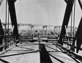
![Fir [Street] and 4[th Avenue intersection, 4 of 4]](/uploads/r/null/e/9/e/e9e89e26eff0765d776e5f8b453182b7df6c5243b7df25f40f07824906ab6b65/a3445d86-40e8-4592-b6cc-ec10063bb8e6-2019-103.0644_142.jpg)
Fir [Street] and 4[th Avenue intersection, 4 of 4]
- COV-S505-1-: 2019-103.0644
- Item
- [198-?]
Part of City of Vancouver fonds
2319 results with digital objects Show results with digital objects
Fir [Street] and 4[th Avenue intersection, 4 of 4]
Part of City of Vancouver fonds
![Fir [Street] and 4[th Avenue intersection, 3 of 4]](/uploads/r/null/3/4/7/347fbe61da599fc949abd73351c74c6b903e6281d414326d457f6baad11d9a2f/b525cf91-6509-4e27-8a3d-485434091a32-2019-103.0642_142.jpg)
Fir [Street] and 4[th Avenue intersection, 3 of 4]
Part of City of Vancouver fonds
![[Burrard Street Bridge, 3 of 3]](/uploads/r/null/1/d/7/1d744db11b4d7423fbffc805972c5694e3a1fab315ac73ae3ae3f7f6205014ae/620998a7-dd5f-4266-ae95-45faccfd905f-CVA1095-15069_142.jpg)
[Burrard Street Bridge, 3 of 3]
Part of City of Vancouver fonds
![[Burrard Street Bridge, 2 of 3]](/uploads/r/null/b/7/1/b71695b76d79c18cfe3eca173064b375f56c794b93c98642faf7bf8753a0845a/703e5e4b-b9be-424d-a557-3bddc16cdf6b-CVA1095-15068_142.jpg)
[Burrard Street Bridge, 2 of 3]
Part of City of Vancouver fonds
![[Burrard Street Bridge, 1 of 3]](/uploads/r/null/8/2/7/8272b00c7778bee0357fc7fdaeb93e9009fb5d4ad2b00865251e9730d3fd3666/d74bdc73-21ac-4cbe-a77f-aefb7ea6e743-CVA1095-15066_142.jpg)
[Burrard Street Bridge, 1 of 3]
Part of City of Vancouver fonds
![[Buildings and bridge, 2 of 2]](/uploads/r/null/2/3/3/233119e90a202a70b6aaf8538578b58683dc17af05d65653af449d9b3aa593ea/28d287c7-9b0d-4bdd-a364-ac4123dd1f72-CVA1095-14683_142.jpg)
[Buildings and bridge, 2 of 2]
Part of City of Vancouver fonds
![[Buildings and bridge, 1 of 2]](/uploads/r/null/4/b/7/4b746d60a5edcad5541e0ec05bcd8d839b4335381479f366269d050f7f1df6b9/98aa5923-5c95-49ce-b711-4724c905436c-CVA1095-14682_142.jpg)
[Buildings and bridge, 1 of 2]
Part of City of Vancouver fonds

Aerial photo, vertical, False Creek, Fairview to Kits Point
Item is a photograph of False Creek, showing English Bay to W 16th Avenue, and from Maple Street to the Cambie Street Bridge. Includes the Burrard Street Bridge, the new Granville Bridge, the Cambie Bridge, and Granville Island.
![[Aerial view of] British Pacific Properties [and North Vancouver]](/uploads/r/null/1/4/14644a75d43dd6a85d7a3c082e63134f4994ac268e97d1c0940f786b344bbd7e/46041e12-d683-4b08-81b0-797947030f8f-A23485_142.jpg)
[Aerial view of] British Pacific Properties [and North Vancouver]
Part of Major Matthews collection
Oblique view. Photograph shows Lions Gate (First Narrows) Bridge
![[Aerial view looking north over] Granville Island](/uploads/r/null/8/3/83f9be0a597100103c181fa4d68c68baa4a0802471126afafea3b7850103e12b/ea9e7fb6-7465-4fa6-8fa9-18923e3d9307-A49646_142.jpg)
[Aerial view looking north over] Granville Island
Oblique view showing the Granville Bridge and the new Granville Bridge under construction, the Kitsilano Trestle Bridge, of the Burrard Bridge and the industrial and undeveloped areas on the north and south sides of False Creek

Aerial photo, vertical, Marpole and junction of Fraser River, Bridgeport
Item is a photograph of Marpole and northern Richmond, looking north. The area photographed centres on the fork of the Fraser River at Sea Island, and runs from W 67th Avenue to Cambie Rd., and from the western most tip of Richmond Island to the west tip of Mitchell Island. Includes the Marpole Bridge and both Oak Street and Moray bridges under construction.

Aerial photo, oblique, CPR docks in foreground, looking south Granville Street at centre
Item is a photograph of the Vancouver waterfront, looking southwest down Burrard Street, showing the waterfront and downtown Vancouver, including Waterfront Station, Hotel Vancouver, Marine Building, Burrard Bridge, Granville Street Bridge, and the city beyond.

Part of Major Matthews collection
Photograph was exhibit 8 in the Ducharme murder case
![[Keefer Street parking lot, 2 of 2]](/uploads/r/null/8/8/c/88c9b96a18916fc7c901bd97e5072ad287046681b615277fb36dc4fe3a3953ac/5ec0cbf6-ecd6-4f1c-b1a4-8552746194b6-CVA1095-08566_142.jpg)
[Keefer Street parking lot, 2 of 2]
Part of City of Vancouver fonds
Item is a photograph that depicts a parking lot with a sign for the Vanport Hotel visible behind it.
![[Keefer Street parking lot, 1 of 2]](/uploads/r/null/b/8/f/b8fcc8fbb02c370b4e1b9f8b5fdb4129ffad0bf1fe29aa70b6a164f47043fb97/e35ef3f6-f7b3-4e89-8b5b-52f2bc7ba9c9-CVA1095-08565_142.jpg)
[Keefer Street parking lot, 1 of 2]
Part of City of Vancouver fonds
Item is a photograph that depicts a parking lot in front of an overpass.
![Miscellaneous [61 of 130]](/uploads/r/null/e/7/e7e0fabc8c4f7c5f7153259f7f4731fc00ec44e940f2c173c1f4c907df09299c/6a3cd828-f875-4758-a618-f0699e50a753-A64392_142.jpg)
Part of City of Vancouver fonds
Item is a photograph showing workers at Bingham Fisheries, 2115 Commissioner Street, and boats docked.
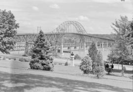
![[North end of Oak Street Bridge]](/uploads/r/null/6/c/8/6c8815bc29a455f7a6869e35447b02eb51b787bd3ef8b350a847151c0733854c/89154a87-8e10-4335-b196-a90a2912a63a-CVA1095-01088_142.jpg)
[North end of Oak Street Bridge]
Part of City of Vancouver fonds
View of the Oak Street Bridge taken from Eburne Park.
![[View of Lions Gate Bridge from Stanley Park]](/uploads/r/null/6/5/e/65eb22cd806d83d976f34f90d16e6df9e406ea4f2cd42f9d8e6cc713442a4435/ed2e6151-010e-4037-ba31-74c9758b7909-CVA1095-00567_142.jpg)
[View of Lions Gate Bridge from Stanley Park]
Part of City of Vancouver fonds
![[North-bound view of Stanley Park Causeway]](/uploads/r/null/3/7/c/37c7c88cab0cca4dbf7f18a14d422b08eac593f411b9d187b7c44cf6ea7b99c7/61696b28-0fda-4920-ad1b-6b05335a248e-CVA1095-00566_142.jpg)
[North-bound view of Stanley Park Causeway]
Part of City of Vancouver fonds
![[View of industrial buildings and Oak Street Bridge]](/uploads/r/null/b/9/b/b9b1054fad0b2e80f94276ea3fa24e412dafa55084b05c52f8a5b632611eb1e5/5179aac2-ed62-4e53-a747-8c7ebe7237a0-CVA1095-07263_142.jpg)
[View of industrial buildings and Oak Street Bridge]
Part of City of Vancouver fonds
![[View of industrial lots and Oak Street Bridge]](/uploads/r/null/8/0/9/8096f58aa5ccedbb062a4543b4c18a785dd65508fb988a993beab06159b1a40e/799e1642-30ea-4f93-a844-ece853314904-CVA1095-07262_142.jpg)
[View of industrial lots and Oak Street Bridge]
Part of City of Vancouver fonds
![[View southwest from Oak Street Bridge, 1 of 5]](/uploads/r/null/a/9/4/a94e0e3d0d3d39d5131673b634304dd181cada1d6e2ff3e2c4fd2515657a3e7f/7b14a261-66b3-46ce-b707-dbdb4b8625f9-CVA1095-07206_142.jpg)
[View southwest from Oak Street Bridge, 1 of 5]
Part of City of Vancouver fonds
![[1010 Beach Avenue - Essington Seafood Restaurant]](/uploads/r/null/8/d/7/8d7bc1e891340ef66dcf7e81148ced311fe0f2875e0f2ea854fb9304e71b8bf3/d8ba7a78-1193-4249-9a71-8ef9f93b3d8c-CVA1095-06514_142.jpg)
[1010 Beach Avenue - Essington Seafood Restaurant]
Part of City of Vancouver fonds
![[View of BC-99 and Oak Street Bridge]](/uploads/r/null/4/5/8/458b5c3aa806b1876ce89d19c5995c3674bf2f5ce63fef81450a44a02f73f06e/69af4c29-e135-4608-9de7-23b4220e84db-CVA1095-02761_142.jpg)
[View of BC-99 and Oak Street Bridge]
Part of City of Vancouver fonds
![[North end of Burrard Bridge]](/uploads/r/null/8/8/d/88df8cb35881fa60d8534635db1ddc94dbaf003a3dd6383e9fad02e549501cdb/3fbd50bd-7899-4556-acc2-f2f3966c8e4e-CVA1095-01167_142.jpg)
Part of City of Vancouver fonds
Item is a photograph that depicts a view looking south over the Burrard Bridge.
![[Dedication plaque for the construction of the Burrard Bridge]](/uploads/r/null/7/7/d/77d318c0c5187a095acee61542bcf9469ba4c742074f0269c3523cc19cccf652/4fbaafd9-5f36-46f0-9cdd-859773a27632-CVA1095-01166_142.jpg)
[Dedication plaque for the construction of the Burrard Bridge]
Part of City of Vancouver fonds
![[East facing cityscape view of Kitsilano]](/uploads/r/null/9/d/9d09c63567e6331ed970e470005d4e500d48b5731459d17ac756c1c4f0af8606/8d5b2a25-0e5e-43bf-bb36-f9f945d0625b-A59251_142.jpg)
[East facing cityscape view of Kitsilano]
Part of City of Vancouver fonds
Photograph also shows the Granville Street Bridge and the Connaught (Cambie) Bridge.
Looking north from the Fraser Street Bridge showing the open swing span
Part of Major Matthews collection
![Fraser Ave. bridge - Looking towards Lulu Island [Mitchell Island]](/uploads/r/null/2/5/253a8110987daa7db7887442db4e0ad731836d92a62eb6a3c4dd2d9910373610/d7a2861e-23ab-41d4-a0dc-a858caffd7a5-A61153_142.jpg)
Fraser Ave. bridge - Looking towards Lulu Island [Mitchell Island]
Part of Major Matthews collection
Item is a photograph showing a group at the bridge with a diver in a boat preparing to dive to the submerged automobile.

Fraser Ave. bridge over North Arm - Fraser River
Part of Major Matthews collection
Item is a photograph showing the gates of the draw bridge and bridge tender Thomas Dodson is standing far right.

Southern end Fraser Avenue Bridge
Part of Major Matthews collection

Looking north towards South Vancouver over Fraser Avenue Bridge
Part of Major Matthews collection
![WHC APWA [American Public Works Association?] Presentation [27 of 32]](/uploads/r/null/d/7/d73e06bc8f651e7a9c601442d763af5c7d3fdf1750552e87986086a04c40605c/cd12ad9e-3fff-4cca-9c1b-b51fe6c9d367-A69002_142.jpg)
WHC APWA [American Public Works Association?] Presentation [27 of 32]
Part of City of Vancouver fonds
Item is a photograph showing the 1200 block of Powell Street at Clark Drive.
![Streets [75 of 139]](/uploads/r/null/6/3/639f10b22123d86274ec47d707c64acb8efb3e487379e8735419fa31b081a852/ea328414-4e69-4d62-9693-848a939e85c5-A64264_142.jpg)
Part of City of Vancouver fonds
Item is a photograph showing East Broadway between Commercial Drive and Victoria Drive. Taken from East 10th, the photograph shows the Grandview Cut in the foreground.
![Vancouver, B.C. Connaught Br. [Cambie Bridge] and west](/uploads/r/null/8/1/2/812afcfdc1ae047980e6d5f922d44782e2cc8b2e14671603fe495311c69a4120/22405b60-cda0-4fc6-bd59-01a4219b4892-2014-055_142.jpg)
Vancouver, B.C. Connaught Br. [Cambie Bridge] and west
![Vancouver, B.C. Cambie Br. [bridge]](/uploads/r/null/d/a/9/da9942388ff02d1a8b65d1bfeb1c75a017e0cd4ae269e5557f50a4cb73df2adc/9b8ee4bb-f63f-4874-9e80-aeb2fd1058c2-2014-055_142.jpg)
Vancouver, B.C. Cambie Br. [bridge]

Ambleside & West Lion's Gate Bridge
![Vancouver, B.C. N. [north] End Lion's Gate Bridge](/uploads/r/null/6/f/e/6feff36adf72e7a2b8184d907d1a619f3fb3c9d6f42e1f57abe09c79289129ac/51d5d38f-bf43-4380-8c69-4134019a091c-2014-055_142.jpg)
Vancouver, B.C. N. [north] End Lion's Gate Bridge

Vancouver, B.C. Burrard Bridge
2nd Narrows Bridge under Construction
![Vancouver, B.C. Cloverleaf - N. [north] End Granville Bridge](/uploads/r/null/a/1/c/a1ca23293aba4a0df735121e9f46a98d76eaf6d0141da0d7cf5437c9a109c4b6/1a0404fe-80ee-4ef0-8cae-911f5ab9c506-2014-055_142.jpg)
Vancouver, B.C. Cloverleaf - N. [north] End Granville Bridge

Part of City of Vancouver fonds
Item is a photograph showing the view from the seawall at the 1500 block of Island Park Walk. Boats are also shown in Fishermen's Wharf.

Part of City of Vancouver fonds
Item is a photograph showing the view from Anderson Street at Granville Island looking west towards the 1500 block of Island Park Walk. Boats are also shown in Fishermen's Wharf.

Part of City of Vancouver fonds
Item is a photograph showing the marina looking northwest with the Burrard Bridge in the background.

Part of City of Vancouver fonds
Item is a photograph showing the marina looking northwest with the Burrard Bridge in the background.
![[View of unidentified bridge]](/uploads/r/null/9/b/d/9bd46735394d1c68c0f0cec7ad2eec4e3a8c007e64880ff95bc783388b1bdc15/12b8a2e6-c272-4f88-bf86-3a255781c7a4-2018-020_142.jpg)
Part of BC Gay and Lesbian Archives
![[Lions Gate Bridge]](/uploads/r/null/0/6/e/06e622269bd119f05074c08be0720f3331a7db4ee545b286ac691c173a4237c6/77dc57fb-f8ee-47ca-a806-57b071c0ee56-2018-020_142.jpg)
Part of BC Gay and Lesbian Archives
![[View of Lions Gate Bridge from water]](/uploads/r/null/4/1/2/412d5974ff67a8291fafd6bb88564161641bcf19646a3e038b91308b74283f78/3d9e9b2e-7e64-4b33-8e77-c3fb142f20a9-2018-020_142.jpg)
[View of Lions Gate Bridge from water]
Part of BC Gay and Lesbian Archives

Scenes : Pattullo Bridge and Peace Portal
Scenes : Pattullo Bridge and Peace Portal