- AM1594-: LEG1384.7
- Item
- 1923
Part of City of Vancouver Archives technical and cartographic drawing collection
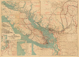
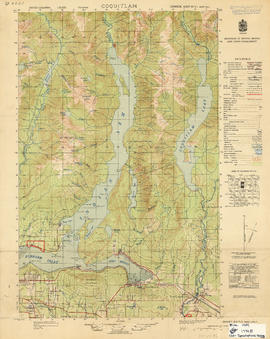
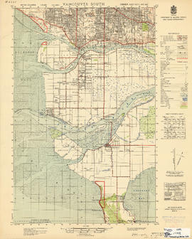
Item is a map of southwestern British Columbia from Bute Inlet to Alta Lake and Chilko Lake to northern Gabriola Island showing Crown granted land, surveyed timber leases and licenses, Indian Reserves, government reserves, land district and park boundaries, nautical distances, municipalities, cities and villages, telegraph and telephone lines, pipelines, railways, government agents' offices, mining and sub-mining recording offices, post offices, lighthouses, roads, and elevations of geographical features.