- AM1594-: MAP 709-: LEG1328.5
- Part
- 1959
Part of City of Vancouver Archives technical and cartographic drawing collection
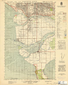
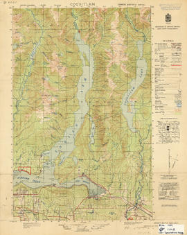
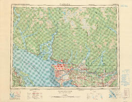
Part contains a map of the Greater Vancouver area showing topographic contour lines at 500-foot intervals, roads and road characteristics, railways, parks, towns, reserves, elevations, airports, streams, lakes, and adminstrative boundaries. Includes a key plan of adjoining sheets published in the same series and a small ancillary map showing the declination of the compass needle in 1958.