Showing 5 results

Archival description
Greater Vancouver (B.C.) Pictorial maps With digital objects
Print preview View:

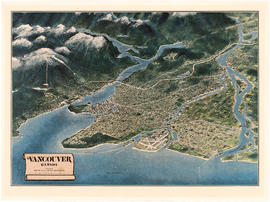
Vancouver, Canada

Item is a map of the Lower Mainland from the City of Vancouver east to Port Coquitlam, including the North Shore municipalities, Vancouver, Burnaby, New Westminster, the western portion of Port Coquitlam, Richmond, and the northern portion of Surrey. The pictorial map is in the form of an oblique aerial view oriented to the E/NE.

Commercial map of Greater Vancouver and district

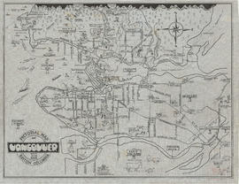
Item is a map sheet containing two maps. The principal map depicts greater Vancouver, including portions of North and West Vancouver, Richmond and Surrey. The information depicted on the map includes streets, postal blocks, streetcar and railway lines, parks and golf courses, and schools. The map includes 1/2 mile distance circles centred on old City Hall at Main and Hastings.

The sheet includes an inset map of Granville Island. Depth of water given along shorelines of Burrard Inlet, English Bay, and along the West Vancouver coast from First Narrows to Howe Sound. The sheet includes an index of streets.

Perspective of Greater Vancouver from Grouse Mountain (elevation 4000 ft.)

item is an illustrated, map-like pictorial view of Greater Vancouver. Locations of districts, waterways, beaches, golf courses, principal parks and significant buildings are identified by matching an index list to corresponding letters and numbers on the vertical and horizontal axes along the border of the map.