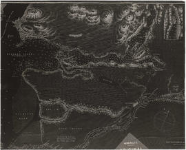
Item is a sheet with three nautical charts. The main chart depicts Burrard Inlet from Atkinson Point [Point Atkinson] in the west to the "townsite of Port Moody" in the east. The inset charts depict Vancouver Harbour and the Second Narrows.
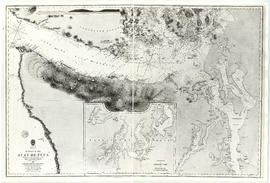
Item is a reproduction of a map of the Strait of Juan de Fuca, including the southern tip of Vancouver Island, the southern Gulf Islands and adjacent mainland, Admiralty Inlet and Puget Sound.