Showing 132 results

Archival description
City of Vancouver Archives technical and cartographic drawing collection Land subdivision
Print preview View:

96 results with digital objects Show results with digital objects

Plan of sub-division of lot 2027, group 1, New Westminster District, B.C., to be sold by public auction at Vancouver, B.C.

Item is a map showing major streets, lot numbers, lot boundaries and property sold or reserved in the area from Chaldecott Road (now King Edward Ave.) in the north to Magee Road (now W. 49th Ave.) in the south. Kaye Road (now Trafalgar St.), Wilson Road (now W. 41 Ave.), Bodwell Road (now W. 33rd Ave.) and Johnson Road (now Blenheim) are all included on the map.

Plan of provincial government property being a portion of townsite of Vancouver and sub-division of lot 540, group 1, New Westminster District, B.C., to be sold by public auction at Vancouver, B.C.

Item is a map showing lot numbers, lot boundaries, major streets and property sold or reserved in the area bounded by Campbell Street (Alma Street), present-day Trafalgar Street (unnamed on map), English Bay, and 16th Avenue.

Plan of Greater Vancouver, British Columbia

Item is a map of Greater Vancouver from Alma Road (Alma Street) to Boundary Road and Burrard Inlet to King Edward Avenue. Map shows district lot, block, and lot numbers, waterfront businesses, rail lines, schools, parks, beaches, and concentric circles indicating distances from a point located approximately at the intersection of Cambie and Hastings Streets.

Plan of Kitsilano Indian Reserve, No. 6 (contours)

Item is a topographical map used as a base for showing surveying information such as lot numbers, boundaries, contours, bearings, pipelines, bridge and rail rights-of-way and other landmarks on the Kitsilano Indian Reserve. The map was likely used in planning the development of Vanier Park and/or the Vancouver Museum in the mid-late 1960s. Annotations show "most likely entrance" at McNicoll Avenue.

Vancouver (B.C.). Engineer's Office

Vancouver Harbour, British Columbia

Item is a nautical chart of Burrard Inlet, including the southern portions of the North Arm of Burrard Inlet. The map shows depth soundings, harbour anchorages, headlines, beacons, buoys, bells, piers and wharves. The map also shows lot numbers, municipal boundaries and major street names of the southern portion of North Vancouver and the northern portions of Point Grey, Kitsilano, Mt. Pleasant, Fairview, Hastings Townsite, Burnaby and Port Moody from the Coquitlam municipal boundary in the east to the western boundary of the Vancouver harbour (between Point Atkinson and Point Grey) in the west. The item also includes a key map showing the location of the Vancouver Harbour in relation to northwestern Washington and Vancouver Island and an inset map showing lots surrounding the north arm of Burrard Inlet to the Inlailawatash Indian Reserve.

Hastings Townsite : Rupert Street to Boundary Road and Strathcona Road (22nd Avenue) to Government Road (29th Avenue)

Part is a sheet of a sectional map of Hastings Townsite showing streets, railways, legal addresses, some lot sizes, and municipal boundaries. Item has been annotated with information regarding property ownership and various symbols of unspecified meaning.

Hastings Townsite : Renfrew Street to Rupert Street and Strathcona Road (22nd Avenue) to Government Road (29th Avenue)

Part is a sheet of a sectional map of Hastings Townsite showing streets, railways, legal addresses, some lot sizes, and municipal boundaries. Item has been annotated with information regarding property ownership and various symbols of unspecified meaning.

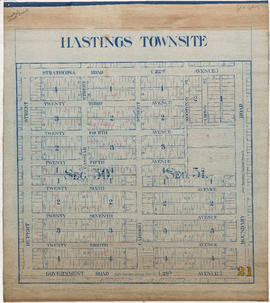
Hastings Townsite : Nanaimo Street to Renfrew Street and Strathcona Road (22nd Avenue) to Government Road (29th Avenue)

Part is a sheet of a sectional map of Hastings Townsite showing streets, railways, legal addresses, some lot sizes, and municipal boundaries. Item has been annotated with information regarding property ownership and various symbols of unspecified meaning.

Hastings Townsite : Nanaimo Street to Renfrew Street and 13th Avenue to Strathcona Road (22nd Avenue)

Part is a sheet of a sectional map of Hastings Townsite showing streets, railways, legal addresses, some lot sizes, and municipal boundaries. Item has been annotated with information regarding property ownership, including identification of properties included in a 1919 tax sale, and various symbols of unspecified meaning.

Hastings Townsite : Rupert Street to Boundary Road and 5th Avenue to 13th Avenue

Part is a sheet of a sectional map of Hastings Townsite showing streets, railways, legal addresses, some lot sizes, and municipal boundaries. Item has been annotated with information regarding property ownership, including identification of properties included in a 1919 tax sale, and various symbols of unspecified meaning.

Hastings Townsite : Renfrew Street to Rupert Street and 5th Avenue to 13th Avenue

Part is a sheet of a sectional map of Hastings Townsite showing streets, railways, legal addresses, some lot sizes, and municipal boundaries. Item has been annotated with information regarding property ownership, including identification of properties included in a 1919 tax sale, and various symbols of unspecified meaning.

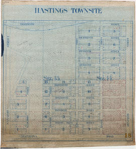
Hastings Townsite : Nanaimo Street to Renfrew Street and Burrard Inlet to Cambridge Street

Part is a sheet of a sectional map of Hastings Townsite showing streets, railways, legal addresses, some lot sizes, and municipal boundaries. Item has been annotated with information regarding property ownership and various symbols of unspecified meaning.

Hastings Townsite

Item is a partial sectional map of Hastings Townsite showing streets, railways, legal addresses, some lot sizes, and municipal boundaries. Item has been annotated with information regarding property ownership, including identification of properties included in a 1919 tax sale, and various symbols of unspecified meaning.

Powell Lake

Item is a map of the southwest coast of British Columbia from Cortes Island to Alta Lake and Chilko Lake to the northern tip of Gabriola Island. Map shows timber leases, Crown granted land, parks, municipalities, power lines, roads, railways, elevation of lakes and some mountains, hospitals, schools and canneries.

British Columbia : Port Moody sheet : west of seventh, east and west of coast meridians

Item is a map of the Lower Mainland of British Columbia, from the international border in the south to Britannia Beach in the north and from Sechelt Peninsula in the west to Chilliwack and Harrison Lake in the east. Map shows railways, railway stations, trails, roads surveyed, post offices, townships, and ranges.

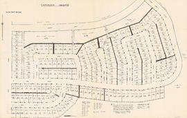
City of Vancouver : Residential lots, Area B, Champlain Heights

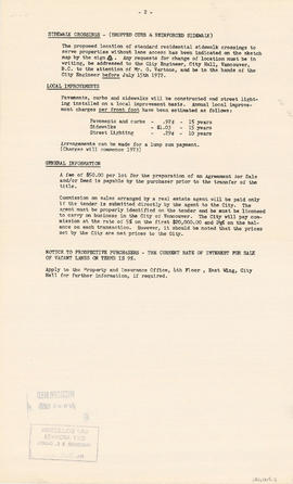
Item contains information on the sale of lots in Champlain Heights by the City of Vancouver. A map shows lot numbers, lot sizes, lot values and sidewalk crossings in the area from Rosemont Drive in the north to 63rd Avenue in the south and from Butler Street in the east to Kerr Street in the west, and text outlines the details associated with sales.

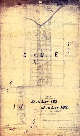
Plan of subdivision of D in lot 183 and subdivision of J in lot 182, City of Vancouver

Item is a subdivision map showing block and lot numbers of subdivisions D and J in lots 183 and 182 respectively. These areas are situated roughly between Burrard Inlet in the north and First Avenue in the south and between Victoria Drive in the east and Clark in the west.

Garden, Hermon and Burwell, Provincial Land Surveyors

Plan of re-subdivision of lots 3 to 14, subn [subdivision] 2 of bk [block] 3. D.L. 391 & 392

Map shows the subdivision of lots in the block bordered by 31st Avenue East, 32nd Avenue East, St. Catherines Street and Windsor Street, at that time in the District of South Vancouver. Map is certified by the surveyor Arthur H. Holland, British Columbia Land Surveyor, and W.A. Pound, Reeve of the District of South Vancouver. It is unclear as to whether the map was commissioned by the Corporation of the District of South Vancouver.

West section Richmond municipality

Item is a copy of part of a published map of Richmond, B.C. The map shows lot numbers, post offices, dikes, streets, roads, swinging bridges, churches, schools, municipal boundaries and geographical features in the area from Marpole in the north to Gunn Island in the south and from Jacombs Road in the east to Sturgeon Bank in the west. The portion has been annotated with a grid, but information is included which indicates what the lines mean.

Indexed guide map of the city of Vancouver and suburbs

Part is a map showing district lots, blocks, and boundaries between the City of Vancouver, Point Grey, South Vancouver, Burnaby, New Westminster, and parts of Richmond, North Vancouver and West Vancouver. Concentric circles indicate the distance in miles from the intersection of Main Street and Hastings Street in intervals of 1/2 mile.

Map of the city of Liverpool, Burrard Inlet, British Columbia

Item is a copy of a land registry map used to document the registration of block and lot subdivisions in what later became the West End neighbourhood of Vancouver. The original map has been heavily annotated around the map image to record information regarding the individual filings submitted for registration of individual blocks and lots, though the writing is not always legible. The map also shows the boundaries between the lands owned by John Morton, Hailstone and Brighouse, and David Oppenheimer and others, between the original Granville Township and the government reserve that later became Stanley Park.

Turner, George

Plan of town of Lonsdale : situate [sic] on harbour opposite City of Vancouver

Map shows lot numbers and boundaries in the area from Keith Road in the north to Burrard Inlet in the south and from St. Patrick's road in the east to Chesterfield Avenue in the west. Several lots at St. Andrews Road and Fourth Street are hand-coloured pink, but the significance of the colouring is unknown. The ancillary map is an index map showing the location of Lonsdale in relation to Burrard Inlet and Vancouver.

Map of Vancouver, B.C. including Hastings Townsite and D.L. 301

Item is a map which shows Vancouver city streets, blocks, parks and neighbourhood boundaries. Map includes Kitsilano, Shaughnessy Heights, West End, Fairview, Mount Pleasant, Grandview, Rosedale and Hyde Park areas. Map also indicates steamship, car and railway lines.

The map was originally designed to be folded and enclosed in a small folder to which it was attached.

Lot numbers, boundaries, railway lines and street names in the municipality of Point Grey

Primary map shows lot numbers, boundaries, railway lines and street names in the municipality of Point Grey from 16th Avenue in the north to the Fraser River in the south and from Ontario Street in the east to Blanca Drive in the west. A smaller map in the bottom left-hand corner of the item shows the north west portion of Point Grey.

Results 1 to 50 of 132