Vancouver 1886-1986 : yesterday, gateway to the Pacific : today, crossroads of the world
Vancouver 1886-1986 : yesterday, gateway to the Pacific : today, crossroads of the world
City of Vancouver : Residential lots, Area B, Champlain Heights
City of Vancouver : Residential lots, Area B, Champlain Heights
City-owned lands-False Creek
City-owned lands-False Creek
A composite plan showing Capilano Indian Reserve No. 5 and district lot 5521
A composite plan showing Capilano Indian Reserve No. 5 and district lot 5521

North Arm Road, 1876. North Arm, Fraser River

Vancouver, British Columbia
West section Richmond municipality
West section Richmond municipality
Bird's eye view of Vancouver, B.C.
Bird's eye view of Vancouver, B.C.
Burnaby municipality
Burnaby municipality

Plan of Lot 6311, Vancouver, B.C. fronting on Kitsilano Indian Reserve No. 6

Vancouver

Vancouver

Map of Richmond municipality
Vancouver Harbour : plan of south shore, Burrard Inlet between Heatley Ave. and Victoria Dr.
Vancouver Harbour : plan of south shore, Burrard Inlet between Heatley Ave. and Victoria Dr.

British Columbia federal constituencies
Plan of portion of Kitsilano Indian Reserve, No. 6 of the Squamish band, occupied by No. 2 Equipment Depot, R.C.A.F.
Plan of portion of Kitsilano Indian Reserve, No. 6 of the Squamish band, occupied by No. 2 Equipment Depot, R.C.A.F.
Plan of Kitsilano Indian Reserve, No. 6 (contours)
Plan of Kitsilano Indian Reserve, No. 6 (contours)

Vancouver North. British Columbia

Second section : Shaughnessy Heights

University Endowment Lands : plan of units nos. 1 and 2
![[Second section of] Shaughnessy Heights](/uploads/r/null/9/4/d/94d42178bb60a8c60cdc002199430e863ae830696947ad73807b5fd11046c39a/72c651d3-6742-4c5c-a0bc-d83c3526a9ba-MAP330_142.jpg)
[Second section of] Shaughnessy Heights

University Endowment Lands : plan of units no. 1 and 2
![D.L. [District Lot] 526](/uploads/r/null/c/b/4/cb45fc2541156cf0f1c89b637733e961198017ddd4aa199ba866f1150856a8ba/dfb19024-a115-4097-9258-559e228c275d-MAP332_142.jpg)
D.L. [District Lot] 526
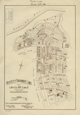
University Endowment Lands : plan of units nos. 1 and 2
![[First section of] Shaughnessy Heights](/uploads/r/null/c/d/0/cd05f96b7e9f01fee4ba2afe83ac83cef9d70b3cf83d3ba8c4ebe5a0a20a429d/0d2ec941-063b-4722-8d84-aff283b273f6-MAP329_142.jpg)
[First section of] Shaughnessy Heights
Vancouver Harbour, British Columbia
Vancouver Harbour, British Columbia

Vancouver harbour
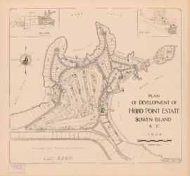
Plan of development of Hood Point Estate, Bowen Island, B.C., 1928
![Plan of Point Grey Municipality [ward boundaries]](/uploads/r/null/a/c/a/aca691b3d6e49d092070fc230a88f5ca7bd346fc8c5894892d7cdc5a79b535ee/9a14b192-1858-43aa-ab28-d0b03a2304eb-MAP360_142.jpg)
Plan of Point Grey Municipality [ward boundaries]
University Endowment Lands, District Lot 140, group 1, New Westminster District
University Endowment Lands, District Lot 140, group 1, New Westminster District
![[Third section of] Shaughnessy Heights](/uploads/r/null/b/9/c/b9c97036cadac8b6ffc53f2380c1c158d767da3473d29ad1b04968cc742d132e/0301116d-9946-489d-a272-9d6453523103-MAP331_142.jpg)
[Third section of] Shaughnessy Heights

Plan of district lots 264, 265, 266 and 552, North Vancouver, British Columbia

Plan of government subdivision at Point Grey, B.C.
Municipality of Point Grey : sale of municipal-owned lands
Municipality of Point Grey : sale of municipal-owned lands
![Sectional map [Kaslo Street to Yale Street to Cotton Drive to East 1st Avenue]](/uploads/r/null/5/b/5b3ce173622ff68f920706abdf2b71af76caf9469cb2cbd3346b37f55694015e/4e7b285b-63cb-45b1-8e0c-6002788dbae6-MAP427_142.jpg)
Sectional map [Kaslo Street to Yale Street to Cotton Drive to East 1st Avenue]

Part of D.L. 526 (Vancouver section 29)

Powell Lake

Municipality of South Vancouver

Plan of West Vancouver Municipality

Plan of the City of Vancouver, B.C.

Plan showing lands occupied in Stanley Park near Brockton Point, City of Vancouver, B.C.

Southerly portion. Vancouver Island
Indexed guide map of the City of Vancouver and suburbs
Indexed guide map of the City of Vancouver and suburbs

Municipality of South Vancouver
West Vancouver
West Vancouver

Plan of subdivision of part of D.L. 526 : South Vancouver
Southerly portion of Vancouver Island
Southerly portion of Vancouver Island

British Columbia : Port Moody sheet : west of seventh, east and west of coast meridians
Map of New Westminster District
Map of New Westminster District

Portions of New Westminster District and Vancouver Island