Port Moody, the western terminus of the Canadian Pacific Railway
Canadian Pacific Railway. Plan of part of branch line from Port Moody. A point on main line C.P.R. to English Bay, B.C.
Map of New Westminster District, B.C.
City of Vancouver : Canadian Pacific town site
City of Vancouver : Canadian Pacific town site
Plan of the townsite of North Vancouver
Plan of part of subdivision of district lot 540. South Vancouver
Canadian Pacific map of Vancouver [west half]
Map of part of the New Westminster District shewing the proposed new municipality of Burnaby
City of New Westminster British Columbia
Map of New Westminster District, B.C.
City of Vancouver
Plan of subdivision of D in lot 183 and subdivision of J in lot 182, City of Vancouver
Vancouver City : plan of Subdivision of lot 301, Group 1, New Westminster District
Map of the business portion of the City of Vancouver, British Columbia [early street paving]
Municipality of North Vancouver [Burrard Inlet]
British Columbia. Port Moody
Plan of Provincial Government property being a portion of Townsite of Vancouver
Plan of part of D.L. 540
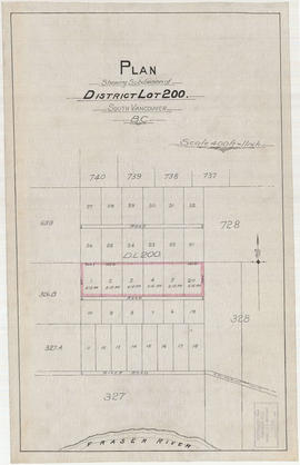
Plan shewing subdivision of District Lot 200. South Vancouver, B.C.
Plan of the City of Vancouver
Plan of town of Lonsdale : situate [sic] on harbour opposite City of Vancouver
Vest pocket map of Vancouver : map C
Map of Western Canada
Vest pocket map of Vancouver : map D
Vest pocket map of Vancouver : map B
Plan of provincial government property being a portion of townsite of Vancouver and sub-division of lot 540, group 1, New Westminster District, B.C., to be sold by public auction at Vancouver, B.C.
Plan of part of sub-division of district lot 540, South Vancouver, provincial government property
Plan of provincial government property being a sub-division of a portion of expired timber lease situated in North Vancouver, New Westminster district, B.C., to be sold by public auction
Plan of sub-division of lot 2027, group 1, New Westminster District, B.C., to be sold by public auction at Vancouver, B.C.
East Vancouver Heights
Plan of the City of Vancouver, British Columbia
Map of the south-western part of British Columbia
Plan of townsite at Eburne
Vancouver and Northern Railway, 1908
Map of Grandview and east end
Plan of subdivision of part of D.L. 526, New Westminster District, B.C., Kitsilano, City of Vancouver
Hastings Townsite : Renfrew Street to Rupert Street and 5th Avenue to 13th Avenue
Hastings Townsite : Rupert Street to Boundary Road and 5th Avenue to 13th Avenue
Hastings Townsite : Nanaimo Street to Renfrew Street and 13th Avenue to Strathcona Road (22nd Avenue)
Hastings Townsite : Renfrew Street to Rupert Street and Strathcona Road (22nd Avenue) to Government Road (29th Avenue)
Map and guide of Greater Vancouver
Hastings Townsite : Nanaimo Street to Renfrew Street and Strathcona Road (22nd Avenue) to Government Road (29th Avenue)
Plan of the municipality of South Vancouver
Hastings Townsite : Rupert Street to Boundary Road and Strathcona Road (22nd Avenue) to Government Road (29th Avenue)

![[Vancouver, B.C. : district lots]](/uploads/r/null/4/a/4a5c15633319c3754d3aa0cc525470bfebcf5a98ad8caeedf44b777194f300bd/2f055d65-47f7-4679-bb91-66b8f1843d2f-MAP531_142.jpg)


![Canadian Pacific map of Vancouver [west half]](/uploads/r/null/f/a/fa49266d21715d75ce93883012d471657dd058b90843927ec82b44d2bb42b007/f12ea9a5-4914-4db8-bda9-312aa2e2ccef-MAP10_142.jpg)


![Map of the business portion of the City of Vancouver, British Columbia [early street paving]](/uploads/r/null/7/1/7187f671d2770050eb87f7f397a10ea92bf0bc593b0a186e3a4bf341b3d26e42/8770145a-b925-4eef-82ac-e397f61a65aa-Map1163_142.jpg)
![Municipality of North Vancouver [Burrard Inlet]](/uploads/r/null/6/d/6d0d9a4b75b38672c56aa89a5984fe2d0e6d66be85f6f375cbe8e2fd7ac94a98/577914e1-3de2-478b-a629-5f391731387a-MAP588_142.jpg)


![Plan of town of Lonsdale : situate [sic] on harbour opposite City of Vancouver](/uploads/r/null/c/5/d/c5d4b56db1d7f9e1cf57dd5a974f6fcb23507e64543bad1bdd8f62139042389f/1cc57eaf-6c92-438e-a65d-335940738df7-MAP686_142.jpg)


