
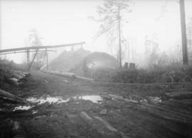
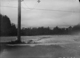
Bunkers at Dunbar and 1st Avenue
- AM1257-S25-: CVA 275-6
- Item
This is excavation for public works purposes.
94 results with digital objects Show results with digital objects
Bunkers at Dunbar and 1st Avenue
This is excavation for public works purposes.

Capilano and Seymour water sheds
Part of City of Vancouver fonds
Item is a map showing Capilano and Seymour water sheds, reservoirs, pipelines, lot numbers and major roads in the area from Howe Sound to Port Moody and Britannia to Delta. The item includes information about the drainage area, annual precipitation and annual runoff associated with the Capilano and Seymour water sheds.

Cheakamus power survey : copy of portion of plan no. 11 accompanying report by E.A. Cleveland
Part of City of Vancouver fonds
Map is a topographical plan showing elevations and the location of power houses, dams, pipelines, tunnels and railways as well as mountains, glaciers, creeks and lakes in the Garibaldi Lake area. The map shows the area approximately between the Cheakamus River in the west and Pitt River in the east, and between Green Lake in the north and Rampart Lake in the south.
The map is a tracing of a portion of one of the maps created by E.A. Cleveland in 1931 and was included in the appendix to his report to the City of Vancouver on the hydro-electric capacity of the Cheakamus River system (the atlas of maps accompanying the Cleveland report is MAP 939). Sheet 11 of that atlas was a copy of the map Topographical map of Garibaldi Park, published by the British Columbia Department of Lands in 1928, a copy of which had been used as a base map to note elements of the Cheakamus River hydro-electric survey.

Part of City of Vancouver Archives technical and cartographic drawing collection
Map is a topographical plan showing a proposed hydroelectric development in the Cheakamus River area, between Garibaldi Lake and Daisy Lake, and a profile along the tunnel and pipeline route. Included on the map are Daisy Lake, Garibaldi Lake, Cheakamus River, various creeks, including Parnassus Creek and Scott Creek, bluffs, and ponds. Also indicated on the map are the locations of a pipeline, tunnel and tunnel intake, the Daisy Lake Trail and other trails, a construction shaft, proposed dam, proposed Daisy Lake Reservoir, and the power station for the Garibaldi-Daisy Lake Development. The map was created to accompany E.A. Cleveland's "Report on a Preliminary Investigation of the Cheakamus River Power Possibilities made for the City of Vancouver."

Part of City of Vancouver Archives technical and cartographic drawing collection
Map is a plan showing the location of power houses, dams and pipes for the Garibaldi-Daisy Lake development, Cheakamus Lake-McGuire, McGuire-Brandywine, Cheakamus Canyon and Daisy Lake Dam areas. Map created to accompany E.A. Cleveland's "Report on a Preliminary Investigation of the Cheakamus River Power Possibilities made for the City of Vancouver."
Part of City of Vancouver Archives technical and cartographic drawing collection
Map consists of a graph showing the discharge in acre feet of the Cheakamus River at Watson, 1917-1926, and the Cheakamus River near Daisy Lake, 1926-1930. Map created to accompany E.A. Cleveland's "Report on a Preliminary Investigation of the Cheakamus River Power Possibilities made for the City of Vancouver." Map has been numbered Tube 55.

Part of City of Vancouver Archives technical and cartographic drawing collection
Map is a plan of the proposed development of the Cheakamus Lake for hydroelectric power. Includes a capacity diagram of Cheakamus Lake with dam at section A-B and a plan of the proposed dam site. The map also shows elevations and types of terrain. Map created to accompany E.A. Cleveland's "Report on a Preliminary Investigation of the Cheakamus River Power Possibilities made for the City of Vancouver." A note on the map reads "Traverse from Sta. 257-50 to Sta. 371-10 by C.W. Williams 1923, Cheakamus Lake from plan by Williams (1923) except soundings as shown." Map has been numbered Tube 56.

Part of City of Vancouver Archives technical and cartographic drawing collection
Map is a plan showing the proposed hydroelectric development near McGuire and Brandywine Creek. Map was created to accompany E.A. Cleveland's "Report on a Preliminary Investigation of the Cheakamus River Power Possibilities made for the City of Vancouver." Map has been numbered Tube 57.

Part of City of Vancouver Archives technical and cartographic drawing collection
Map is a topographical plan showing the proposed hydroelectric development on the Cheakamus River near Mile 19, Pacific Great Eastern Railway. Indicated on the map are the locations of tunnels, dams, by-passes, pipelines, the railway line, and the power station for the Cheakamus Canyon development. The map was created to accompany E.A. Cleveland's "Report on a Preliminary Investigation of the Cheakamus River Power Possibilities made for the City of Vancouver." Map has been numbered Tube 59.

Part of City of Vancouver Archives technical and cartographic drawing collection
Map is a topographical plan showing the proposed diversion works on the Cheakamus River near Mile 19, Pacific Great Eastern Railway. Indicated on the map are the locations of tunnels, dams and the railway line. The map was created to accompany E.A. Cleveland's "Report on a Preliminary Investigation of the Cheakamus River Power Possibilities made for the City of Vancouver." Map is numbered Tube 60.

Part of City of Vancouver Archives technical and cartographic drawing collection
Map is a topographical plan of the Cheakamus River area from a point southward near Mile 34, Pacific Great Eastern Railway, showing elevations and a trail. The map was created to accompany E.A. Cleveland's "Report on a Preliminary Investigation of the Cheakamus River Power Possibilities made for the City of Vancouver." Map has been numbered Tube 62.

Part of City of Vancouver Archives technical and cartographic drawing collection
Map is a plan of the proposed storage reservoir at Daisy Lake on the Cheakamus River. The map includes a plan of the topography of the proposed dam site, a log of borings, and a capacity diagram at Daisy Lake Reservoir. Also included are elevations, power stations, pipelines and the Pacific Great Eastern Railway line. The map was created to accompany E.A. Cleveland's "Report on a Preliminary Investigation of the Cheakamus River Power Possibilities made for the City of Vancouver." Map has been numbered Tube 58.

Part of City of Vancouver Archives technical and cartographic drawing collection
Map is a topographical plan showing the area from Alpha Lake to Cheakamus River, above Mile 34, Pacific Great Eastern Railway. Indicated on the map are the locations of the Mons Gauging Site, a suggested dam site, trails, the old wagon road, the railway line, and Millar Creek. The map was created to accompany E.A. Cleveland's "Report on a Preliminary Investigation of the Cheakamus River Power Possibilities made for the City of Vancouver." Map has been numbered Tube 61.

Part of City of Vancouver Archives technical and cartographic drawing collection
Map is a plan showing the location of power houses, dams and pipes for the Garibaldi-Daisy Lake development, Cheakamus Lake-McGuire, McGuire-Brandywine, Cheakamus Canyon and Daisy Lake Dam areas. Map created to accompany E.A. Cleveland's "Report on a Preliminary Investigation of the Cheakamus River Power Possibilities made for the City of Vancouver."
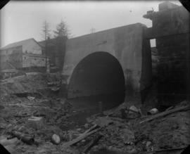
Chute set on trestle for sewer construction
Part of City of Vancouver fonds

Chute set on trestle for sewer construction
Part of City of Vancouver fonds

City of Vancouver redevelopment : project 1, area A-1.1 : existing and proposed utilities
Part of City of Vancouver fonds
Item is a map showing existing and proposed utilities for the area bounded by Campbell Avenue, Glen Drive, Cordova Street, and Union Street, and has been annotated to show which utilities are cost shareable under the Section 23 program.
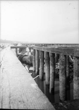
Construction of sewer outfall on 6th Avenue
Part of City of Vancouver fonds
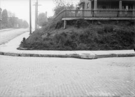
Corner of West 3rd Avenue and Arbutus Street looking east
Part of City of Vancouver fonds
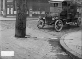
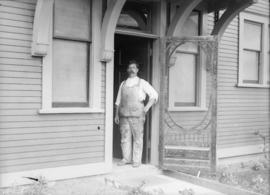
Delivery truck at the corner of Pender and Abbott
Part of City of Vancouver fonds

Excavation for 5'6" sewer on Copley Street just north of Lakeview
Part of City of Vancouver fonds
Part of City of Vancouver fonds
![False Creek development : san [sanitary] sewers tentative layout](/uploads/r/null/c/a/ca111eaa497f59a66ecdad4c91bfb2238f21efb21b91a1172f460ef16667055f/4da08847-7457-4d4c-8938-e4c6c1dc50c3-MAP692_142.jpg)
False Creek development : san [sanitary] sewers tentative layout
Part of City of Vancouver fonds
Item is a copy of a sheet from a sectional map of Vancouver which has been annotated to show the proposed locations of sanitary sewers in the area from Keefer Street in the north to 3rd Avenue in the south and from Clark Drive in the east to Ontario Street in the west.
Vancouver (B.C.). Engineer's Office

Part of City of Vancouver fonds
Greater Vancouver sewerage and drainage district
Part of City of Vancouver Archives technical and cartographic drawing collection
Item is a pamphlet with a map of the Greater Vancouver sewerage and drainage district on one side, and general and statistical information about the district on the other.

Hydro electric surveys. Plan showing location of water powers investigated by City of Vancouver
Part of City of Vancouver fonds
Item is a map which shows the locations and the dates of use of "gauging stations established" and "city gauging stations still in use" in the area of south-western British Columbia where the City of Vancouver conducted hydro-electric surveys up to 1923.

Hydro electric surveys. Plan showing location of water powers investigated by City of Vancouver
Part of City of Vancouver fonds
Item is a map which functions as a visual index to the locations of various hydro electric surveys carried out by the City of Vancouver along the following rivers: Squamish River, Cheakamus River, Green River, Lillooet River, Eagle River, Indian River, Pitt River, Chehalis River, Harrison River, Chilliwack River, the Fraser and Thompson Rivers, and Bridge River. The map lists the names of the surveyors responsible and the areas covered by each survey. Annotations include the locations and the dates of use of "gauging stations established" and "city gauging stations still in use."

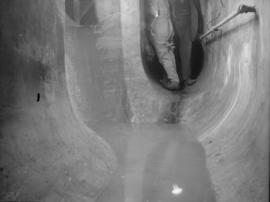
Interior of brick lined sewer tunnel
Part of City of Vancouver fonds

Part of City of Vancouver fonds

Man seated on a beam through a tunnel
Part of City of Vancouver fonds
Item is a photograph showing the China Creek sewer before paving.

Part of City of Vancouver fonds
Item is a photograph showing a man sitting in the construction site for the the sewer junction at the Bridge Street and Seventh Avenue sewers.

Man standing by sewer with houses above
Part of City of Vancouver fonds
Part of City of Vancouver fonds
Map of City of Vancouver showing distribution of electric light, gas, & power services
Part of Major Matthews collection
Item is a map which shows the City of Vancouver in the early parts of the 20th century (ca. 1905) and depicts city blocks which had been supplied with electric street lights, with electric power and gas service. J.S. Matthews annotated the map in 1947 with counts of electric street lights in various neighbourhoods.

Part of City of Vancouver fonds

Men standing by sewer construction
Part of City of Vancouver fonds

Men standing by sewer tunnel construction
Part of City of Vancouver fonds
Men standing in opening of concrete sewer tunnel
Part of City of Vancouver fonds
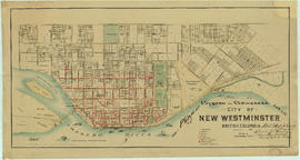
New Westminster waterworks : plan of city distribution system
Part of City of Vancouver Archives technical and cartographic drawing collection
Map shows New Westminster waterworks gates, hydrants, street and property boundaries, pipelines and divisions between high and low levels.
![Paving finish on invert for 5'6" interceptor in [sewage] tunnel at 1st avenue near Vine Street](/uploads/r/null/f/3/f3e44df5584efe0cbaaa2f1dc3c7fecc40289a78b7d00ab17da8ed1baad53bef/2862f8db-a8d7-4aa9-9b33-73956f89ba99-CVA275-7_142.jpg)
Paving finish on invert for 5'6" interceptor in [sewage] tunnel at 1st avenue near Vine Street
Part of City of Vancouver fonds

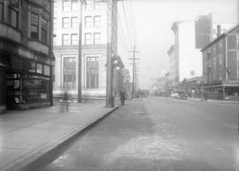
Pender and Richards looking east
Part of City of Vancouver fonds

Part of City of Vancouver Archives technical and cartographic drawing collection
Item includes a small drawing in the top right-hand corner of the map showing Greater Vancouver Water District's mains and connections at Second Narrows Crossing.
Plan of pipe lines from intake to tunnel [Capilano Creek]
Part of City of Vancouver fonds
Item is a map showing pipeline plans, lot numbers and lot boundaries along Capilano Creek.
Hermon and Burwell Engineers

Plan of subdivision of block 120 (explanatory plan 8011), district lot 181
Part of City of Vancouver fonds
Item is a map annotated to show locations of hydro, telephone, water and gas services and sewers on the east side of the area cleared for development between Campbell Avenue, Raymur Avenue, Hastings Street, and Union Street. Base map is a subdivision plan for the area.
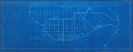
Plan of system of sewerage for the city of New Westminster, British Columbia
Part of City of Vancouver Archives technical and cartographic drawing collection
Item is a published map of the City of New Westminster which has been annotated to depict a planned sewer system.
Hill, Albert J.
Plan of topographic survey of block 96, and portion of block 97, District Lot 264a
Part of Wilson family fonds
Item is a map showing parcels of land, sewers, drainages, water mains, fire hydrants and elevations in the area from 5th Avenue in the north to 7th Avenue in the south and from Glen Drive in the east to St. Catherines Street in the west.
Underhill and Underhill Engineers and Surveyors (Vancouver, B.C.)

Project 2, area "h" and part of "b" : existing gas, electricity and telephone
Part of City of Vancouver fonds
Item is a map showing the gas lines, the electricity lines, the telephone lines, the boundaries of redevelopment for areas "b" and "h" and the boundaries of project clearance for areas 8 and 9 in redevelopment project 2.

Project 2, area "h" and part of "b" : existing utilities, water and sewer
Part of City of Vancouver fonds
Item is a map showing the water lines, the sewer lines, the direction of sewer flow, the boundaries of redevelopment for areas "b" and "h" and the boundaries of project clearance for areas 8 and 9 in redevelopment project 2.