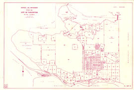
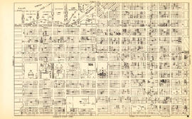
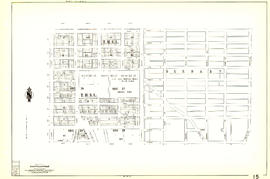
Item is an index map of Vancouver showing the boundaries of the sectional maps in this file. Map includes streets, roads and railways; blocks, lots and legal descriptions; First Nations reserves, government buildings, cemeteries, parks and busines...
File consists of three maps of Vancouver: an index map to the sections, an index map to District Lots, and 62 section sheets drawn and revised between ca. 1935 and 1945. Some time between 1946 and 1951 these maps were compiled and reproduced by th...
File consists of a sectional map of Vancouver, and two accompanying index maps. Maps show streets and roads, blocks, lots, legal descriptions, railways, parks, schools, hospital, cemetery, golf courses, retirement homes, and some businesses.
File consists of three maps of Vancouver: an index to the sectional map sheets, a plan of District Lots in Vancouver, and a sectional map in 62 sheets. The sectional map sheets show streets and roads, blocks, lots, legal descriptions, railways, pa...
File consists of two index maps and eighty-five sectional maps of Vancouver, revised between 1965 and 1970. Sectional maps include streets, blocks, lots, legal descriptions, railways, parks, schools, hospitals, cemetery, golf courses, retirement h...
Item is a topographical plan of Point Grey showing the area from Angus Drive to Granville Street and 71st Avenue to the Fraser River, including property in D.L. 317 and D.L. 318. Plan shows the locations of the Vancouver and Lulu Island Railway, a...
Map is a plan of the Kitsilano Point area showing the area currently known as Kitsilano Beach and Vanier Park, and streets and blocks between Maple Street and Centre Street (Granville Street) and First Avenue to Third Avenue. The plan shows in det...
Item is an index map of Vancouver showing the boundaries of the sectional maps in this file. Map includes streets, roads and railways; blocks, lots and legal descriptions; First Nations reserves, golf courses, cemeteries, parks and businesses alon...
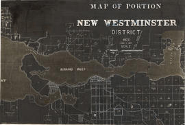
Item is a heavily-amended copy of a map illustrating intended land settlement and subdivision in 1877 in the future sites of Vancouver, Burnaby and the North Shore, from an area bordering on English Bay to an area bordering on North Arm. Also show...
Item is a sketch plan of an area in South Vancouver encompassing Argyle Street, Harrison Avenue and Gritton Avenue. Plan shows the division of property belonging to Major C.W. Hill. The name of the person to which land was deeded and sometimes the...
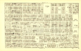
Item is a section showing the area from Cambie Street to Carolina Street and Sixteenth Avenue to Twenty-eighth Avenue. Includes streets, roads, blocks, lots, legal descriptions, parks, nurseries and schools.
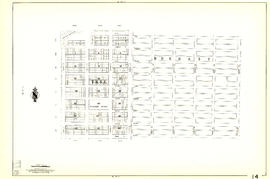
Item is a section showing the area bound by Slocan Street, Boundary Road, Triumph Street and the waterfront. Includes streets, roads, railways, blocks, lots, legal descriptions, quit claims, leases, parks and businesses along the waterfront.
Item is a section showing the area from Carlton Street to Boundary Road and Fortieth Avenue to Fiftieth Avenue. Includes streets, roads, blocks, lots, legal descriptions, parks and schools.
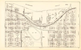
Item is a section showing the area from Clark Drive to Nanaimo Street and Frances Street to Burrard Inlet. Includes streets, blocks, lots and legal descriptions, and the locations of parks and a juvenile detention home.
Item is a section showing the area from Clark Drive to Slocan Street and waterfront to Triumph Street. Includes streets and roads, blocks, lots, legal descriptions, railways, parks, boys' detention home and businesses along the waterfront. Th...
Item is a section showing the area from Clark Drive to Slocan Street and aterfront to Triumph Street. Includes streets and roads, blocks, lots, legal descriptions, railways, parks, boys' detention home and businesses along the waterfront. The...
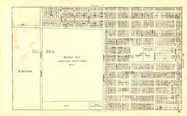
Item is a section showing the area from Cambie Street to St. George Street and Forty-seventh Avenue to Fifty-eighth Avenue. Includes streets, roads, blocks, lots, legal descriptions, golf courses, parks and schools.
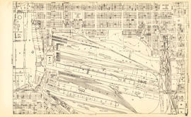
Item is a section showing the area from Carrall Street to Clark Drive and waterfront to Keefer Street. Includes streets and roads, blocks, lots, legal descriptions, railways, parks, schools, freight sheds, warehouses, piers and businesses along th...
Item is a section showing the area from Wall Street to Rupert Street and McGill Street to Burrard Inlet. Includes streets, blocks, lots and legal descriptions, and the locations of parks, schools, and railways.
Item is a section showing the area from Prince Edward Street to Bruce Street and Forty-seventh Avenue to Fifty-eighth Avenue. Includes streets, roads, blocks, lots, legal descriptions, parks and schools.
Item is a section showing the area from Nanaimo Street to Cassiar Street and Pender Street to McGill Street. Includes streets, blocks, lots and legal descriptions, and the locations of bridges, reservoirs and railways.
Item is a section showing the area from Ontario Street to Clark Drive and Keefer Street to Second Avenue. Includes streets, roads, blocks, lots, legal descriptions, railways, parks and schools. Includes Terminal Avenue and land used by the Great N...
Item is a section showing the area from Fleming Street to Carlton Street and Forty-seventh Avenue to Fifty-ninth Avenue. Includes streets, roads, blocks, lots, legal descriptions, parks and schools.
Item is a section showing the area from Ontario Street to Clark Drive and First Avenue to Sixteenth Avenue. Includes streets, roads, blocks, lots, legal descriptions, railways, parks and schools. Includes B.C. Electric Railway car barns.
Item is a section showing the area from Ontario Street to Clark Drive and First Avenue to Sixteenth Avenue. Includes streets, roads, blocks, lots, legal descriptions, railways, parks and schools. Includes B.C. Electric Railway car barns. Annotatio...
Item is a section showing the area from Rupert Street to Boundary Road and Eton Street to Burrard Inlet. Includes streets, blocks, lots and legal descriptions and schools.
Item is a section showing the area from Ash Street to St. George Street and Marine Drive to Fraser River. Includes streets, roads, blocks, lots, legal descriptions, parks and railway lines.
Item is a section showing the area from Cassiar Street to Boundary Road and Pender Street to Kitchener Street. Includes streets, blocks, lots and legal descriptions, and the locations of parks and retirement homes. Also shown are streets and block...
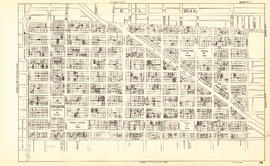
Item is a section showing the area from Main Street to Knight Street and Fifteenth Avenue to King Edward Street. Includes streets and roads, blocks, lots, legal descriptions, parks, schools and businesses.
Item is a section showing the area from Ash Street to St. George Street and Fifty-eighth Avenue to Marine Drive.Includes streets, roads, blocks, lots, legal descriptions, parks and railway lines.
Item is a section showing Oak Street to Main Street and False Creek to Sixteenth Avenue. Includes streets and roads, blocks, lots, legal descriptions, railways, schools, monastery, Vancouver General Hospital and City Hall. Indicates crown land lea...
Item is a section showing Oak Street to Main Street and False Creek to Sixteenth Avenue. Includes streets and roads, blocks, lots, legal descriptions, railways, schools, monastery, Vancouver General Hospital and City Hall.
Item is a section showing the area from Rupert Street to Boundary Road and Kitchener Street to Pender Street. Includes streets, blocks, lots and legal descriptions. Also shown are streets and blocks in the area from Boundary Road to Carleton Avenu...
Item is a sectional map of the "Old City" of Vancouver showing Maple Street to Oak Street and False Creek to Sixteenth Avenue. Includes streets and roads, blocks, lots, legal descriptions, railways, schools and parks. Indicates crown lan...
Item is a section showing Maple Street to Oak Street and False Creek to Sixteenth Avenue. Includes streets and roads, blocks, lots, legal descriptions, railways, schools and parks. Indicates crown land leased to the C.P.R. and other bodies.
Item is a section showing the area from Rupert Street to Boundary Road and Fifth Avenue to Kitchener Street. Includes streets, blocks, lots and legal descriptions, and the location of railways.
Item is a section showing the area from St. George Street to Argyle Street and Fifty-eighth Avenue to the Fraser River. Includes streets, roads, blocks, lots, legal descriptions, railway lines, parks and schools.
Item is a section showing the area from Argyle Street to Vivian Street and Sixty-second Avenue to Kent Street. Includes streets, roads, blocks, lots, legal descriptions and golf courses.
Item is a section showing the area from Nanaimo Street to Rupert Street and Charles Street to Pender Street. Includes streets, blocks, lots and legal descriptions. Includes streets, blocks, lots and legal descriptions, and the locations of parks ...
Item is a section showing Trutch Street to Maple Street and Fourth Avenue to Sixteenth Avenue. Includes streets, roads, blocks, lots, legal descriptions, parks and schools. Annotations in pencil.
Item is a section showing Trutch Street to Maple Street and Fourth Avenue to Sixteenth Avenue. Includes streets, roads, blocks, lots, legal descriptions, parks and schools.