Add to clipboard
Plan of the town of Newcastle, English Bay
Report of Vancouver Civic Centre Committee
Add to clipboard
Report of Vancouver Civic Centre Committee
Add to clipboard
Plan of Cambie St. grounds
The problem of city development : an economic survey
Add to clipboard
The problem of city development : an economic survey
Corporation of Point Grey proposed foreshore development scheme between first Ravine and Imperial Street plan
Add to clipboard
Corporation of Point Grey proposed foreshore development scheme between first Ravine and Imperial Street plan
Commercial Map of Greater Vancouver and District [BC]
Add to clipboard
Commercial Map of Greater Vancouver and District [BC]
Commercial Map of Greater Vancouver and District [BC]
Add to clipboard
Commercial Map of Greater Vancouver and District [BC]
Add to clipboard
Commercial map of Greater Vancouver and district [assessment districts]
Add to clipboard
Plan of government subdivision at Point Grey, B.C.
Information and opinions relating to proposed civic centre site, Vancouver, B.C.
Add to clipboard
Information and opinions relating to proposed civic centre site, Vancouver, B.C.
The official plan and the work of the Commission and the by-law under which the commission was appointed
Add to clipboard
The official plan and the work of the Commission and the by-law under which the commission was appointed
Add to clipboard
Proposed system of drainage and sewerage for False Creek and marginal areas
Add to clipboard
Preliminary report on civic centre
Add to clipboard
Point Grey, B.C. : district map
Add to clipboard
Greater Vancouver, British Columbia : regional major street plan
Add to clipboard
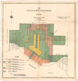
City of North Vancouver zone map showing "use" and "set-back" restrictions
A plan for the City of Vancouver, British Columbia, including Point Grey and South Vancouver and a general plan of the region
Add to clipboard
A plan for the City of Vancouver, British Columbia, including Point Grey and South Vancouver and a general plan of the region
A Plan for the City of Vancouver, British Columbia, including a General Plan of the Region
Add to clipboard
A Plan for the City of Vancouver, British Columbia, including a General Plan of the Region
Sidelights on important facts concerning annexation of the Municipality of Point Grey with Vancouver City
Add to clipboard
Sidelights on important facts concerning annexation of the Municipality of Point Grey with Vancouver City
A plan for the City of Vancouver, British Columbia, including Point Grey and South Vancouver and a general plan of the region
Add to clipboard
A plan for the City of Vancouver, British Columbia, including Point Grey and South Vancouver and a general plan of the region
A plan for the city of Vancouver, British Columbia, including Point Grey and South Vancouver and a general plan of the region 1928.
Add to clipboard
A plan for the city of Vancouver, British Columbia, including Point Grey and South Vancouver and a general plan of the region 1928.
Add to clipboard
Vancouver, British Columbia, south-easterly portion, formerly South Vancouver : major street plan
Commercial map of Greater Vancouver and district [planning]
Add to clipboard
Commercial map of Greater Vancouver and district [planning]
A plan for the city of Vancouver, British Columbia, including Point Grey and South Vancouver and a general plan of the region 1928.
Add to clipboard
A plan for the city of Vancouver, British Columbia, including Point Grey and South Vancouver and a general plan of the region 1928.
A plan for the city of Vancouver, British Columbia, including Point Grey and South Vancouver and a general plan of the region 1928.
Add to clipboard
A plan for the city of Vancouver, British Columbia, including Point Grey and South Vancouver and a general plan of the region 1928.
A plan for the South Vancouver area : City of Vancouver, British Columbia
Add to clipboard
A plan for the South Vancouver area : City of Vancouver, British Columbia
Add to clipboard
Vancouver, British Columbia : northerly portion, former City of Vancouver : major street plan
Plans and diagrams from the report of the Town Planning Commission
Add to clipboard
Plans and diagrams from the report of the Town Planning Commission
A plan for the city of Vancouver, British Columbia, including Point Grey and South Vancouver and a general plan of the region 1929.
Add to clipboard
A plan for the city of Vancouver, British Columbia, including Point Grey and South Vancouver and a general plan of the region 1929.
A plan for the city of Vancouver, British Columbia, including Point Grey and South Vancouver and a general plan of the region 1929.
Add to clipboard
A plan for the city of Vancouver, British Columbia, including Point Grey and South Vancouver and a general plan of the region 1929.
Add to clipboard
Vancouver, British Columbia : south-westerly portion, formerly Point Grey : major street plan
Add to clipboard
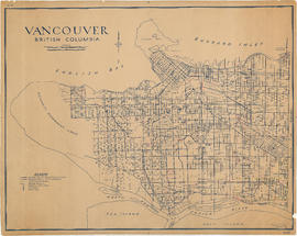
Vancouver, British Columbia
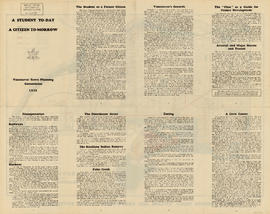
A student to-day, a citizen tomorrow
Add to clipboard
A student to-day, a citizen tomorrow
A student today, a citizen tomorrow
Add to clipboard
A student today, a citizen tomorrow
Add to clipboard
City of Vancouver, British Columbia : zoning diagram
Add to clipboard
A student to-day, a citizen tomorrow
A student today, a citizen tomorrow
Add to clipboard
A student today, a citizen tomorrow
The taxpayer
Add to clipboard
The taxpayer
Report of Special Committee regarding proposal for the construction of a bridge across the First Narrows Burrard Inlet
Add to clipboard
Report of Special Committee regarding proposal for the construction of a bridge across the First Narrows Burrard Inlet
Report of Vancouver Town Planning Commission on proposed First Narrows bridge
Add to clipboard
Report of Vancouver Town Planning Commission on proposed First Narrows bridge
Town planning aspects of Vancouver and Fraser River harbours
Add to clipboard
Town planning aspects of Vancouver and Fraser River harbours
Map of Vancouver Unemployment and Relief [BC]
Add to clipboard
Map of Vancouver Unemployment and Relief [BC]
Add to clipboard
Plan showing parcels 'A', 'B' & 'C' : Kitsilano Indian Reserve, No. 6 of the Squamish band, Vancouver, B.C.
Add to clipboard
Plan of sea wall site, Main Street, and surrounding properties
Add to clipboard
Stanley Park [Golden Jubilee]
Sectional plan of Vancouver [zoning and land use]
Add to clipboard
Sectional plan of Vancouver [zoning and land use]
Add to clipboard
Plan of District Lot boundaries. City of Vancouver, B.C.
Civic administration : proposal for stabilizing land values and controlling the development in the City of Vancouver, submitted to the Special Committee on Civic Administration
Add to clipboard
Civic administration : proposal for stabilizing land values and controlling the development in the City of Vancouver, submitted to the Special Committee on Civic Administration
The municipal news
Add to clipboard
The municipal news
Plan of Kitsilano Indian Reserve, No. 6 (contours)
Add to clipboard
Plan of Kitsilano Indian Reserve, No. 6 (contours)


![Commercial map of Greater Vancouver and district [assessment districts]](/uploads/r/null/0/9/2/0928add1a06ab55bc236f8bebb87712b7e6ad4422db32cc3065efe7c9da96c04/b5b4129d-f9ba-49b9-a863-2ab6e954897e-MAP102_142.jpg)


![Stanley Park [Golden Jubilee]](/uploads/r/null/2/4/24135e2d726e60ffbc74f0d81c3a53d51a38fe9ea1e86ecda92708249adac23b/1b46df5d-6871-41b2-b1dd-91a0c1d5ad02-MAP624_142.jpg)
