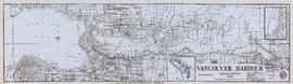
Vancouver Harbour, British Columbia, 1945
- AM1594-: MAP 222
- Item
- 1945
Part of City of Vancouver Archives technical and cartographic drawing collection
Item is a nautical chart showing English Bay and Burrard Inlet with soundings in feet, anchorages, locations of submarine cables, and ferry lines. Land features include city blocks and district lot numbers. Includes inset maps of the North Arm of Burrard Inlet and Vancouver Island. Note at the bottom of map states, "Not to be used for navigational purposes."