Showing 16 results

Archival description
Zoning With digital objects
Print preview View:
North-East Burnaby Study, revised Simon Fraser townsite plan : 1967 City of Vancouver alternative...
North-East Burnaby Study, revised Simon Fraser townsite plan : 1967 City of Vancouver alternative proposals
Official Regional Plan : proposed amendments within the City of Vancouver
Key map showing proposed areas for partial and comprehensive redevelopment
Proposed zoning : comprehensive redevelopment areas
Existing service stations, retail shopping centres and commercial zoning
Proposed zoning
Proposed zoning
Proposed development of Vancouver City Yard, 49th Avenue at Ross Street, South Vancouver
Rezoning application map (Point Grey Road)
Redevelopment plan for Jericho Department of National Defence lands
Development in the western portion of the Lower Mainland region, 1968
Vancouver South, British Columbia
Point Grey, B.C. : district map
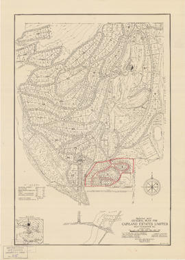
General plan for Capilano Estates Limited
Map of City of Vancouver, British Columbia
City of Vancouver, British Columbia : zoning diagram
City of North Vancouver zone map showing "use" and "set-back" restrictions