Canadian Pacific Railway. Plan of part of branch line from Port Moody. A point on main line C.P.R. to English Bay, B.C.
North Arm Road, 1876. North Arm, Fraser River
Map of New Westminster District, B.C
Plan of Greater Vancouver, British Columbia
Canadian Pacific Railway plan of foreshore at Vancouver, Burrard Inlet as shewn on plan fyled in Department of Railways and Canals, 31st March, 1886
Map of New Westminster District, B.C.
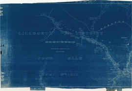
Lillooet District from sale April 6th 1911
Portions of Lillooet and New Westminster land districts
Plan of the City of Vancouver
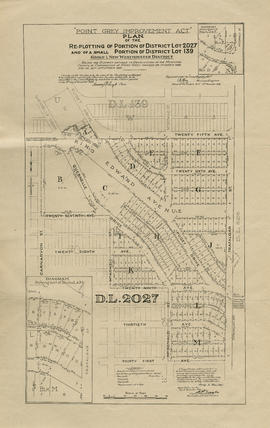
Point Grey Improvement Act : plan of the re-plotting of portion of District Lot 2027 and of a small portion of District Lot 139, Group 1, New Westminster District
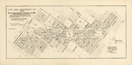
Point Grey Improvement Act : plan of the re-plotting of portion of District Lot 139, Group 1, New Westminster District
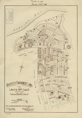
University Endowment Lands : plan of units nos. 1 and 2
University Endowment Lands : plan of units nos. 1 and 2
Plan of Lot 6311, Vancouver, B.C. fronting on Kitsilano Indian Reserve No. 6
Map of Richmond municipality
Vancouver and Northern Railway, 1908
Lower Mainland, B.C. : land subdivision
British Columbia. Port Moody
Plan of subdivision of part of D.L. 526 : South Vancouver
Vancouver harbour
Municipality of South Vancouver
Plan of the City of Vancouver
Sectional map : City of Vancouver, B.C. : Sheet no. S.V. 23
Plan of the town of Granville, Burrard Inlet, B.C.
Second section : Shaughnessy Heights
Plan of subdivision of part of D.L. 526, New Westminster District, B.C., Kitsilano, City of Vancouver
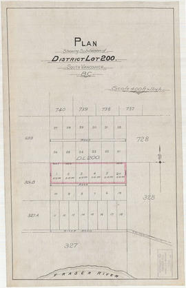
Plan shewing subdivision of District Lot 200. South Vancouver, B.C.
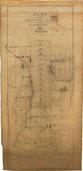
Plan of pre-emption claims, group 1, New Westminster District B.C., 1887-1888
Map of the Lower Mainland showing municipal boundaries and lot numbers
Plan of New Westminster City and suburban lots
Port Moody, the western terminus of the Canadian Pacific Railway
Port Moody, the western terminus of the Canadian Pacific Railway
Map of the business portion of the City of Vancouver, British Columbia [early street paving]
Plan of the town of Newcastle, English Bay
City of Vancouver : Canadian Pacific town site
Map of part of the New Westminster District shewing the proposed new municipality of Burnaby
[Third section of] Shaughnessy Heights
[Second section of] Shaughnessy Heights
[First section of] Shaughnessy Heights
Water service map of South Vancouver : Vivian Street to Kerr Street and 56th Avenue (54th Avenue) to 67th Avenue (65th Avenue)
Water service map of South Vancouver : Vivian Street to Doman Street and 67th Avenue (65th Avenue) to North Arm of Fraser River
Water service map of South Vancouver : Victoria Drive to Vivian Street and 56th Avenue (54th Avenue) to 67th Avenue (65th Avenue)
Water service map of South Vancouver : Victoria Drive to Vivan Street and 67th Avenue (65th Avenue) to North Arm of Fraser River
Water service map of South Vancouver : Tyne Street to Park Street (Boundary Road) and 56th Avenue (54th Avenue) to 67th Avenue (65th Avenue)
Water service map of South Vancouver : Point Grey boundary to Ontario Street and River Avenue (Marine Drive S.W.) to North Arm of Fraser River
Water service map of South Vancouver : Ontario Street to Fraser Street and River Avenue (Marine Drive) to North Arm of Fraser River
Water service map of South Vancouver : Ontario Street to Fraser Street and 61st Avenue (59th Avenue) to River Street (Marine Drive S.E.)
Water service map of South Vancouver : Knight Street to Victoria Drive and 61st Avenue (59th Avenue) to North Arm of Fraser River
Water service map of South Vancouver : Kerr Street to Tyne Street and 56th Avenue (54th Avenue) to 67th Avenue (65th Avenue)
Water service map of South Vancouver : Fraser Street to Knight Street and 61st Avenue (59th Avenue) to North Arm of Fraser River


![Map of the business portion of the City of Vancouver, British Columbia [early street paving]](/uploads/r/null/7/1/7187f671d2770050eb87f7f397a10ea92bf0bc593b0a186e3a4bf341b3d26e42/8770145a-b925-4eef-82ac-e397f61a65aa-Map1163_142.jpg)


![[Third section of] Shaughnessy Heights](/uploads/r/null/b/9/c/b9c97036cadac8b6ffc53f2380c1c158d767da3473d29ad1b04968cc742d132e/0301116d-9946-489d-a272-9d6453523103-MAP331_142.jpg)
![[Second section of] Shaughnessy Heights](/uploads/r/null/9/4/d/94d42178bb60a8c60cdc002199430e863ae830696947ad73807b5fd11046c39a/72c651d3-6742-4c5c-a0bc-d83c3526a9ba-MAP330_142.jpg)
![[First section of] Shaughnessy Heights](/uploads/r/null/c/d/0/cd05f96b7e9f01fee4ba2afe83ac83cef9d70b3cf83d3ba8c4ebe5a0a20a429d/0d2ec941-063b-4722-8d84-aff283b273f6-MAP329_142.jpg)


