
St. Patrick's School for Girls in Mount Pleasant, with students on steps
- AM1616-S1-: CVA 136-521
- Item
- Mar. 1940
Part of Pacific Press fonds
2373 results with digital objects Show results with digital objects
St. Patrick's School for Girls in Mount Pleasant, with students on steps
Part of Pacific Press fonds
![[Spotless Rag Wiping Company]](/uploads/r/null/9/b/9/9b9034526a0226367804d355eee9d77315c248cb95c6d8c78f78db1b6a181909/d17cf2ab-fce4-4727-8609-2f66a5ca5be9-CVA1095-03274_142.jpg)
Part of City of Vancouver fonds
Item is a photograph that depicts an exterior view of the Spotless Rag Wiping Company, likely located on the 1900 block of Main St.
![[Skateboard park bowl with graffiti]](/uploads/r/null/9/8/988655418933e452c613bf63136ad3bced7f4aa2de6525d6350fc9c1c88a8ad8/7ce2f9c2-da0b-4c06-9a46-de2e79de5fe0-A69848_142.jpg)
[Skateboard park bowl with graffiti]
Item is a photograph showing the China Creek Skateboard Park.
![[Skateboard park]](/uploads/r/null/9/5/9500096098870fb8d827610ab03f141dd0bf01c45d617caa544e87f330285c6d/70798748-0df3-4d88-8398-cf1cc534a489-A69849_142.jpg)
Item is a photograph showing the China Creek Skateboard Park.

Part of City of Vancouver fonds
![[Side view of 2812 Yukon Street]](/uploads/r/null/d/6/e/d6eb8831d1714bfa28610311b88fd41053ff1fce26f9b00d42f87253448f7e62/f9b9862a-d853-4dad-8720-f529ec667df7-CVA1095-03074_142.jpg)
[Side view of 2812 Yukon Street]
Part of City of Vancouver fonds
![[Side view of 2632 Alberta Street]](/uploads/r/null/1/4/b/14b903f7566838692d978b212e3374719a779b144c8ec092a3df41966ebe47bb/25fd2d70-c933-4e7b-bbab-ee26175acc6c-CVA1095-03118_142.jpg)
[Side view of 2632 Alberta Street]
Part of City of Vancouver fonds
![[Royal City Antiques building]](/uploads/r/null/8/2/8/828ee79fe975364c685781b9fc1bcc35aa886f177052f434508c429fbb932767/46a2dfe5-d7af-4be7-8645-3d95322fe2e2-CVA1095-01686_142.jpg)
[Royal City Antiques building]
Part of City of Vancouver fonds
![[Roadwork on] Kingsway](/uploads/r/null/4/8/484b015b604eabb76763aa147dd9b4c16d9b74baba9ae101ca53f2152953d6ef/fe2a2dce-dc7f-4232-b63b-31963f438069-A16612_142.jpg)
Part of City of Vancouver fonds

Residential street in Mount Pleasant area
Part of Pacific Press fonds
![[Rendell Tractor Equipment Co. Ltd. - 62 West 4th Avenue]](/uploads/r/null/9/2/f/92f2b03264db6329e04478df1d3d5d4cce3283751e5df24f0f9dbb61ef20f8c7/7178d9e2-836a-4750-b76c-7961aad220a9-CVA1095-00778_142.jpg)
[Rendell Tractor Equipment Co. Ltd. - 62 West 4th Avenue]
Part of City of Vancouver fonds

Recording of first Centennial song at Griffiths Gibson Productions
Recording of first Centennial song at Griffiths Gibson Productions
![R.C.M.P. [Royal Canadian Mounted Police] Building, Main Street, west facade](/uploads/r/null/a/d/b/adbc09f89c670832271e75247cbd4dc4e4032bbb8407a3cad970b27809a0edf5/7a73d915-c683-494d-b735-78b65a7f1006-CVA70-16_142.jpg)
R.C.M.P. [Royal Canadian Mounted Police] Building, Main Street, west facade
Part of Art Grice fonds
Item is a photograph of the whole west (Main Street) facade of the R.C.M.P. building (later, Heritage Hall, 3102 Main Street) at the corner of Main Street and 15th Avenue. Both towers, entrances and all architectural features are visible.
![R.C.M.P. [Royal Canadian Mounted Police] Building, Main Street, north facade and clock tower](/uploads/r/null/f/1/3/f13b3c0d36643beee7d88d19a63a13b1aca3588fc2c2589a01baad7e2530b923/cc2920b3-3d9c-474d-b2c5-38619a59b10f-CVA70-13_142.jpg)
R.C.M.P. [Royal Canadian Mounted Police] Building, Main Street, north facade and clock tower
Part of Art Grice fonds
Item is a photograph of the (northern) clock tower, north facade, and frieze of the R.C.M.P. building (later, Heritage Hall, 3102 Main Street) at the corner of Main Street and 15th Avenue.
![R.C.M.P. [Royal Canadian Mounted Police] Building, Main Street, main entrance](/uploads/r/null/5/b/5/5b50e92503f01bd8a74fc5892f9f3708bb94bc9362fe91870501831f4d5c604c/10505865-147b-4588-98fc-e331a460607f-CVA70-14_142.jpg)
R.C.M.P. [Royal Canadian Mounted Police] Building, Main Street, main entrance
Part of Art Grice fonds
Item is a photograph of the main entrance of the R.C.M.P. building (later, Heritage Hall, 3102 Main Street) at the corner of Main Street and 15th Avenue showing the doorway, columns, windows, and architectural details above the main doorway. Also visible are some of the sculptures decorating the frieze above the second level.
![R.C.M.P. [Royal Canadian Mounted Police] Building, Main Street, clock tower detail](/uploads/r/null/4/7/8/4784077b86de352a04cf10904113237db0b62ab4b677e8244ec70993c8e4d32b/a94b914d-e305-45f2-8e7e-0bb76a62637e-CVA70-15_142.jpg)
R.C.M.P. [Royal Canadian Mounted Police] Building, Main Street, clock tower detail
Part of Art Grice fonds
Item is a photograph of the upper portion of the (northern) clock tower of the R.C.M.P. building (later, Heritage Hall, 3102 Main Street) at the corner of Main Street and 15th Avenue. The item details the clock face, tower roof, flag pole, lightning rods, and other architectural features.
![R.C.M.P. [Royal Canadian Mounted Police] Building, Main Street south entrance](/uploads/r/null/7/8/b/78bfd9357beddc228b5ad9726f607de307afa28829edd3a24c136b54b7882a16/ecded68b-962b-4fa7-a698-1c9b933fa643-CVA70-12_142.jpg)
R.C.M.P. [Royal Canadian Mounted Police] Building, Main Street south entrance
Part of Art Grice fonds
Item is a photograph of the secondary entrance of the R.C.M.P. building (later, Heritage Hall, 3102 Main Street) at the corner of Main Street and 15th Avenue showing a low angle view of the windows, ceiling, and architectural details above the doorway in the smaller southern tower. Also visible are some of the sculptures decorating the frieze above the second level.

Public Convenience to be erected at Kingsway & Broadway
Part of City of Vancouver fonds
Item is an architectural drawings depicting a design for proposed public toilets. The drawing includes a floor plan, multiple exterior elevations, and the site plan.
Vancouver (B.C.). Building Department

Proposed convenience at Kingsway & Main St.
Part of City of Vancouver fonds
Item is an architectural drawing of an underground public toilet facility. Drawing includes pans and cross-sections.
Vancouver (B.C.). Engineer's Office

Project 2, area "h" and part of "b" : plan of redevelopment
Part of City of Vancouver fonds
Item is a map showing boundaries of redevelopment areas "b" and "h", boundaries of project 2 clearance for areas 8 and 9, in project 2, proposed land use, new streets and lanes, sites in project 2 not to be acquired and buildings in project 2 to be retained.

Project 2, area "h" and part of "b" : pavements, curbs and sidewalks
Part of City of Vancouver fonds
Item is a map showing the types of pavement, the curbs and gutters, the sidewalks, the boundaries of redevelopment for areas "b" and "h" and the boundaries of project clearance for areas 8 and 9 for redevelopment project 2.

Project 2, area "h" and part of "b" : existing utilities, water and sewer
Part of City of Vancouver fonds
Item is a map showing the water lines, the sewer lines, the direction of sewer flow, the boundaries of redevelopment for areas "b" and "h" and the boundaries of project clearance for areas 8 and 9 in redevelopment project 2.

Project 2, area "h" and part of "b" : existing gas, electricity and telephone
Part of City of Vancouver fonds
Item is a map showing the gas lines, the electricity lines, the telephone lines, the boundaries of redevelopment for areas "b" and "h" and the boundaries of project clearance for areas 8 and 9 in redevelopment project 2.

Project 2, area "h" and part of "b" : condition of buildings
Part of City of Vancouver fonds
Item is a map showing the condition of buildings (ranging from very good to very poor), the boundaries of redevelopment for areas "b" and "h" and the boundaries of project clearance for areas 8 and 9 for redevelopment proct 2.

Project 2, area "h" and part of "b" : condition of buildings
Part of City of Vancouver fonds
Item is a map showing the conditions of buildings (ranging from very good to very poor) in area "a" and part of area "b" in project 2. The map has been annotated to highlite part of the boundary around sub-area 9, as well as the southern portion of the sub-area. The significance of these annotations is not known.

Project 2 area "h" and part of "b" : identification plan
Part of City of Vancouver fonds
Item is a map created to show the boundaries of redevelopment areas "b" and "h" in Project 2 and Project 2 clearance areas 8 & 9. The map also shows City-owned property, Adjacent lots in same ownership, as well as property, streets and lanes be acquired for the project. The portion of the City depicted in the map is the area between Main Street and Clark Drive and between Evans Avenue and 10th Avenue (D.L.200, D.L. 264A, D.L. 301, and D.L. 2037).
![Opsal Steel Ltd. [97 E. 2nd Avenue]](/uploads/r/null/2/3/2/232ac779d96989d15d252741cab0695612ef729cc1e731fed9f739c897c3c296/73ecb72a-8d0f-48c3-802c-9e9b06d7b626-CVA786-23_142.jpg)
Opsal Steel Ltd. [97 E. 2nd Avenue]
Part of City of Vancouver fonds
Item is a photograph showing Opsal Steel Ltd. Logging Equipment.

Old Beaver dam in Mount Pleasant, with girl by stream
Part of Pacific Press fonds
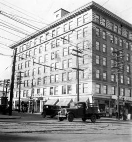
Office building at corner of Broadway and Main Street
Part of Pacific Press fonds

Part of City of Vancouver Archives technical and cartographic drawing collection
Item consists of a large scale site plan, depicting a proposed development in False Creek [Expo 86?] annotated on top of what appears to be a City planning map. The plan appears to depict part of the Concord Pacific development.
![[Northeast corner of intersection of Yukon Street and West 10th Avenue]](/uploads/r/null/2/a/3/2a3826de6222eec4c7240dc022c99724ea4187663e6ba5a1efb57a282fe98257/a165df5b-5e4d-4d3a-a88d-09f148c0009f-CVA1095-01982_142.jpg)
[Northeast corner of intersection of Yukon Street and West 10th Avenue]
Part of City of Vancouver fonds
Item is a photograph that depicts the intersection of Yukon Ave. and West 10th St. Visible is the Christ Evangelical Lutheran Church, located at 375 West 10th Ave.
![[North view of False Creek and Bird Foundry]](/uploads/r/null/a/c/6/ac67d754269be29604e22e319f8a434ec0a2b998858b94f1fb1fe4f97da28d29/f214010b-7d68-4b2a-a5ed-c82364b48309-CVA1095-03287_142.jpg)
[North view of False Creek and Bird Foundry]
Part of City of Vancouver fonds
![[North view down Quebec Street of the Evangelistic Tabernacle]](/uploads/r/null/8/8/9/8896ff38bcedaa96629c8e20603a5e77eb435c29b2ff1880c87c89a0f33f3f88/35e8e2cd-77de-4afe-96b9-875497c07e41-CVA1095-01562_142.jpg)
[North view down Quebec Street of the Evangelistic Tabernacle]
Part of City of Vancouver fonds
Item is a photograph that depicts a view north down Quebec St., and the spire of the Evangelistic Tabernacle, located at 2525 Quebec St.
![[North view down Quebec Street at West 10th Avenue]](/uploads/r/null/5/9/c/59c8ebf6638fb5904115af1b170f8efbe01be6c20e8e6a0ce22e603626a34641/da468c8d-5503-4609-a24c-e04423f330f2-CVA1095-03039_142.jpg)
[North view down Quebec Street at West 10th Avenue]
Part of City of Vancouver fonds
Item is a photograph that depicts the intersection of Quebec St. and West 10th Ave. Visible is the Federal Store (2601 Quebec St) and the Evangelistic Tabernacle (2525 Quebec St).
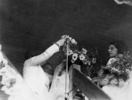
Mt. Pleasant Queen crowned by Mayoress McGeer, July 16th

Mt. Pleasant Queen and attendants before crowning, July 16th
![Mt. Pleasant Chapel [306 E. 11th Avenue]](/uploads/r/null/c/9/4/c9444f5daa92fecb2c5b4512e9a31827e619d22809be4b3fc67501d6921bee87/289ff074-dd2d-47b7-ba2b-0901694e9b14-CVA786-60_142.jpg)
Mt. Pleasant Chapel [306 E. 11th Avenue]
Part of City of Vancouver fonds
![Mt. Pleasant Chapel [306 E. 11th Avenue]](/uploads/r/null/4/3/6/4360df72fa9d132a45fbcdef2dcd76aaf55963d7425e78b10819981db72bf6ac/3cea5762-ecc5-4665-9b8b-62a7b8fed362-CVA786-61_142.jpg)
Mt. Pleasant Chapel [306 E. 11th Avenue]
Part of City of Vancouver fonds
![Mount Pleasant/Broadway - 102 [3 of 3]](/uploads/r/null/3/4/4/344f8f68d4a865dbaade60f0327debf67038a3de8913d001232165a8027f2500/04aaa942-31c4-4cea-9568-bd72624b703e-CVA1095-01581_142.jpg)
Mount Pleasant/Broadway - 102 [3 of 3]
Part of City of Vancouver fonds
![Mount Pleasant/Broadway - 102 [2 of 3]](/uploads/r/null/b/1/2/b12effa5b660a6be607bd5a99965b799e1b86cddc27da3768085d84ca97b98a4/c515fb0e-42f9-4232-94fe-e9aff440409b-CVA1095-01578_142.jpg)
Mount Pleasant/Broadway - 102 [2 of 3]
Part of City of Vancouver fonds
![Mount Pleasant/Broadway - 102 [1 of 3]](/uploads/r/null/7/1/4/7143cc7070edc281bddeea299519dd6b5742eb6bfd406b56ecf1f6a44e32389b/ad0b7cac-94b1-4e09-81fa-770d3b0951be-CVA1095-01577_142.jpg)
Mount Pleasant/Broadway - 102 [1 of 3]
Part of City of Vancouver fonds
![Mount Pleasant [Wooden lattice detail]](/uploads/r/null/c/7/1/c71d8aa6946cfc758098d8aa3f66f7a85bffec9639a133164ba30352ba8e53bd/9eee9302-f366-4226-9350-9079e9fddf8b-CVA1095-12883_142.jpg)
Mount Pleasant [Wooden lattice detail]
Part of City of Vancouver fonds
![Mount Pleasant [Stonework steps detail]](/uploads/r/null/0/c/9/0c9c8089651becebb54b1d3003dc523ded4e7bdc20fe312fce95e5df177b391b/c5f5124a-8d9f-4870-a3b6-89199f1a3402-CVA1095-12895_142.jpg)
Mount Pleasant [Stonework steps detail]
Part of City of Vancouver fonds
![Mount Pleasant [Second-storey detail]](/uploads/r/null/d/2/a/d2a96de791e36ea24ca2638f53f0145237c18ecc59864bbbab73982d2b65a649/eded2837-f8cc-46f4-850a-1d4745d0c8c7-CVA1095-12896_142.jpg)
Mount Pleasant [Second-storey detail]
Part of City of Vancouver fonds

Mount Pleasant School class photo
Item is a photograph showing students and principal of Mount Pleasant School. Marie Rivere (nee Gauvreau) is pictured third from left in the second row. Annotation on verso: "Principal possibly Mr. Jamieson or Mr. Baxter."
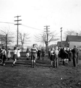
Mount Pleasant School children's outdoor dance class
Part of Pacific Press fonds

Mount Pleasant School children's outdoor dance class
Part of Pacific Press fonds

Mount Pleasant School children's outdoor dance class
Part of Pacific Press fonds

Mount Pleasant School boy pupils, sitting down outside
Part of Pacific Press fonds