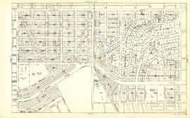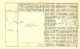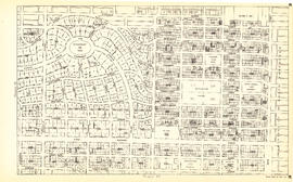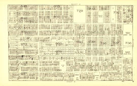
Sheet G : Trafalgar Street to Granville Street and Sixteenth Avenue to Nanton Avenue
Map of Vancouver and Lower Mainland : avenue guide
Map of Vancouver and Lower Mainland : avenue guide

City of Vancouver

City of Vancouver : east half

City of Vancouver

Vancouver harbour

Town-site of Hastings

Sheet J : University Endowment Lands to Wallace Street and Twenty-seventh Avenue to Thirty-eighth Avenue
![Proposed Raymur Ave. [Avenue] Trunk Sewer diverting sewage from False Creek reclaimed area](/uploads/r/null/a/8/a8edd70876832fb32ffa8add8b5e261fe78b0e6efcb26d07a6fe1c74bf545b57/ac62eada-955d-4eee-8508-6bf4b71a21e5-MAP761_142.jpg)
Proposed Raymur Ave. [Avenue] Trunk Sewer diverting sewage from False Creek reclaimed area
![Proposed Raymur Ave. [Avenue] Trunk Sewer diverting sewage from False Creek reclaimed area](/uploads/r/null/5/2/5260099e92441f23442086ea3a8b5f7512bb5b4b4b5cbf554c9f13450bf4d37f/b5165f5d-bd82-46b5-9beb-0f969f7755ef-MAP761_142.jpg)
Proposed Raymur Ave. [Avenue] Trunk Sewer diverting sewage from False Creek reclaimed area
![Proposed Raymur Ave. [Avenue] Trunk Sewer diverting sewage from False Creek reclaimed area](/uploads/r/null/c/d/cddf61ac60b97b6fc54309ecbf8d1aea8e9aac3c672576fbd9953a05b82d42fc/14951fa4-0fd0-480c-a1f3-b7c2ef158398-MAP761_142.jpg)
Proposed Raymur Ave. [Avenue] Trunk Sewer diverting sewage from False Creek reclaimed area

Sheet 11 : Cambie Street to St. George Street and Forty-seventh Avenue to Fifty-eighth Avenue

Sheet B : Discovery Street to Trutch Street and waterfront to Fourth Avenue

Sheet 10 : Carlton Street to Boundary Road and Fortieth Avenue to Fiftieth Avenue

Sheet H : Alexandra Street to Cambie Street and Fifteenth Avenue to Twenty-seventh Avenue

Sheet C : University Endowment Lands to Discovery Street and Fourth Avenue to Sixteenth Avenue

Sheet E : University Endowment Lands to Wallace Street and Sixteenth Avenue to Twenty-seventh Avenue

Sheet F : Wallace Street to Trafalgar Street and Sixteenth Avenue to Twenty-seventh Avenue

Sheet K : Wallace Street to Trafalgar Street and Twenty-seventh Street to Thirty-eighth Avenue

Sheet S : Musqueam Reserve to Macdonald Street and Forty-ninth Avenue to Fraser River

Sheet D : Discovery Street to Trutch Street and Fourth Avenue to Sixteenth Avenue

Sheet S.V. 15 : Dawson Street to Boundary Road and Foster Avenue to Fiftieth Avenue

City of Vancouver : west half

City and District of North Vancouver
Map of Greater Vancouver including streets, districts, schools, churches, shopping centres, parks, etc.
Map of Greater Vancouver including streets, districts, schools, churches, shopping centres, parks, etc.
Vancouver, B.C. and vicinity road map
Vancouver, B.C. and vicinity road map

Guide map: Vancouver - New Westminster, Burnaby and North Shore municipalities

Vancouver, British Columbia : south-westerly portion, formerly Point Grey : major street plan

Greater Vancouver, British Columbia : regional major street plan

Vancouver, British Columbia : northerly portion, former City of Vancouver : major street plan

Vancouver, British Columbia, south-easterly portion, formerly South Vancouver : major street plan
New Westminster, British Columbia
New Westminster, British Columbia
Indexed map of Greater Vancouver
Indexed map of Greater Vancouver
Victoria and Vancouver street and vicinity maps
Victoria and Vancouver street and vicinity maps

Sheet W : Fraser River to French Street and Fifty-ninth Avenue to Seventy-first Avenue
![Vancouver, B.C. Plan showing location of water pipes, hydrants, etc. [Hastings Sunrise]](/uploads/r/null/b/c/bc8cb6a6f5ac5df0dd88a65e8a29ecceca242bde2c1b605533ad17eb835cc450/b2741291-73c5-4a98-9f41-db7fdc46fe83-MAP72_142.jpg)
Vancouver, B.C. Plan showing location of water pipes, hydrants, etc. [Hastings Sunrise]
D.L. 301 - Ward 8 [water pipes and hydrants]
D.L. 301 - Ward 8 [water pipes and hydrants]

Sheet 18 : Vivian Street to Boundary Road and Sixty-fifth Avenue to Fraser River

Sheet 17 : Argyle Street to Vivian Street and Sixty-second Avenue to Kent Street

Sheet 16 : St. George Street to Argyle Street and Fifty-eighth Avenue to Fraser River

Sheet 15 : Ash Street to St. George Street and Fifty-eighth Avenue to Marine Drive

Sheet 14 : Ash Street to St. George Street and Marine Drive to Fraser River

Sheet 13 : Fleming Street to Carlton Street and Forty-seventh Avenue to Fifty-ninth Avenue

Sheet 12 : Prince Edward Street to Bruce Street and Forty-seventh Avenue to Fifty-eighth Avenue

Sheet 9 : Fleming Street to Carlton Street and Thirty-seventh Avenue to Forty-eighth Avenue

Sheet 8 : Prince Edward Street to Bruce Street and Thirty-fifth Avenue to Forty-seventh Avenue

Sheet 7 : Cambie Street to St. George Street and Thirty-seventh Avenue to Forty-eighth Avenue

Sheet 6 : Craddock Street to Boundary Road and Twenty-ninth Avenue to Fortieth Avenue

Sheet 5 : Dumfries Street to Fairmont Street and Twenty-seventh Avenue to Thirty-seventh Avenue

Sheet 4 : Prince Edward Street to Bruce Street and King Edward Avenue to Thirty-sixth Avenue


![Proposed Raymur Ave. [Avenue] Trunk Sewer diverting sewage from False Creek reclaimed area](/uploads/r/null/a/8/a8edd70876832fb32ffa8add8b5e261fe78b0e6efcb26d07a6fe1c74bf545b57/ac62eada-955d-4eee-8508-6bf4b71a21e5-MAP761_142.jpg)
![Proposed Raymur Ave. [Avenue] Trunk Sewer diverting sewage from False Creek reclaimed area](/uploads/r/null/5/2/5260099e92441f23442086ea3a8b5f7512bb5b4b4b5cbf554c9f13450bf4d37f/b5165f5d-bd82-46b5-9beb-0f969f7755ef-MAP761_142.jpg)
![Proposed Raymur Ave. [Avenue] Trunk Sewer diverting sewage from False Creek reclaimed area](/uploads/r/null/c/d/cddf61ac60b97b6fc54309ecbf8d1aea8e9aac3c672576fbd9953a05b82d42fc/14951fa4-0fd0-480c-a1f3-b7c2ef158398-MAP761_142.jpg)


![Vancouver, B.C. Plan showing location of water pipes, hydrants, etc. [Hastings Sunrise]](/uploads/r/null/b/c/bc8cb6a6f5ac5df0dd88a65e8a29ecceca242bde2c1b605533ad17eb835cc450/b2741291-73c5-4a98-9f41-db7fdc46fe83-MAP72_142.jpg)


