
City of Vancouver

City of Vancouver : west half

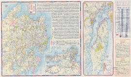
City of Vancouver : east half

Maps of downtown Vancouver and the Fraser Valley, detail maps of traffic interchanges, and general information

Street map of Greater Vancouver, B.C.

Street map of Vancouver
Maps of Victoria and Vancouver Island, mileage chart and traffic routes

Map of Vancouver, Burnaby, New Westminster, British Columbia : street index and advertisements

B.C. Electric guide to Greater Vancouver : Richmond transit system, downtown Vancouver transit system, street index, and general information

Street map of Greater Vancouver showing distances from Bekins building

Map of Vancouver, Burnaby, New Westminster, British Columbia ; Points of interest in Vancouver, British Columbia

Street map of Greater Vancouver : map cover, street index and advertisements

B.C. Electric guide to Greater Vancouver : Richmond transit system, downtown Vancouver transit system, street index, and general information

Street map of Greater Vancouver, B.C.

Map of West Vancouver and North Vancouver, street index, real estate information, and list of golf courses

Visitors map of Vancouver ; world famous Stanley Park ; downtown Vancouver

Street map of Vancouver

Visitors map of Vancouver

Sheet S.V. 17 : Jellicoe Street to Boundary Road and Sixty-third Avenue to Fraser River

Sheet S.V. 16 : Dawson Street to Boundary Road and Fiftieth Avenue to Sixty-third Avenue

Sheet 4 : Slocan Street to Boundary Road and Broadway to Seventeenth Avenue

Map of Fraser Valley

Dial map of Greater Vancouver and suburbs

Dial map of Greater Vancouver and suburbs

Map of Lulu Island and Sea Island ; Municipality of Delta ; Municipality of Surrey ; Municipality of Langley ; Map of Maillardville

Street map of Greater Vancouver, B.C.

Street map of Greater Victoria, B.C., map cover, and street index of Greater Vancouver

City and District of North Vancouver

Sheet 22 : Stanley Park to Burrard Street and waterfront to Robson Street

Sheet 22 : Stanley Park to Burrard Street and waterfront to Robson Street

Sheet 20 : Granville Street to Ontario Street and Robson Street to Sixth Avenue

Sheet 23 : Stanley Park to Granville Street and Robson Street to False Creek

Sheet 21 : Burrard Street to False Creek and waterfront to Robson Street

Sheet 21 : Burrard Street to False Creek and waterfront to Robson Street

Sheet 23 : Stanley Park to Granville Street and Robson Street to False Creek

Dial map of Greater Vancouver

Map of Burnaby and New Westminster, British Columbia

Map of Lulu Island and Sea Island ; Municipality of Surrey ; Map of Maillardville ; University Endowment Lands

Dial map of Greater Vancouver and suburbs

Vancouver, B.C. street map

Vancouver, B.C. city map : street index to Vancouver map, detail map of Downtown Vancouver, and tourist attractions

Wrigley's new map of Vancouver and Lower Mainland

Street index of Vancouver and lower mainland

Sheet 4 : Slocan Street to Boundary Road and Seventh Avenue to Seventeenth Avenue

Sheet 5 : Slocan Street to Boundary Road and Seventeenth Avenue to Twenty-ninth Avenue

Sheet 7 : Clark Drive to Slocan Street and Seventh Avenue to Eighteenth Avenue

Sheet 13 : Ontario Street to Clark Drive and First Avenue to Sixteenth Avenue

Sheet 14 : Main Street to Knight Street and Fifteenth Avenue to King Edward Street

Sheet B : Imperial Street to Trutch Street and waterfront to Fourth Avenue

Sheet C : University Endowment Lands to Imperial Street and Fourth Avenue to Sixteenth Avenue