
City of Vancouver, Canadian Pacific Town Site
- AM1594-: MAP 33
- Item
- [between 1887 and 1889]
Part of City of Vancouver Archives technical and cartographic drawing collection
The map shows the area currently occupied by Downtown Vancouver and parts of Kitsilano. It shows the location of C.P.R. Wharf, Royal City Saw Mills, Hastings Saw Mill and Wharf, Leamy and Kyle's Saw Mill and other saw mills. "Streets graded and side-walked marked thus . . . . .." An insert shows "Canadian Pacific Mail Steamship Lines" on a map of the world. The north shore of Burrard Inlet indicates the locations of "Indian Houses" and a mission church.


![Plan shewing location of sewers on C.P.Rly. [Canadian Pacific Railway] industrial sites](/uploads/r/null/7/6/1/7619e437193646086fba2c0b959aeb02c1226500076d36df8da8fa5f9e9388e9/b1d0ba23-309d-48e1-a012-2b2eb18a2ff8-MAP738_142.jpg)
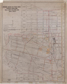


![Proposed Raymur Ave. [Avenue] Trunk Sewer diverting sewage from False Creek reclaimed area](/uploads/r/null/c/d/cddf61ac60b97b6fc54309ecbf8d1aea8e9aac3c672576fbd9953a05b82d42fc/14951fa4-0fd0-480c-a1f3-b7c2ef158398-MAP761_142.jpg)
![Proposed Raymur Ave. [Avenue] Trunk Sewer diverting sewage from False Creek reclaimed area](/uploads/r/null/5/2/5260099e92441f23442086ea3a8b5f7512bb5b4b4b5cbf554c9f13450bf4d37f/b5165f5d-bd82-46b5-9beb-0f969f7755ef-MAP761_142.jpg)
![Proposed Raymur Ave. [Avenue] Trunk Sewer diverting sewage from False Creek reclaimed area](/uploads/r/null/a/8/a8edd70876832fb32ffa8add8b5e261fe78b0e6efcb26d07a6fe1c74bf545b57/ac62eada-955d-4eee-8508-6bf4b71a21e5-MAP761_142.jpg)


![False Creek development : san [sanitary] sewers tentative layout](/uploads/r/null/c/a/ca111eaa497f59a66ecdad4c91bfb2238f21efb21b91a1172f460ef16667055f/4da08847-7457-4d4c-8938-e4c6c1dc50c3-MAP692_142.jpg)


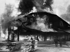
![[View of fire at lumber yard - B.C. Forest Products fire?]](/uploads/r/null/9/b/b/9bb7b1121a5a4c910f4d3264b043a9f028cc0099a2b18e0f2606d798651b2662/edfdcb36-ab3c-4829-adf0-63aafb6fd88a-CVA354-416_142.jpg)


![[Aerial view of lumber yard fire on south shore of False Creek]](/uploads/r/null/3/2/0/3208cbc9d06338a92738b56e1cb989d6c70179caf44b699eb76f28dadbba5a99/0c03d83a-377f-47eb-bbde-90519d0ddcea-CVA354-411_142.jpg)