
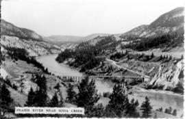
- AM54-S4-: Mon P92.3
- Item
- 1957
Part of Major Matthews collection
4659 results with digital objects Show results with digital objects
Part of Major Matthews collection

Part of Arthur Collier fonds

Part of Arthur Collier fonds

Part of Arthur Collier fonds

Part of Arthur Collier fonds

Part of Arthur Collier fonds

Part of Arthur Collier fonds
![[Agassiz-Rosedale Bridge]](/uploads/r/null/b/9/b9a0eb51c46b2d4d18d17731a36fa41612fd8d34f153433851eda3dd6d55e728/ab733b8f-00dc-42e4-bf26-7ef4383180bb-A24439_142.jpg)
![[Union S.S. "Lady Cynthia"]](/uploads/r/null/3/d/3da5f7cfeb7b6a57d8086ddd58cc0b2f655004afc672b31110f6144453b823bc/675d1178-21ee-4f60-b52f-427f5ba03643-A24301_142.jpg)
Part of Major Matthews collection
![[S.S. "Chilcotin" in Gardner Inlet]](/uploads/r/null/6/e/6e97bed4f2a7e8d745c69c8f4dfdc94fd9eea3d266cf4166ad7dc0ca4d1219e0/149bc75d-043a-4336-8472-7a6a0d1e73bf-A24291_142.jpg)
[S.S. "Chilcotin" in Gardner Inlet]
Part of Major Matthews collection
Photograph shows the glacier clad mountains of Europa Reach.
![[S.S. "Chilcotin"]](/uploads/r/null/9/4/9490f8bb2c9e103890fc6ea805b1c5cac34f3d803e27bf40d8161660025475f6/9ac2d4a6-e3df-4581-b2f1-388633c0b5d4-A24282_142.jpg)
Part of Major Matthews collection
![[S.S. "Chilcotin"]](/uploads/r/null/d/3/d3f21671eed7def9a6cd5fa9aa59aff154af83457b38d71f2e5f32d712541bb6/3ddbe68e-c8fe-4c09-affa-b4491ada060c-A24293_142.jpg)
Part of Major Matthews collection
![[The pier at] Camp Artaban](/uploads/r/null/8/3/832468a71ca0f1c151bfa4e85e3797e73fb5c6ee3251b38eefe5a0fd1e675d9e/053b8b3d-acd5-46b5-b57b-0c98c2429583-A61633_142.jpg)
Part of Major Matthews collection
![[Lunch room in the Union S.S. "Lady Cynthia"]](/uploads/r/null/c/7/c7a06283f4795dbddb182217bc97e0d28f706313bb0bd06f3637afa5a7aec84c/888d946c-eea9-41ec-950e-43ba079ff991-A24304_142.jpg)
[Lunch room in the Union S.S. "Lady Cynthia"]
Part of Major Matthews collection
![[Interior passenger deck of the Union S.S. "Lady Cynthia"]](/uploads/r/null/5/3/53d8f571bca3d4ab363722f38bcaafeab6588b1945555ce8616d89638640c023/7c0b577e-c9a0-476b-83ec-9dd75a7044fa-A24305_142.jpg)
[Interior passenger deck of the Union S.S. "Lady Cynthia"]
Part of Major Matthews collection
![[Driving the last spike of the Pacific Great Eastern Railway line 25 miles north of Horseshoe Bay]](/uploads/r/null/8/6/865249cd08465450446cf3fbba7cb5f3835813180d9172e6001e6fd65f64a12c/04e7f1a8-6f42-4a37-a8c0-632d0027d414-A37620_142.jpg)
[Driving the last spike of the Pacific Great Eastern Railway line 25 miles north of Horseshoe Bay]
Part of Major Matthews collection
Photograph shows Bill Smetanuch, Mr. Chetwynd and others
![[Opening of the Pacific Great Eastern Railway line]](/uploads/r/null/7/e/7ef195228d11841032be08069554e6231ab74b63b82265b0d4f7e0848ba13867/3d768683-86a4-48f4-91a0-1bbf9c786b11-A37621_142.jpg)
[Opening of the Pacific Great Eastern Railway line]
Part of Major Matthews collection
Photograph shows Mr. Chetwynd, Elnar Gunderson and others

Part of City of Vancouver Archives technical and cartographic drawing collection
Part contains general information about British Columbia's government, economy, and resources, and text advertising the services of Western Development and Power Limited.

Item is a map of the central British Columbia coast including Haida Gwaii and the mainland from Stewart in the northwest to Kleena Kleene in the southeast. Map shows cities, municipalities, and settlements, post offices, government agents, railways, roads, ferry and steamship routes, air and seaplane ports, parks, campsites, glaciers, customs ports of entry, and elevations of mountains. An small key map shows the primary map's location in relation to the rest of British Columbia and other maps published in the same series.
![[Interior hall way of Union S.S. "Lady Cynthia"]](/uploads/r/null/8/6/86cf3029ba68137a879719a7bc57725c5f57bee5196f5cbf8cee49b2f361a6fb/a7720e4e-d0e8-45e7-9980-7f45ff0b90c1-A24302_142.jpg)
[Interior hall way of Union S.S. "Lady Cynthia"]
Part of Major Matthews collection
![[Interior passenger deck of the Union S.S. "Lady Cynthia"]](/uploads/r/null/1/0/1096c9b1de1800ce3f785e5198a44010bcd2406c88da4e12b3b537db12075752/f52beb81-07d2-43dc-9201-e85d9c69fc4f-A24306_142.jpg)
[Interior passenger deck of the Union S.S. "Lady Cynthia"]
Part of Major Matthews collection
![[A sleeping hut at Camp Artaban]](/uploads/r/null/e/4/e4b19075d2cd87a9e0b529105ec06550e218c4c19264adf9282a18d9db6e500f/3de3a24e-6055-4c2c-a2a0-b608126652dd-A61632_142.jpg)
[A sleeping hut at Camp Artaban]
Part of Major Matthews collection
![[Aerial view of] British Pacific Properties [and North Vancouver]](/uploads/r/null/1/4/14644a75d43dd6a85d7a3c082e63134f4994ac268e97d1c0940f786b344bbd7e/46041e12-d683-4b08-81b0-797947030f8f-A23485_142.jpg)
[Aerial view of] British Pacific Properties [and North Vancouver]
Part of Major Matthews collection
Oblique view. Photograph shows Lions Gate (First Narrows) Bridge

Happy Old Age Society Annual Picnic Belcarra Park
Part of Major Matthews collection
Group portrait
![[View from tug boat of "Makedonia" being towed]](/uploads/r/null/e/8/e816f3321e19391c25fe4b597bfe3e5cfbcf4ea35e437b7e98708c94e1ab1e28/8a237075-5503-4e94-870f-f5ae13257249-A24164_142.jpg)
[View from tug boat of "Makedonia" being towed]
Part of Major Matthews collection

South western British Columbia
Item is a map of southwestern British Columbia and northwestern Washington showing cities, municipalities, and settlements, post offices, government agents, railways, roads, ferry and steamship routes, air and seaplane ports, parks, campsites, glaciers, customs ports of entry, and elevations of mountains. Inset maps show the islands north of Cape Scott and the Seattle region. An small key map shows the primary map's location in relation to the rest of British Columbia and other maps published in the same series.

Dress gala, Mrs. Sherwood Lett on left of Mrs. W.A.C. Bennett
British Columbia : principal water power resources and distribution facilities
Item shows hydro installations and power distribution systems, both developed and undeveloped.
![[P.G.E. Diesel, Eng.#]567 [Class MCGE RSC 3]](/uploads/r/null/2/5/2500f419973538ce5cf59f6ba9f9ed391ff4126b75534be918453f2bcdc19e0b/3e76ea9c-8d3c-4ced-983f-af2c3e3ef4b6-A28564_142.jpg)
[P.G.E. Diesel, Eng.#]567 [Class MCGE RSC 3]
Part of Walter E. Frost fonds
Bellingham sectional aeronautical map (Fraser Mills, B.C.)
![C.P.R. Steam, Pass. Eng. #3630 [Class N2A]](/uploads/r/null/d/4/d409bfb7a4ce85fa997293358e3b36a68882423ca0ff7b610faac03583b56d50/e438382e-2386-452b-94e6-189498ce0e3f-A22123_142.jpg)
C.P.R. Steam, Pass. Eng. #3630 [Class N2A]
Part of Walter E. Frost fonds

Tugs "Wando" and "Hercules" with large section of Prince Rupert drydock near Butedale B.C.
Part of Major Matthews collection
![C.P.R. Steam, Pass. Eng. #3630 [Class N2A]](/uploads/r/null/4/7/474f40803408859f315541bf5e5c18d76801945be1239d938cc3fb1cf0c01462/f4a4c61e-1f29-4158-8c77-6cdf1e142e33-A22124_142.jpg)
C.P.R. Steam, Pass. Eng. #3630 [Class N2A]
Part of Walter E. Frost fonds
![C.P.R. Steam, Pass. Eng. #3663 [Class N2A]](/uploads/r/null/e/1/e13419a61da3b514cdbdeb327dcf201b11b69f5435c857a2d13cc674bd541cef/4f0cf7a1-0599-463a-8c20-1e296ecab560-A22132_142.jpg)
C.P.R. Steam, Pass. Eng. #3663 [Class N2A]
Part of Walter E. Frost fonds
![C.P.R. Steam, Pass. Eng. #5759 [Class R3B]](/uploads/r/null/c/c/cc555550fbedb34c0599d9779e014972b7cbd9744f9d97727f7879e66b1664b2/75896191-440d-493a-bc33-66772e99283c-A22245_142.jpg)
C.P.R. Steam, Pass. Eng. #5759 [Class R3B]
Part of Walter E. Frost fonds
Part of Major Matthews collection
![C.P.R. Steam, Freight Eng. #5310 [Class P2B, "Mikado"]](/uploads/r/null/3/2/3263c85531fb5ffac2d6721e415999abb9b9c99f4f979fefcae7340fb7199c2d/12918c80-2f21-4a46-8b0e-d43e7344db54-A22198_142.jpg)
C.P.R. Steam, Freight Eng. #5310 [Class P2B, "Mikado"]
Part of Walter E. Frost fonds
![[Aerial view of western side Bowen Island, Langdale and Keats Island]](/uploads/r/null/c/f/cfa3b48707527f99931a8687eb7821100c5cf3941db7aec18fcb3355c4cd0320/ce3f1d50-7991-4fec-bd64-b5d9b2f2afe2-A31871_142.jpg)
[Aerial view of western side Bowen Island, Langdale and Keats Island]
Part of Major Matthews collection
![[The left bank high level fishway at Hell's Gate]](/uploads/r/null/6/2/621a202df122b92fbad6fa835b4393ad0b0eb0cb1001b7f2b872502c40291d41/c0105ad4-bdb8-43f8-8203-de56a5ad5e50-A33643_142.jpg)
[The left bank high level fishway at Hell's Gate]
Part of Major Matthews collection
![C.P.R. Steam, Freight Eng. #5310 [Class P2B, "Mikado"]](/uploads/r/null/8/3/83ce860c91e23af7f2ed3aed5221a4d0a8db89684d4107935f281ae4d702ccb7/5a4739b1-4c1b-469f-8eae-78e16faf20ec-A22200_142.jpg)
C.P.R. Steam, Freight Eng. #5310 [Class P2B, "Mikado"]
Part of Walter E. Frost fonds
![[A part of the Lillooet-Burrard Inlet Trail south of Mount Garibaldi]](/uploads/r/null/2/7/276615923edd27e18a3a3581d7553c4fb0d1254339d7ffdc1a34ed405d57af5f/a1f98700-798a-47a7-85ff-8f592653097e-A33434_142.jpg)
[A part of the Lillooet-Burrard Inlet Trail south of Mount Garibaldi]
Part of Major Matthews collection
![[Aerial view of portion of Bowen Island, Langdale and Keats Island]](/uploads/r/null/f/5/f58d336d3b69110ac58eeb23c1fbda9d8ef018235e990e24a9a7d138d5f6915e/840eafa7-a8ff-4e69-a9be-033cafca1570-A31875_142.jpg)
[Aerial view of portion of Bowen Island, Langdale and Keats Island]
Part of Major Matthews collection

C.N.R. Steam, Pass. Eng. #2752
Part of Walter E. Frost fonds
![[View of the Lillooet-Burrard Inlet Trail south of Mount Garibaldi]](/uploads/r/null/a/5/a545ac048fb5d9fd84dfaff5b6f294cdcc3d0714ee8a8dca342c0cd66d3308a3/20b4e14c-6ced-4b05-b66c-1f38b485161e-A33439_142.jpg)
[View of the Lillooet-Burrard Inlet Trail south of Mount Garibaldi]
Part of Major Matthews collection

Part of Major Matthews collection
Photograph shows Burrard Inlet, West Vancouver, North Vancouver, Vancouver, Richmond, Burnaby, Port Moody, Coquitlam, Port Coquitlam, New Westminster, Richmond, Delta and Surrey
![[Phyllis (Mackay) Lake looking south towards the divide]](/uploads/r/null/5/d/5db2e56935c10a5bf234dcd58278f1be096b6d3c68fb29914969886355d1ae63/2dcc2eb9-edde-4d40-87a3-dbba3b862ae1-A32858_142.jpg)
[Phyllis (Mackay) Lake looking south towards the divide]
Part of Major Matthews collection

Part of Major Matthews collection
!["Mickey Island" [from Pasley Island]](/uploads/r/null/d/6/d601a858e0744fd34493de96087e33ee31532ebcf3f5e152a9632c380ef3f66a/4095fa4d-dd84-46d6-bdc5-4d8db4969ad2-A33417_142.jpg)
"Mickey Island" [from Pasley Island]
Part of Major Matthews collection

Capilano Valley and the Lions from the air
Part of Major Matthews collection