
City of Vancouver, British Columbia
- COV-S365-: MAP 716
- Item
- Dec. 1959-Apr. 12, 1961
Part of City of Vancouver fonds
Item is a map showing city streets and address block numbers.
3815 results with digital objects Show results with digital objects
City of Vancouver, British Columbia
Part of City of Vancouver fonds
Item is a map showing city streets and address block numbers.

Sheet 10 : Clark Drive to Slocan Street and Burrard Inlet to Triumph Street
Part of City of Vancouver fonds
Item is a section showing the area from Clark Drive to Slocan Street and aterfront to Triumph Street. Includes streets and roads, blocks, lots, legal descriptions, railways, parks, boys' detention home and businesses along the waterfront. The Town of Hastings is indicated on the map. Map is hand coloured to show tax sale property for sale, property with no water, street widening and drainage, replotting, reserved land for schools, reserved land for parks, sundry land, capital assets not including schools and parks, schools, and parks, as applicable.
Vancouver (B.C.). Office of the City Engineer

Sheet 8 : McLean Drive to Slocan Street and William Street to Seventh Avenue
Part of City of Vancouver fonds
Item is a section showing the area from McLean Drive to Slocan Street and William Street to Seventh Avenue. Includes streets and roads, blocks, lots, legal descriptions, railways, parks, schools and some businesses. Map is hand coloured to show tax sale property for sale, property with no water, street widening and drainage, replotting, reserved land for schools, reserved land for parks, sundry land, capital assets not including schools and parks, schools, and parks, as applicable. Some annotations have been made in pencil.
Vancouver (B.C.). Office of the City Engineer

Sheet 16 : Maple Street to Oak Street and False Creek to Sixteenth Avenue
Part of City of Vancouver fonds
Item is a section showing Maple Street to Oak Street and False Creek to Sixteenth Avenue. Includes streets and roads, blocks, lots, legal descriptions, railways, schools and parks. Indicates crown land leased to the C.P.R. and other bodies. Map is hand coloured to show tax sale property for sale, property with no water, street widening and drainage, replotting, reserved land for schools, reserved land for parks, sundry land, capital assets not including schools and parks, schools, and parks.
Vancouver (B.C.). Office of the City Engineer

Sheet 18 : Trutch Street to Maple Street and English Bay to Third Avenue
Part of City of Vancouver fonds
Item is a section showing Trutch Street to Maple Street and English Bay to Third Avenue. Includes streets, roads, blocks, lots, legal descriptions, parks and crown grants. Map is hand coloured to show tax sale property for sale, property with no water, street widening and drainage, replotting, reserved land for schools, reserved land for parks, sundry land, capital assets not including schools and parks, schools, and parks.
Vancouver (B.C.). Office of the City Engineer

Sheet 21 : Burrard Street to False Creek and waterfront to Robson Street
Part of City of Vancouver fonds
Item is a section showing Burrard Street to False Creek and waterfront to Robson Street. Includes streets and roads; blocks, lots and legal descriptions; the locations of hotels, court house, businesses, parks, and schools; crown leases; C.P.R. land and the company's Piers B and C, yards, sheds and depot; the B.C. Electric Railway Carrall Street Yard; and the Union Steamship Company. Map is hand coloured to show tax sale property for sale, property with no water, street widening and drainage, replotting, reserved land for schools, reserved land for parks, sundry land, capital assets not including schools and parks, schools, and parks, as applicable.
Vancouver (B.C.). Office of the City Engineer

Sheet 6 : Knight Street to Slocan Street and Eighteenth Avenue to Twenty-ninth Avenue
Part of City of Vancouver fonds
Item is a section showing the area from Knight Street to Slocan Street and Eighteenth Avenue to Twenty-ninth Avenue. Includes streets and roads, blocks, lots, legal descriptions, railways, parks and schools. Some annotations have been made in pencil. Map is hand coloured to show tax sale property for sale, property with no water, street widening and drainage, replotting, reserved land for schools, reserved land for parks, sundry land, capital assets not including schools and parks, schools, and parks. Map is hand coloured to show tax sale property for sale, property with no water, street widening and drainage, replotting, reserved land for schools, reserved land for parks, sundry land, capital assets not including schools and parks, schools, and parks, as applicable.
Vancouver (B.C.). Office of the City Engineer

Sheet D : Imperial Street to Trutch Street and Fourth Avenue to Sixteenth Avenue
Part of City of Vancouver fonds
Item is a section showing the area from Imperial Street to Trutch Street and Fourth Avenue to Sixteenth Avenue. Includes streets and roads; blocks; lots and legal descriptions; and parks, schools and golf courses. Section is annotated to show tax sale property for sale, property with no water, street widening and drainage, replotting, reserved land for schools, reserved land for parks, sundry land, capital assets not including schools and parks, schools, and parks, as applicable.
Vancouver (B.C.). Office of the City Engineer

Sheet G : Trafalgar Street to Granville Street and Sixteenth Avenue to Nanton Avenue
Part of City of Vancouver fonds
Item is a section showing the area from Trafalgar Street to Granville Street and Sixteenth Avenue to Nanton Avenue. Includes streets, roads and sewers; blocks, lots and legal descriptions; and parks, railway lines and schools. Section is annotated to show tax sale property for sale, property with no water, street widening and drainage, replotting, reserved land for schools, reserved land for parks, sundry land, capital assets not including schools and parks, schools, and parks, as applicable.
Vancouver (B.C.). Office of the City Engineer

Sheet X : Marine Drive to Ash Street and Fifty-ninth Avenue to Seventy-first Avenue
Part of City of Vancouver fonds
Item is a section showing the area from Marine Drive to Ash Street and Fifty-ninth Avenue to Seventy-first Avenue. Includes streets and roads; blocks, lots and legal descriptions; and parks and schools. Map is hand coloured to show tax sale property for sale, property with no water, street widening and drainage, replotting, reserved land for schools, reserved land for parks, sundry land, capital assets not including schools and parks, schools, and parks, as applicable.

Sheet 6 : Craddock Street to Boundary Road and Twenty-ninth Avenue to Fortieth Avenue
Part of City of Vancouver fonds
Item is a section showing the area from Craddock Street to Boundary Road and Twenty-ninth Avenue to Fortieth Avenue. Includes streets, roads, blocks, lots, legal descriptions, parks. railway lines and schools. Map is hand coloured to show tax sale property for sale, property with no water, street widening and drainage, replotting, reserved land for schools, reserved land for parks, sundry land, capital assets not including schools and parks, schools, and parks, as applicable.
Vancouver (B.C.). Office of the City Engineer

Sheet 3 : Cambie Street to St. George Street and Twenty-seventh Avenue to Thirty-eighth Avenue
Part of City of Vancouver fonds
Item is a section showing the area from Cambie Street to St. George Street and Twenty-seventh Avenue to Thirty-eighth Avenue. Map shows streets, roads, blocks, lots and legal descriptions and the locations of parks, schools, reservoirs and Mountainview Cemetery. Map is hand coloured to show tax sale property for sale, property with no water, street widening and drainage, replotting, reserved land for schools, reserved land for parks, sundry land, capital assets not including schools and parks, schools, and parks, as applicable.
Vancouver (B.C.). Office of the City Engineer

Sheet 13 : Fleming Street to Carlton Street and Forty-seventh Avenue to Fifty-ninth Avenue
Part of City of Vancouver fonds
Item is a section showing the area from Fleming Street to Carlton Street and Forty-seventh Avenue to Fifty-ninth Avenue. Includes streets, roads, blocks, lots, legal descriptions, parks and schools. Map is hand coloured to show tax sale property for sale, property with no water, street widening and drainage, replotting, reserved land for schools, reserved land for parks, sundry land, capital assets not including schools and parks, schools, and parks, as applicable.
Vancouver (B.C.). Office of the City Engineer

Sheet 11 : Cambie Street to St. George Street and Forty-seventh Avenue to Fifty-eighth Avenue
Part of City of Vancouver fonds
Item is a section showing the area from Cambie Street to St. George Street and Forty-seventh Avenue to Fifty-eighth Avenue. Includes streets, roads, blocks, lots, legal descriptions, golf courses, parks and schools. Map is hand coloured to show tax sale property for sale, property with no water, street widening and drainage, replotting, reserved land for schools, reserved land for parks, sundry land, capital assets not including schools and parks, schools, and parks, as applicable.
Vancouver (B.C.). Office of the City Engineer

Sheet 9 : Fleming Street to Carlton Street and Thirty-seventh Avenue to Forty-eighth Avenue
Part of City of Vancouver fonds
Item is a section showing the area from Fleming Street to Carlton Street and Thirty-seventh Avenue to Forty-eighth Avenue. Includes streets, roads, blocks, lots, legal descriptions, parks and schools. Map is hand coloured to show tax sale property for sale, property with no water, street widening and drainage, replotting, reserved land for schools, reserved land for parks, sundry land, capital assets not including schools and parks, schools, and parks, as applicable.
Vancouver (B.C.). Office of the City Engineer

Part of City of Vancouver fonds
Image shows vacant lot in foreground, portions the Nelson Rooms and Nothingham Apartments in the 1200 block of Robson Street and the east side of the Sheraton Landmark building.

Part of City of Vancouver fonds
Image shows vacant lot in foreground and the back of the Nelson Rooms and the Nothingham Apartments.
![[Street in Kitsilano]](/uploads/r/null/9/9/995b64e959c5d0a2bd16b4ad59feda2f735201ac7a9d2440b83b0ff59c9015f7/26acbbfe-74dd-4783-b448-a76b1f679dc7-A58952_142.jpg)
Part of City of Vancouver fonds
Photograph also shows houses

Part of City of Vancouver fonds
Photograph also shows a Richmond Transfer truck.

Part of City of Vancouver fonds
Photograph also shows buildings downtown including the Harbour Centre (555 West Hastings Street)
![[East facing cityscape view of] Water St[reet and West Cordova Street]](/uploads/r/null/4/c/4ce1044a578de08f6b0c6694f11dab01ef1134bd26eacefa6b31b9eccd465ead/e75dbf34-7999-40e0-be07-94dd0603fa79-A59644_142.jpg)
[East facing cityscape view of] Water St[reet and West Cordova Street]
Part of City of Vancouver fonds
![Cambie and 12th [Avenue] taken looking south west from the City Hall](/uploads/r/null/a/9/a95f8048b04d26c3060361b361c2b136bb58d850bbddd32cf9f2dc465086b275/92b1e557-98de-4bde-b1e7-944c3db510dd-A43707_142.jpg)
Cambie and 12th [Avenue] taken looking south west from the City Hall
Part of City of Vancouver fonds
Photograph shows the corner of the Imperial Oil gas station lot and the Blink Bonny apartments at 2825 Cambie Street and the house at 510 West 12th Avenue.
![[Granville Street at Robson Street, looking south]](/uploads/r/null/a/a/aa31b4fb329fc0a45fc4bf57eb1ba9577b8974130b3833b770e5a34f423e5bb2/67f9af08-68f0-415e-95e6-beed8a502406-A43709_142.jpg)
[Granville Street at Robson Street, looking south]
Part of City of Vancouver fonds
Photograph shows "Theatre Row".
![[Granville Street at Broadway, looking south]](/uploads/r/null/a/d/ad9fb3d4863318eb2af9936be53f2590f9885be4f79a66193f9ccc3f857a8c94/ad4447d5-b4e3-4378-a692-86d3e86a5a5f-A43711_142.jpg)
[Granville Street at Broadway, looking south]
Part of City of Vancouver fonds
Photograph shows the Aristocratic cafe and Jordans.
![[Granville Street at 11th Ave, looking south]](/uploads/r/null/b/0/b0b95d9b06cf45c97e2a41efb25abec88233f2d3fd8a49a08c95b8769c61bde4/7c7f2be8-6b05-439e-b609-a6224798fc49-A43713_142.jpg)
[Granville Street at 11th Ave, looking south]
Part of City of Vancouver fonds
Photograph shows the Stanley Theatre
![[One way traffic Seymour St. at Georgia Street, looking south]](/uploads/r/null/6/a/6ab5722dd80ce8659c50534737b97713ef7378106e8777583f6504275d6eb353/28fb7cc1-f428-4efb-9354-3631dfad7020-A43714_142.jpg)
[One way traffic Seymour St. at Georgia Street, looking south]
Part of City of Vancouver fonds
![[Seymour St. at Nelson St., looking east]](/uploads/r/null/6/7/674f17e26621bf88a01685886f3b90e9c81d8d4f7631a2430e620005b18466ff/7df56426-d3dd-4bfd-a460-566da7150ef1-A43720_142.jpg)
[Seymour St. at Nelson St., looking east]
Part of City of Vancouver fonds
Photograph shows Seymour Billiards.
![[800 E Hastings St]](/uploads/r/null/2/8/28ac1de86a0ec4e02f2ccaebd198f03b30e9d50715bfcf7843b57a82d6981417/14007932-5aa0-49f6-9caa-c7bb2c95c70a-A43722_142.jpg)
Part of City of Vancouver fonds
Photograph shows north side of the 800 Block of east Hastings Street as viewed from the southwest.
![[Hawkes Avenue at Hastings Street]](/uploads/r/null/4/3/4396259b55799a72f95a40de0cb3e84ce61fee05f34f430850ea64b1ae69c11b/d53216db-d489-4a3a-862e-f06decea401a-A43724_142.jpg)
[Hawkes Avenue at Hastings Street]
Part of City of Vancouver fonds
Photograph shows Buckshon's Pharmacy and the Rice Block at 404 Hawks Avenue
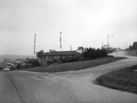
Puget Drive and Eddington Avenue - southeast corner - view southeast
Part of City of Vancouver fonds
Photograph shows 4662 Puget Drive
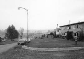
Eddington Drive, south side, from Paton Street to Haggarts Street
Part of City of Vancouver fonds
Photograph shows 2404 and 2406 Eddington Drive

Haggart Street, east side, from 32nd Avenue to lane north - view south
Part of City of Vancouver fonds

10th Avenue and Tolmie Street looking north
Part of City of Vancouver fonds
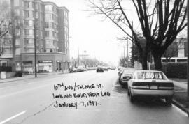
10th Avenue and Tolmie Street looking west
Part of City of Vancouver fonds
![Glen [Drive] and 12th [Avenue] looking west](/uploads/r/null/2/0/20a6d1c09b41715730cdbf9baf3aa85418cea20fa296a70020a9f7697931498c/4c61cc09-30a4-436b-ad6f-36bc6ee208bb-A44557_142.jpg)
Glen [Drive] and 12th [Avenue] looking west
Part of City of Vancouver fonds
![12th Avenue and Larch [Street] looking south](/uploads/r/null/1/1/1170cd2d4c024cfe3eae8e18ef482d4e407aba279f821de17792e7cdcaea2cf0/cfb6ff81-80ae-4ebc-9a72-8763ee292316-A44560_142.jpg)
12th Avenue and Larch [Street] looking south
Part of City of Vancouver fonds
![12th Avenue and Woodland [Street] looking south](/uploads/r/null/1/c/1cd8bde4ad56854ff7e6240a02d4b446b56d7dcdcc1960fe4e69553990abe298/4f339865-9d88-4b6c-9294-4028480adc5d-A44565_142.jpg)
12th Avenue and Woodland [Street] looking south
Part of City of Vancouver fonds
![12th Avenue and Woodland [Street] looking east](/uploads/r/null/2/b/2b688e195e897590018793bd773ae786538747cb949b7f9bd58277851ef3479c/e6351f1a-0756-4ece-b43f-7d245a5dd6db-A44566_142.jpg)
12th Avenue and Woodland [Street] looking east
Part of City of Vancouver fonds
![12th Avenue and Woodland [Drive] looking west](/uploads/r/null/5/d/5d37bc1dd0922dcc9fac26af58914e9ba405b465f323715ce914cc35aee4a37f/bdeb1fb6-3664-40e9-bd5a-2a6a07c86797-A44567_142.jpg)
12th Avenue and Woodland [Drive] looking west
Part of City of Vancouver fonds
![16th Avenue and Ontario [Street] looking south](/uploads/r/null/1/1/11d5990179d2751884b6dfaafa5ca51e29fc3b112f2cd4827cc7d51582c82558/5907b7c9-3c7a-4f95-bd84-ce253fdcd326-A44569_142.jpg)
16th Avenue and Ontario [Street] looking south
Part of City of Vancouver fonds
![16th Avenue and Ontario [Street] looking east](/uploads/r/null/5/e/5ef7507610b67af600514549e5ad1aa38d64e29729830281fa1bee612fb3c076/5718e5a9-a684-43cb-9777-836c10667329-A44570_142.jpg)
16th Avenue and Ontario [Street] looking east
Part of City of Vancouver fonds
![Nootka [Street] and 22nd [Avenue] looking north](/uploads/r/null/a/9/a9dcdd1ced2a54ba9c8cd516fa7ef85d926e9288951a82818794e82b0219aae6/ad368217-3dfe-42ef-81c1-435cf575d6f3-A44572_142.jpg)
Nootka [Street] and 22nd [Avenue] looking north
Part of City of Vancouver fonds
Photograph shows Fire Hall No. 5
![Nootka [Street] and 22nd [Avenue] looking east](/uploads/r/null/3/8/387b9ce1247e5df1792552f6cebd09d20babf77d196ba94a8a2caf51837fe703/13e39dcb-4124-4c4a-928b-d779635e70e8-A44574_142.jpg)
Nootka [Street] and 22nd [Avenue] looking east
Part of City of Vancouver fonds
![Nootka [Street] and 22nd [Avenue] looking west](/uploads/r/null/b/0/b08d8184ebcf4d80e2cdae06c6585c4d59241e257f39f293d38cc8e7c06539c7/8bc3d140-35a5-444b-a76c-3cb85f6e6d27-A44575_142.jpg)
Nootka [Street] and 22nd [Avenue] looking west
Part of City of Vancouver fonds
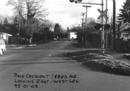
Pine Crescent and 33rd Avenue looking east
Part of City of Vancouver fonds
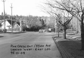
Pine Crescent and 33rd Avenue looking west
Part of City of Vancouver fonds
![41st Avenue and Wales [Street] looking south](/uploads/r/null/3/b/3b82d0495adb10479bf9049990dd82fef0546001b9f2bd7f3baa22fccb11b966/dc53ae51-18b8-42d1-b8aa-1fc3f601e8c9-A44584_142.jpg)
41st Avenue and Wales [Street] looking south
Part of City of Vancouver fonds
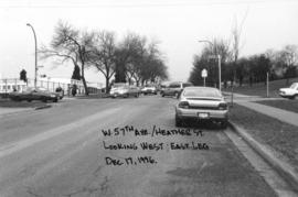
West 57th Avenue and Heather Street looking west
Part of City of Vancouver fonds
![Arbutus [Street] and King Edward [Avenue looking west]](/uploads/r/null/f/6/f67cbf44163e552055f67ab9c0bf31b06be4bb5321be2b384e062e0f4a299caf/b1fa3ae6-b4d6-4574-bbbd-477c3fae2401-A44597_142.jpg)
Arbutus [Street] and King Edward [Avenue looking west]
Part of City of Vancouver fonds
![Clark [Drive] and Hastings [Street looking] west](/uploads/r/null/1/9/19746babb0caf614ee269d1cc5fbd8a9530314dcb1af237ec01407bb1a832b0a/7a6f5878-5a0f-41e9-95da-74b1a96eff9d-A44599_142.jpg)
Clark [Drive] and Hastings [Street looking] west
Part of City of Vancouver fonds