
- COV-S639-2-F17-: CVA 791-0500
- Item
- Dec. 1985
Part of City of Vancouver fonds
Part of City of Vancouver fonds
![[Chief Turner and Captain Munro of Point Grey Fire Department aboard Fire Chief's automobile]](/uploads/r/null/3/e/5/3e56e5f7a117044aa405bb2770771b159eaa81c0098a98a3b9a0bc8b4ce9b545/a568a13d-a0a2-4bb7-b487-d0ba9f4a08d3-CVA354-047_142.jpg)
[Chief Turner and Captain Munro of Point Grey Fire Department aboard Fire Chief's automobile]
Part of City of Vancouver fonds
Item is a photograph showing Turner in the passenger seat and Munro at the wheel.

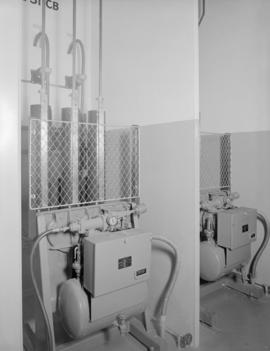
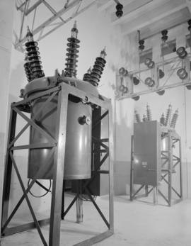
Electrical Industries : switch boxes, lights, etc.
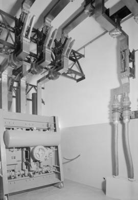
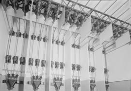
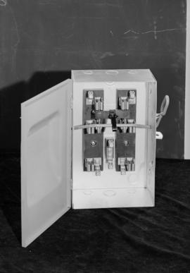
Electrical Industries : switch boxes

Electrical Industries : switch boxes
![Electrician at work [at] Pacific Mills](/uploads/r/null/5/1/513394a229c165fc992df1e80235716e23f22a7dc8a7b947dfecaff217891106/3ae1b1ad-3674-4879-b149-adfc1938b908-A14734_142.jpg)
Electrician at work [at] Pacific Mills
![B.C. Electric - electronics window [display]](/uploads/r/null/e/5/e5c62aecad450d6cc039bd32f2fcbc4b3cef7e7e7a8cef5762b76c719fd99e7c/56ca5d4a-7774-46cc-9577-01b02e1465dc-A06350_142.jpg)
B.C. Electric - electronics window [display]

B.C. Electric sub-station at Second Narrows Bridge

Spitzer and Mills Adv. Ltd., B.C. Electric Rly. Co.

B.C. Electric Ltd. public information : control room at Carrall St. plant
![[Exterior of the Dawson Block at 193 East Hastings Street]](/uploads/r/null/1/9/19ea87419ca22c13aa2eca88e119562ea4ebf2c9ee1784ebd6e1343b63082a39/ccb0bc30-ea1e-4bd2-8b9a-f091d9699c3d-A61079_142.jpg)
[Exterior of the Dawson Block at 193 East Hastings Street]
Part of Major Matthews collection
Photograph shows the cupola of Carnegie Library and a man hanging from a power line

Part of City of Vancouver Archives technical and cartographic drawing collection
Map is a plan showing the location of power houses, dams and pipes for the Garibaldi-Daisy Lake development, Cheakamus Lake-McGuire, McGuire-Brandywine, Cheakamus Canyon and Daisy Lake Dam areas. Map created to accompany E.A. Cleveland's "Report on a Preliminary Investigation of the Cheakamus River Power Possibilities made for the City of Vancouver."

Part of City of Vancouver Archives technical and cartographic drawing collection
Map is a plan of the proposed storage reservoir at Daisy Lake on the Cheakamus River. The map includes a plan of the topography of the proposed dam site, a log of borings, and a capacity diagram at Daisy Lake Reservoir. Also included are elevations, power stations, pipelines and the Pacific Great Eastern Railway line. The map was created to accompany E.A. Cleveland's "Report on a Preliminary Investigation of the Cheakamus River Power Possibilities made for the City of Vancouver." Map has been numbered Tube 58.

Part of City of Vancouver Archives technical and cartographic drawing collection
Map is a topographical plan showing the proposed hydroelectric development on the Cheakamus River near Mile 19, Pacific Great Eastern Railway. Indicated on the map are the locations of tunnels, dams, by-passes, pipelines, the railway line, and the power station for the Cheakamus Canyon development. The map was created to accompany E.A. Cleveland's "Report on a Preliminary Investigation of the Cheakamus River Power Possibilities made for the City of Vancouver." Map has been numbered Tube 59.

Part of City of Vancouver Archives technical and cartographic drawing collection
Map is a topographical plan showing the proposed diversion works on the Cheakamus River near Mile 19, Pacific Great Eastern Railway. Indicated on the map are the locations of tunnels, dams and the railway line. The map was created to accompany E.A. Cleveland's "Report on a Preliminary Investigation of the Cheakamus River Power Possibilities made for the City of Vancouver." Map is numbered Tube 60.

Part of City of Vancouver Archives technical and cartographic drawing collection
Map is a topographical plan showing the area from Alpha Lake to Cheakamus River, above Mile 34, Pacific Great Eastern Railway. Indicated on the map are the locations of the Mons Gauging Site, a suggested dam site, trails, the old wagon road, the railway line, and Millar Creek. The map was created to accompany E.A. Cleveland's "Report on a Preliminary Investigation of the Cheakamus River Power Possibilities made for the City of Vancouver." Map has been numbered Tube 61.
![[Hydro electric dam]](/uploads/r/null/a/a/aaf0842ab12de9b6514858e0c01707219f1102162300b8b3c0eca32d9e519c81/b2443a39-aa17-466e-b73e-8a9713e6c98f-A13466_142.jpg)
![[Electrical circuits]](/uploads/r/null/2/f/2f9e310e8ff674e4d86215b2fcc87fa990711bef556eb72de420410ce5ad8d0c/1f018fd3-99db-465b-9137-b1cc16dfe100-A13336_142.jpg)
![[Electrical controls at an industrial building]](/uploads/r/null/e/f/efc28c22bbcf5dfae7be8c71f840e40233491794138bd656845e3f7fabb996d7/b31ef8c2-57a9-427a-8f2e-078d2f8339a0-A12421_142.jpg)
[Electrical controls at an industrial building]
![[Construction of Horne-Payne substation]](/uploads/r/null/9/6/966fc1dd459b33da24cd25807b5ab435331d7ff7fb2f6c3d9b5b8914062b7582/13f46aa9-4d96-4f6e-8d97-a1eeac90e979-A08196_142.jpg)
[Construction of Horne-Payne substation]
Part of Major Matthews collection
![[Construction of penstocks at rear of power house of Buntzen Lake Power Plant number two]](/uploads/r/null/e/3/e31637cdb540c3052c86139d66378348fcf2f465f2c45c127b3b4cf726b24d1e/d193d003-3874-4308-b178-4cf1cad651c1-A08168_142.jpg)
[Construction of penstocks at rear of power house of Buntzen Lake Power Plant number two]
Part of Major Matthews collection
Photograph shows pipes and railway tracks leading up hill.

Part of Major Matthews collection
![[Derrick for lifting transformers to transformer house of Buntzen Lake Power Plant number one]](/uploads/r/null/f/a/fa129cdb99fc70d9d03773fd5e5b08e76af49368896cecc693536e048d8debf3/89862092-a9b7-45fe-a95b-16f44cbaf882-A08589_142.jpg)
[Derrick for lifting transformers to transformer house of Buntzen Lake Power Plant number one]
Part of Major Matthews collection
![[Diagram of electrical connections for Buntzen Lake Power Plant number two]](/uploads/r/null/f/0/f0e513e791ab8c944f65d4075a063e39e49de2fd1c9afbef3fd064caee9f6d82/9f2d02ce-0793-4493-b36e-f8175356377c-A08431_142.jpg)
[Diagram of electrical connections for Buntzen Lake Power Plant number two]
Part of Major Matthews collection
Photograph negative is a copy of a technical drawing.
![[Looking north along the Second Narrows Bridge]](/uploads/r/null/1/4/1431496ef3d60c88d398cd98db594f656ca872a9879943ee5f29e939ccbd5a2b/4670be2c-db67-456b-985f-668168f0c5ae-A74408_142.jpg)
[Looking north along the Second Narrows Bridge]
Part of James Crookall fonds
Photograph shows a power transmission tower in the middle of the harbour
![[Powerline tower]](/uploads/r/null/2/2/227371dc125b0ee5ea87caa500af12715b890370343f6706efda2807b9ee97e0/3ea31ff2-3e1f-43e5-94b2-d2536cf3c339-A74363_142.jpg)
Part of James Crookall fonds
![[Old power house at Buntzen Lake]](/uploads/r/null/3/f/3f163db340381f5befd4c5d403e490e4fbe431510e62b358a7d30e67669e1a6f/a2a0a4f6-d19d-4dd8-9feb-e371e3222595-A20573_142.jpg)
[Old power house at Buntzen Lake]
Part of James Luke Quiney fonds
![Valve seats for 6'-6" needle intake valve [used for Buntzen Lake Power Plant number two]](/uploads/r/null/4/0/40918e1e70e18adcf8ada78aadba85a0c8c356b1795daafb42c9b596d4506f9a/ba93a477-9225-4d53-9b70-e997e3ba5470-A08533_142.jpg)
Valve seats for 6'-6" needle intake valve [used for Buntzen Lake Power Plant number two]
Part of Major Matthews collection
Photograph negative is a copy of a technical drawing produced by the Pelton Water Wheel Company.

Part of Major Matthews collection
Photograph negative is a copy of a technical drawing produced by the Pelton Water Wheel Company.

Vancouver Island Power Company Ltd. Jordan River Power House
Part of Major Matthews collection
Photograph negative is a copy of an architectural drawing showing a floor plan of the power house.
![[Group of men standing with raised power pole]](/uploads/r/null/e/7/e7b6be998e7409161a8aaed2181c87aaf904d0c52991d4299d1a6a329bb57422/65f67784-1e66-46ae-87f3-ddb02d7f2d5f-A04734_142.jpg)
[Group of men standing with raised power pole]
Part of Major Matthews collection
![Outer cylinder for 6'-6" needle intake valve [used for Buntzen Lake Power Plant number two]](/uploads/r/null/9/f/9f44c0ce18aa7c450d722ce6942772c0348c75be7527bce54fe0ec9f8bfd947e/27cd0ae1-a27a-4d77-802c-b517ae3e9a59-A08534_142.jpg)
Outer cylinder for 6'-6" needle intake valve [used for Buntzen Lake Power Plant number two]
Part of Major Matthews collection
Photograph is a copy of a technical drawing produced by the Pelton Water Wheel Company.
![Hastings Street, South Granville, Chinatown [Street light and power lines]](/uploads/r/null/5/5/b/55b7bcff2db2fd3e5804f7e950367b10abe53950da9d3d4677c15d185f212732/9c92271d-5270-4e90-b1f9-c4bb96a359e6-CVA1095-08733_142.jpg)
Hastings Street, South Granville, Chinatown [Street light and power lines]
Part of City of Vancouver fonds
![[Four men standing outside partially constructed gate house for Buntzen Lake Power Plant number two]](/uploads/r/null/e/1/e1f52855aa7dd8bc884eb02db911caa9f17afd50898797ed69536735323988b5/cd44fc4a-8317-4a37-9f6b-d4b34f3ac335-A08142_142.jpg)
[Four men standing outside partially constructed gate house for Buntzen Lake Power Plant number two]
Part of Major Matthews collection
![[Four scenes regarding construction of Buntzen Lake power lines]](/uploads/r/null/9/b/9bef6f4fe696bf18e0bc98679a067ce3c41bce82aea7ed8cd47506acbdda4bf4/4b2c85f6-a8a5-42f9-a039-98b29739a044-A08408_142.jpg)
[Four scenes regarding construction of Buntzen Lake power lines]
Part of Major Matthews collection
Photograph negative is a copy of four photograph prints, showing: men raising power poles; supplies near shore; power poles and lines; and electrical towers and lines.
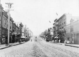
3rd Avenue Prince Rupert, B.C.
Part of Major Matthews collection
![[Rebuilding of upper end of penstocks 1 to 4 for Buntzen Lake Power Plant number one]](/uploads/r/null/6/5/65c70204b549f0ff821059d0b562cfcb939ad19740368c199bb9ff93d017b38f/51f02639-fe7a-418f-bc88-8587faffef18-A08124_142.jpg)
[Rebuilding of upper end of penstocks 1 to 4 for Buntzen Lake Power Plant number one]
Part of Major Matthews collection
Photograph shows workers with partially constructed pipe.
![[Reconstruction of upper portion of penstocks for Buntzen Lake Power Plant number one]](/uploads/r/null/8/f/8fd2d11a8c4488cdb72bcf51ef579950bea39446996af0ad988f73932963ac14/016728fe-fa72-48b2-88b3-280500f4a0fe-A08594_142.jpg)
[Reconstruction of upper portion of penstocks for Buntzen Lake Power Plant number one]
Part of Major Matthews collection
Photograph shows the pipes in the process of having the original wood stove sections replaced with rivetted steel sections.
![[Reinhart Hoffmeister with the first electric generator that he built]](/uploads/r/null/e/7/e7c81a9a3d2db50e9f75ea6db5779224843379615acd22d3c82aa1fb3f268da5/d8b0ca0f-4f93-442d-a150-283d58bc73fd-A35253_142.jpg)
[Reinhart Hoffmeister with the first electric generator that he built]
Part of Major Matthews collection
![[Replacement of upper section of wood stove penstocks for Buntzen Lake Power Plant number one]](/uploads/r/null/1/5/15ae6391238adab29d714b8ec7d283455797dbaea00604c8365990332e50edfa/7a9f8f79-575f-4859-812b-d7b51a992ed4-A08132_142.jpg)
[Replacement of upper section of wood stove penstocks for Buntzen Lake Power Plant number one]
Part of Major Matthews collection
Photograph shows men woking on partially completed section of pipe.
![[Row of large box shaped objects in B.C. Electric Railway Company Limited power station]](/uploads/r/null/9/8/981751965395bfdd7bc5a79c2c90692398dc0c40ffe4947dcc0996fca84f82c3/4da52bf2-c104-434f-ab79-da9f724b7e7b-A04729_142.jpg)
[Row of large box shaped objects in B.C. Electric Railway Company Limited power station]
Part of Major Matthews collection
![[Section of electrical tower]](/uploads/r/null/e/f/efddf5d95448b4eac2813f17a124a116222084940d150fdfb5f5d373c7b6583f/8efa0226-4083-46ce-8864-b5402fed59f6-A04818_142.jpg)
Part of Major Matthews collection
![[Machinery inside B.C. Electric Railway Company Limited power building]](/uploads/r/null/7/2/7286a61da08b0e7146152160d801e91514fc166d04eebb44f18a12d58663ba0e/d633eaff-6f66-41d3-a234-8439cae8af16-A04737_142.jpg)
[Machinery inside B.C. Electric Railway Company Limited power building]
Part of Major Matthews collection
![[Interior of electric power station]](/uploads/r/null/d/5/d56c02afa77357c3a30c73ff9484817dfba1ce384987fbeb58c21392ee79d140/5c0279e3-3dd7-46eb-b4b1-6f2630812fe2-A04755_142.jpg)
[Interior of electric power station]
Part of Major Matthews collection
![[Interior of gate house on west shore for Buntzen Lake Power Plant number two]](/uploads/r/null/2/9/29edf6bd04e546c5d1d2b45c4d555543312833712f63f6eb2c8d04d8b76697bb/e77378ea-74a4-41d9-b5c0-eaf43c1c4023-A08137_142.jpg)
[Interior of gate house on west shore for Buntzen Lake Power Plant number two]
Part of Major Matthews collection
![[Interior of partially constructed generator room for Buntzen Lake Power Plant number two]](/uploads/r/null/a/2/a2be3f84b1afee3154afdb2782ac38a031a70ca46892c76fe7455da8a386778c/22443a82-eba5-442c-8152-dfb8b66e06a5-A08161_142.jpg)
[Interior of partially constructed generator room for Buntzen Lake Power Plant number two]
Part of Major Matthews collection