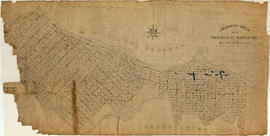
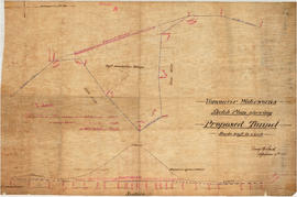
Plan of Paterson's property, block 364 D.L. 562, City of Vancouver, B.C.
- COV-S365-: LEG1967.15
- Item
- Oct. 1912
Part of City of Vancouver fonds
Item is a site plan of a lumber yard in the block bounded by Arbutus Street, Tenth Avenue, Yes Street, and Eleventh Avenue. The map shows the location and usage of buildings on the site and the location of the B.C. Electric Railway spur line on the site.
Vancouver (B.C.). Engineer's Office


![Contour plan 220a [Mt. Pleasant]](/uploads/r/null/b/d/bd5c7afeea1a507ba6bc282b904c55c40d1119da939738b1911ba9fd99e6bd21/21ae5b59-321b-4488-bdc6-e782f391b8ea-MAP690_142.jpg)
![False Creek development : san [sanitary] sewers tentative layout](/uploads/r/null/c/a/ca111eaa497f59a66ecdad4c91bfb2238f21efb21b91a1172f460ef16667055f/4da08847-7457-4d4c-8938-e4c6c1dc50c3-MAP692_142.jpg)


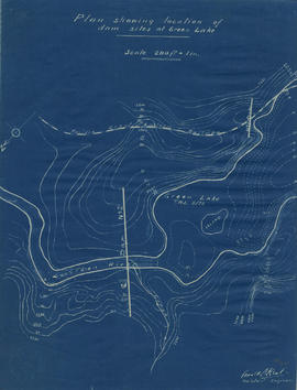
![Plan of fore bay [Nairn Falls hydro electric development]](/uploads/r/null/a/5/5/a55f94fc41cdf02e4a01434daeaf4b6c8715d61bd2a3842a95887e8c7f3371d0/29aba9ea-44a6-4453-9451-4896c8923762-MAP1099_142.jpg)


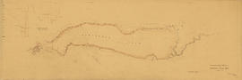
![Profile from Barnet Road [North Burnaby] to Little Mountain reservoir](/uploads/r/null/b/3/8/b38a8b88b093033460f9669a085d04a391615d053b54c9e8d7a441e99d681a7a/16d9a002-45fc-4463-b7bd-99be2a3a4182-LEG1153_142.jpg)


![[Group of people, including one nurse, in workshop]](/uploads/r/null/e/b/eb3c65f6f6575a881ac41a3849bdac75aa551c85f305902387a2e076508148e2/181e4849-686c-4529-97d2-37f43bfbc1b2-A47198_142.jpg)