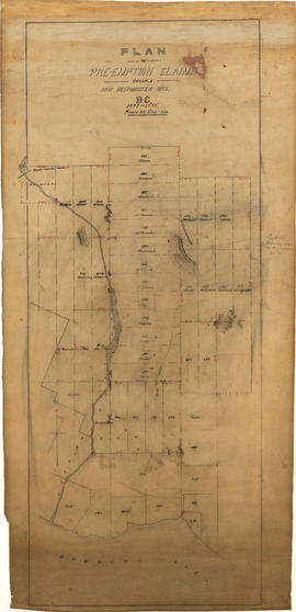
Plan of pre-emption claims, group 1, New Westminster District B.C., 1887-1888
- AM54-S13-: MAP 1043
- Item
- [1888 or after]
Part of Major Matthews collection
Item is a map depicting pre-emption claims in Group 1, New Westminster District, a section of land extending north from Burrard Inlet and including Capilano Creek. The majority of claims are numbered and/or include the owner's last name. In addition to creeks, the map also shows the location of a waterworks dam, mountains, and high hills. Pencil annotations indicate the location of "Trythall's Clearing."


![[Point Atkinson]](/uploads/r/null/9/3/9333b846a9f2e18cb82c6f379dc6a5506207848e596c6822ee72d2ba925684a0/86d8613a-04ec-474e-b189-1c254c08f47a-A19573_142.jpg)
![[Seymour Creek]](/uploads/r/null/7/8/78917a221af47115bbdcfd56655f1037f4619b963ff5d55fe028fdb0c8fb4e49/45c75741-b808-407b-aebc-3138e17bed1c-A19575_142.jpg)
![[Men in boats at B.C. Iron Works Machinists' picnic]](/uploads/r/null/f/f/ff393cc49fdb40a06dc9830757685e33398d99fd27694b60df52f678a9d2935f/7e09a8d9-2319-481c-814d-aa3d74204842-A19585_142.jpg)
![[Machinists' picnic in North Vancouver]](/uploads/r/null/4/a/4a37c33d09ec8cc2420044ef164d054972b374a4aee924da91da63a9b14524e2/84db5310-da9f-4c42-82e7-9d6958bbbdc2-A19589_142.jpg)
![[Machinists' picnic, North Vancouver]](/uploads/r/null/5/5/5500d58c75bc689e0d32892db98d2f9137e06efac26ad84c9ab6684fa802c34c/18717fa5-8c26-499b-aca0-fc89daf300d6-A19592_142.jpg)
![[Seymour Creek]](/uploads/r/null/3/2/32e56d140023fd893cd4f6147bb56413701f462d65e5dbb8442a372b8db60d7a/1a707ebe-41fc-4d68-a560-cbe4addf262a-A19552_142.jpg)
![[Seymour Creek, above canyon]](/uploads/r/null/5/b/5be3cf184af0e0d1e1e500966bedcc62c6d31c4ec6355072dd00eaa3adef7878/2c82e091-6d4a-44ab-84e1-e3d6e9a5ea3e-A19553_142.jpg)
![[Thatcher's hunting cabin, four miles up Seymour Creek]](/uploads/r/null/3/d/3dff8deed6268d57ee2c436ef33669370a6e981dd404aa56dee42228157d345a/e8733d73-f6c2-41e8-96d2-3b04f5e0d731-A19554_142.jpg)
![[Seymour Creek canyon]](/uploads/r/null/4/8/48c666e78831a3c9399eafb2dee6d42cec3ba7ccf471c910fbe6f8afafc84b8e/7f075c5f-ae4e-4c98-b104-fc7f2ee10bf6-A19555_142.jpg)
![[Seymour Creek]](/uploads/r/null/e/f/ef708acad776ca06ea04b376ff405f99c65b2aa06cf927bdd7066f4a17a2965b/a1422ccd-4e2a-4446-bd9b-542ab2202c3a-A19557_142.jpg)
![[Seymour Creek and two unidentified men]](/uploads/r/null/c/6/c6a0e837ccdb032585c6144391ecd26a00080c85419cc8f2c228ba3ae52e5b75/e95c8751-f342-482d-8d6b-e6c860e132b3-A19558_142.jpg)
![[Seymour Creek]](/uploads/r/null/d/a/da36d9a4755fd3a3b0e21f9b4c07374935baddd8d35c6674e173b0b20ba0d08f/79c53f30-f6bf-49ec-8a46-3e4dfc379d2e-A19561_142.jpg)

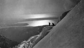


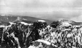


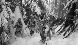
![Camel's Back [on] Mount Crown](/uploads/r/null/4/0/40e0f31ade5374029d9bd2585fc3e54956358f525db82aebed30a0a6a04bf544/f9846157-5741-4a09-8260-3dd19983177d-A22612_142.jpg)
![[Peak of] Mount Crown [and Camel's Back]](/uploads/r/null/9/f/9ffbc7fc505924a9da3547dcddfd0f7e93869a90f5ff7c0ca7f2e9bac504e758/1fad0a6f-16f1-45fa-acae-a20259ebdbac-A22613_142.jpg)

![Cornice [on] Mount Crown](/uploads/r/null/d/a/da53a041b1170fc20a9899c7c7769834da110e3443cda69d522581b7007fc63f/0b6d6b6c-b02b-48c7-9442-83efa579213c-A22614_142.jpg)