
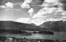
Aerial view of passenger ship entering the Narrows, Vancouver, B.C.
- AM1052-: AM1052 P-308
- Item
- [ca. 1937]
Item is a postcard printed with an image of a passenger ship entering the First Narrows of Burrard Inlet, seen from the air above Stanley Park, looking northwest. Portions of Stanley Park and West Vancouver are visible. This postcard includes personal correspondence. Sent to Mr. and Mrs. J.R. Morgan of Sedgewick Bay, Queen Charlotte Islands from Royal in Vancouver.


![[View of farm buildings and fields taken from the air]](/uploads/r/null/9/b/9b1f700b1bdee44fb2534cdd56a164987f3e8bb21e6f247ae7822623a2df94dc/7d25fb85-64f0-4eca-a154-b9f6d0bc65bf-A13721_142.jpg)
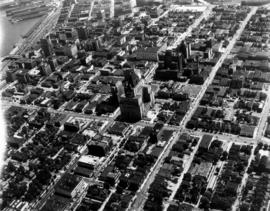
![[Aerial view of Vancouver]](/uploads/r/null/7/0/70fe55216d34bcc4ff4f671e2d7814e6d15c21dd5aaf76b58bc6469a40388a1d/c25263bf-0975-439c-bc93-248713d79567-A13722_142.jpg)
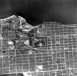
![[Aerial view of Vancouver showing the Fraser River]](/uploads/r/null/d/b/db0369bf59a848e9764e3b839c47c8ec7201f99a4017bbddd8512f47ca26200f/5ab47fec-a8ce-4ad4-a81e-ae2c39689e5a-A13723_142.jpg)
![[View of the Goodyear blimp taken from an airplane above Vancouver]](/uploads/r/null/3/3/3336881308e1e37de96b9ef201f813bbbd6e2db7aa1821f78400ef5a8deb32ff/5b651868-2938-4420-a791-777473cdb6e8-A13724_142.jpg)
![[Aerial view of Vancouver]](/uploads/r/null/d/7/d7f280a1021ddedf2aae71722e35fd9ee91a1e6d3f2e31003eed6fec146e27e7/e30c0e8a-964a-484e-90db-349ad9165b2f-A13725_142.jpg)
![[Aerial view of Vancouver]](/uploads/r/null/b/6/b61e5089ec8edb824f16eea9b4373dfb3ac9ea83b052f855a90859c3a7424f4c/c7a56b73-012c-4e6d-b4e3-c362735e3a05-A13726_142.jpg)
![[Aerial view of Vancouver showing the Goodyear blimp]](/uploads/r/null/8/e/8e555d9af3baf3296446345ad718a4b310d778d587429ac7d783ddf6d0bd1a28/11f7d743-9030-4973-aec6-c44fd5ba4e7c-A13727_142.jpg)
![[Aerial view of Vancouver showing the Goodyear blimp above the Downtown area]](/uploads/r/null/8/4/845b713451cd89bf22d1340d07a741cc7c4b68ce884237a8bf7db719fb1f8a0c/f7115108-1cb7-4a7e-b6f7-b767fbd53e1d-A13728_142.jpg)
![[Aerial view of Vancouver]](/uploads/r/null/b/4/b48d4b96f8547ec1a2bf06286a2cb6ded5510700d395242e2bcb283c884cdcc0/3730cb73-0bef-4e47-843a-9953c8d8e913-A13729_142.jpg)
![[Aerial view of Vancouver showing the Goodyear blimp]](/uploads/r/null/a/d/ad5d6048618bc821a9d06934fa1761a7e251dafba8693dc6f459758258ed169f/ffc49cb9-3d17-409a-b2a2-f9c574508d81-A13730_142.jpg)
![[Aerial view of Vancouver showing CPR piers, Coal Harbour, and Stanley Park]](/uploads/r/null/8/2/82143d16653193252b06da622f500eff3170f5e7e984e78ebfaf6f92255a4522/68bb2619-41d4-40a4-bce2-8562cad89b9e-A13731_142.jpg)
![[Aerial view of piers in Coal Harbour and part of downtown Vancouver]](/uploads/r/null/3/d/3dea4ff428030ca6b9c2fedd905fb85bdb6565d2e128563bae589050d4b0f133/2cddd923-ab3c-4a2c-be2b-fd929084db11-A13732_142.jpg)
![[Aerial view of downtown Vancouver]](/uploads/r/null/9/5/953f0d3ea8e3ecbb55e2210d94ead53f5be11ac38f8801476c6f0a576bc5953d/f265a01b-d073-47c0-99e1-e2832c475ddb-A13733_142.jpg)
![[Aerial view of Vancouver showing piers along the waterfront looking east]](/uploads/r/null/d/4/d4bb5ecff1c03cb6c58a6b9e983755d30fc68d1f35ccda97bbc0817e3cd99e96/8729b350-60b7-4857-97ca-7ce5014b9d0c-A13902_142.jpg)
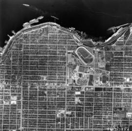
![[Aerial view of Vancouver]](/uploads/r/null/9/b/9b3acec26123edc53f11bf2f41f3286d09254ffea9918cd31b6715395ebe18d0/26473909-fe49-4474-8c3f-05eb1e8ab059-CVA1376-252_142.jpg)
![[Aerial view of fire at Vancouver sawmill]](/uploads/r/null/2/6/261c182ef20aa4aa00d0b46917096bf17c339730ec5975e81a6c1fbc2b63158f/05be5137-bdbf-42ad-a142-3e73d5538015-A71287_142.jpg)
![[R.C.A.F. Maritime Air Command plane No. 102 flying over English Bay]](/uploads/r/null/1/3/13b6c7a118ed10801cfbe633df28806771f06f62a484edbf5de83c5acd20e0a4/ff8af309-b1af-4c30-9216-ba8a2859660d-A71302_142.jpg)
![[Aerial photograph of downtown Vancouver looking north]](/uploads/r/null/2/4/24032a0f19bc217e5bb533d7218824f932301e972f1020a352118b50afcf8a93/8e2450db-6794-4283-95a6-7641bc80437d-A69847_142.jpg)
![[Aerial view of Downtown Vancouver looking south from Burrard Inlet]](/uploads/r/null/3/2/32bc12be65a895f144d669768ee019e6abc83bc4018b11b3ecf96930fbd98786/024e645a-ce5d-4e73-a4e1-efb2ad9b7995-A71518_142.jpg)
![[Aerial view of rail yard and industrial area]](/uploads/r/null/9/f/9f92989deb2b54597c6743bd67717653fc644c23b6fc48e55d2e1b9dbf6e8489/763b5a38-9eae-4b16-bedc-45ca5c32d888-A71602_142.jpg)
![[Aerial view of industrial area]](/uploads/r/null/5/d/5dd69372e15c5f349b4b4b8cdb7a12063cbbf02d158ab97d57ba863214b5c209/5f3baa69-a2f9-4adb-a590-4b420086d51d-A71604_142.jpg)


![[Aerial view looking north over] Granville Island](/uploads/r/null/8/3/83f9be0a597100103c181fa4d68c68baa4a0802471126afafea3b7850103e12b/ea9e7fb6-7465-4fa6-8fa9-18923e3d9307-A49646_142.jpg)


![[Aerial photograph of downtown Vancouver and Burrard Inlet waterfront]](/uploads/r/null/8/8/880f3eb359e4ba87a53dbb1528c9a52637f0890bd7fa1f026f2a2f8d55770b5f/07f1720e-3884-4019-874b-7ae1f538a5ea-A38733_142.jpg)