Image shows 2 storey building at 564-566 Seymour Street (Grassie Fairbanks Diamond Specialists), 4 storey building at 568-570 Seymour Street (The Quarterdeck and Genoa Yacht Sales), and 7-storey building at 574-578 Seymour Street (the Arts & Crafts Building, visible at ground level is Mr. Big'n Tall Shop).
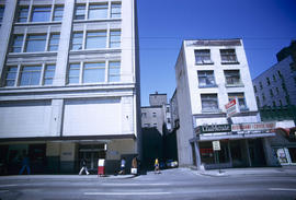
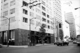
Image shows part of 2-storey brick building at 541-547 Seymour Street (at ground level Canadian Armed Forces and Maison Lawrence Coiffures) and the ground level portion of the Seymour Building (525 Seymour Street).
Image shows 3 storey brick building at 555 Seymour Street (B.C. Tel Building) and part of 2 storey federal government brick building at 541-547 Seymour Street (Canadian Armed Forces).
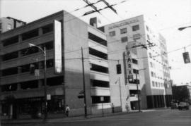
Image shows The Staperies (644 Seymour Street), Hudson's Bay Company Parkade and the following ground level businesses: Burns Leather Goods Ltd., Riviera Barbers, The Leather Place, Schiffer Photography
Image shows 4 storey building at 692-698 Seymour Street, i.e. the west side of the building (visible are Toni Cavelti and Bank of Montreal, front is Georgia Street).
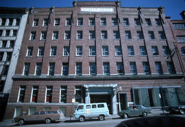
Image shows 2 storey building at 615-619 Seymour Street (Salon George and Rae-Son Shoe Rack) and 6 storey brick building, the St. Regis Hotel (address on Dunsmuir Street).
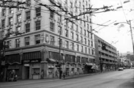
Image shows a portion of the east side of the Hudson's Bay Company Building and the building at 631 Seymour Street including the Clubhouse Restaurant & Coffee Shop.
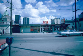
Image shows a 1 storey commercial building at 803-819 Thurlow Street (Archer Realty Ltd., House of Denmark, Big Iron Cleanersand Busy Bee Flower Shop and Market)
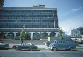
Image shows left side of B.C. Government office building (411 Dunsmuir Street), the alley, and some of the parking lot at Dunsmuir Street & Homer Street. In the distance are the sides of the Kingsley Hotel and the Marble Arch Hotel.
Image shows portion of B.C. Government office building (411 Dunsmuir Street), the parking lot at Dunsmuir Street & Homer Street. In the distance are the sides of the Kingsley Hotel and the Marble Arch Hotel.
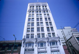
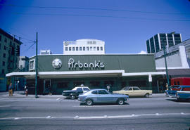
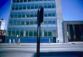
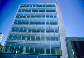
Series consists of images which systematically and comprehensively document the whole of Vancouver's central commercial area, along the waterfront from Cardero to Carrall, narrowing southward to False Creek (Thurlow to Richards at the southernmost point). Photographed in August 1981 (as an internship or work experience project) to provide a reference resource in the preparation for the Vancouver Coreplan. Images are generally 45 degree views of buildings, often from block corners. Arranged in a devised image block numbering scheme (individual image numbers reflect that organization).