Civic improvements during 1952
Add to clipboard
Civic improvements during 1952
Planning Canada's national capital : [an introduction to the National Capital Plan]
Add to clipboard
Planning Canada's national capital : [an introduction to the National Capital Plan]
Simon Fraser Townsite Master Plan prepared ... for the Corporation of the District of Burnaby, The City of Vancouver, Simon Fraser University, Webb & Knapp (Canada) Ltd.
Add to clipboard
Simon Fraser Townsite Master Plan prepared ... for the Corporation of the District of Burnaby, The City of Vancouver, Simon Fraser University, Webb & Knapp (Canada) Ltd.
Zoning and development by-law no. 3575 : effective June 18, 1956 (amended up to and including bylaw no. 3865), dated August 2, 1960, consolidated for convenience only
Add to clipboard
Zoning and development by-law no. 3575 : effective June 18, 1956 (amended up to and including bylaw no. 3865), dated August 2, 1960, consolidated for convenience only
A plan for the city of Vancouver, British Columbia, including Point Grey and South Vancouver and a general plan of the region 1928.
Add to clipboard
A plan for the city of Vancouver, British Columbia, including Point Grey and South Vancouver and a general plan of the region 1928.
Project 200 : Vancouver waterfront development : rezoning submission
Add to clipboard
Project 200 : Vancouver waterfront development : rezoning submission
Vancouver Tomorrow: a search for greatness
Add to clipboard
Vancouver Tomorrow: a search for greatness
An appraisal for the City of Vancouver of transportation systems and routes connecting the Brockton Point crossing to Provincial highways 401 and 499
Add to clipboard
An appraisal for the City of Vancouver of transportation systems and routes connecting the Brockton Point crossing to Provincial highways 401 and 499
Official regional plan of the Lower Mainland Regional Planning Board, the Municipalities of the region, and the Province of British Columbia for the Lower mainland planning area
Add to clipboard
Official regional plan of the Lower Mainland Regional Planning Board, the Municipalities of the region, and the Province of British Columbia for the Lower mainland planning area
Official regional plan schedules
Add to clipboard
Official regional plan schedules
A plan for the city of Vancouver, British Columbia, including Point Grey and South Vancouver and a general plan of the region 1929.
Add to clipboard
A plan for the city of Vancouver, British Columbia, including Point Grey and South Vancouver and a general plan of the region 1929.
A plan for the city of Vancouver, British Columbia, including Point Grey and South Vancouver and a general plan of the region 1928.
Add to clipboard
A plan for the city of Vancouver, British Columbia, including Point Grey and South Vancouver and a general plan of the region 1928.
Proposed redevelopment strategies for Granville Island : an extension to the False Creek studies
Add to clipboard
Proposed redevelopment strategies for Granville Island : an extension to the False Creek studies
City Magazine : February-March 1975 : vol. 1 : no. 3
Add to clipboard
City Magazine : February-March 1975 : vol. 1 : no. 3
City Magazine : June 1977 : vol. 2 : no. 8
Add to clipboard
City Magazine : June 1977 : vol. 2 : no. 8
City Magazine : March 1977 : vol. 2 : no. 7
Add to clipboard
City Magazine : March 1977 : vol. 2 : no. 7
City Magazine : January-February 1976: vol. 1 : no. 8
Add to clipboard
City Magazine : January-February 1976: vol. 1 : no. 8
City Magazine : August-September 1975: vol. 1 : nos. 5 and 6 : double issue
Add to clipboard
City Magazine : August-September 1975: vol. 1 : nos. 5 and 6 : double issue
Strathcona area rehabilitation project : interim report
Add to clipboard
Strathcona area rehabilitation project : interim report
The Vancouver Achievement : Urban Planning and Design
Add to clipboard
The Vancouver Achievement : Urban Planning and Design
Vancouver's urban design : a decade of achievements.
Add to clipboard
Vancouver's urban design : a decade of achievements.
Vancouver, B.C. : zoning diagram
Add to clipboard
Vancouver, B.C. : zoning diagram
Project no. 2 - Maps
Add to clipboard
Project no. 2 - Maps
Sectional map of Vancouver showing streets, block and lot outlines, and building perimeters
Add to clipboard
Sectional map of Vancouver showing streets, block and lot outlines, and building perimeters
Add to clipboard
Vancouver, British Columbia
Add to clipboard
Legend [for colour coding land use]
Add to clipboard
A student to-day, a citizen tomorrow
Add to clipboard
Vancouver - the third largest city of the dominion, and Canada's chief Pacific port
Add to clipboard
City of Vancouver, British Columbia : zoning diagram
Add to clipboard
Map of City of Vancouver, British Columbia
Add to clipboard
Properties from Victoria Drive to Nanaimo Street and Burrard Inlet to Triumph Street
Add to clipboard
Vancouver British Columbia. Major street plan
Add to clipboard
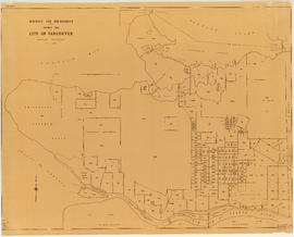
Map showing City of Vancouver, British Columbia [index map]
Add to clipboard
Plan of District Lot boundaries. City of Vancouver, B.C.
Add to clipboard
Plan of government subdivision at Point Grey, B.C.
Add to clipboard
City of Vancouver, British Columbia
Add to clipboard
The official street name map of the City of Vancouver
Add to clipboard
Proposed system of drainage and sewerage for False Creek and marginal areas
Add to clipboard
District lot boundaries within the City of Vancouver
Add to clipboard
Plan of Cambie St. grounds
Add to clipboard
Proposed development of Vancouver City Yard, 49th Avenue at Ross Street, South Vancouver
Add to clipboard
Proposed zoning : comprehensive redevelopment areas
Add to clipboard
Key map showing proposed areas for partial and comprehensive redevelopment
Add to clipboard
Plan showing parcels 'A', 'B' & 'C' : Kitsilano Indian Reserve, No. 6 of the Squamish band, Vancouver, B.C.
Add to clipboard
Plan to accompany report on proposed bridge at Marpole across North Arm of Fraser River
Add to clipboard
Interim harbour headline
Add to clipboard
City of Vancouver : land use 1984
Add to clipboard
Official Regional Plan : proposed amendments within the City of Vancouver
Add to clipboard
North-East Burnaby Study, revised Simon Fraser townsite plan : 1967 City of Vancouver alternative proposals
Add to clipboard
Area bounded by Kaslo St., 14th Ave., Renfrew St. and 18th Ave. : lands affected by proposed filling of Still Creek

![Legend [for colour coding land use]](/uploads/r/null/3/1/2/3120f4f71566883ae774f5f08ae6795bc55fcd40d9f4bdd29f8f25dc782e0a9f/89bc7dbc-376d-43ba-bc88-a0fda629d99a-LEG1153_142.jpg)


![Map showing City of Vancouver, British Columbia [index map]](/uploads/r/null/a/f/b/afbf0b3832ff37e3af2c10d63547517135bca50be83ddddfcd25914b3c7b8f1d/6903af1e-3c6e-4577-9c0a-0967550524a7-LEG1153_142.jpg)