Pacific Highway at Serpentine River incoming
- AM54-S4-1---: CVA 20-6
- Item
- 1931
Part of Major Matthews collection
Photograph shows two Ruddy-Duker Company billboarda advertising spark plugs and oil filters, and David Spencers and a sign on a barn advertising Vancouver Motors Ltd.


![Kingsway and Gilley [Avenue on] south side city outgoing](/uploads/r/null/1/6/16e55cf4106ddd65d99af715a0b8d81aa0419d5ebb0aedb31cc851c3fe99e5ae/a588197a-2628-46dc-8412-a31280de51ea-A20215_142.jpg)
![Kingsway and Waltham [Avenue] south side city incoming](/uploads/r/null/f/1/f1b3b42070a4d97b7f7d7256dbae7adb60d90959c4890c382517485ceb0a2d1b/558d0b72-d0af-45d9-bada-9e5891580ee0-A20216_142.jpg)
![Kingsway and Patterson [Avenue] north side city incoming](/uploads/r/null/e/6/e678bb1c1123bceee7a2229e7d614ae2a44ca3c745c3c97f56e58bd9969b4751/94404ba7-83dc-45fb-80af-2e8b0a58782f-A20218_142.jpg)
![Kingsway and Tyne [Street] south side city outgoing](/uploads/r/null/0/b/0bf39b6b460082650afaf68e6054c37bc2ecbb77845e617d1ab767cf73c28d18/a69f846a-682e-426e-b004-1f9fe36aca0f-A20221_142.jpg)


![[Vancouver from Mount Pleasant]](/uploads/r/null/2/3/23e8640b2925830ea0753e97d4919c0e7e1e7fa630d8293896a6f5ffbf243cbb/faf31b60-1ab8-4eaf-bca7-34193b1b7d99-A20087_142.jpg)

![[View of Mount Rundle]](/uploads/r/null/8/1/81f97b7997616a50b7b33d49f4d388c09e5c92a0b31dfbf9cf2e3a5d30436d48/dc4863f2-fb29-4402-80c2-244c58699767-A20157_142.jpg)


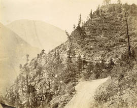
![China Bar Bluff - 28 miles above Yale on the Frazer [Fraser] River](/uploads/r/null/e/9/e9834f1ddcca28563493687bbfecb9567f9ba986b5c202f487df6365406543dc/a92c2367-8f8d-4de3-bbe6-978a47016230-A22918_142.jpg)
![[A waterfront settlement on Ladner Road near New Westminster]](/uploads/r/null/a/8/a8305e7e0c6a4ef2a4bea008bb865269b5263288137581bf21d79e72f1c36ccd/4c575fbf-d2ce-4159-95c7-8202db5c0a8b-A26748_142.jpg)
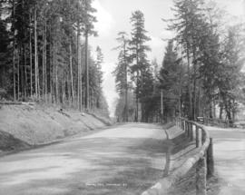
![[A road through the trees]](/uploads/r/null/a/8/a8dc303fc5efd4327a4f27ea1e7d0b4644ff7564613216ac85c71bb1f268e2db/bab5fe3e-6c6d-40d8-ad33-3b0c46a4b5e9-A71824_142.jpg)
![[A road through the trees]](/uploads/r/null/8/6/86a98c83dc0deae200e0699ac7ed13319a2f39af0608b3b673be27042ce6edc0/22ed0950-451b-4d94-bee3-5771f97e900a-A71860_142.jpg)
![[A woman and girl on a road]](/uploads/r/null/4/3/43160757588168ed5b8d6a26c5ef6f7f1ea3828239dc0b928c4776178231a070/a17dc457-3628-4af4-8b18-f2796226e833-A71858_142.jpg)
![[A road through the trees]](/uploads/r/null/4/9/49a0533aa1b0d0c3a043de6f0aae9f3671d76f1ca1f1f9dee1c0efd8bd1dc64a/0acb5208-16e3-44a1-b63c-97b6db32874c-A71821_142.jpg)
![[A road through the trees]](/uploads/r/null/4/7/475b5fc2136ff79ccff658d80b3ef20d372db77682d425ef80b1158731638e86/ee2823cd-8eb4-4207-99a7-6402968f7f05-A71814_142.jpg)
![[A road through the brush]](/uploads/r/null/7/f/7fef34c772c7b1819cbf1890e835c21e01423169a4c0f48c2670ac7f5b485e5b/7b4e1fd8-fa76-4530-b712-93556a322e1b-A71853_142.jpg)
![[A road along the water]](/uploads/r/null/8/b/8bda648dec729735276052bf31f8c82c5b00783b39f4a9be1f9a934a2ba5c9ad/58805ca0-2871-4e18-9890-1da9bb5c21c0-A71856_142.jpg)
![[A road along the water]](/uploads/r/null/0/d/0d02f208f334aba3a5b30228f76f45a560c84c4cb64050a0a1309fc420cf3a39/7398235f-b04b-454d-b524-f95c00a94ae7-A71847_142.jpg)
![[A road along the water]](/uploads/r/null/9/4/949a662282337f2d3e301f1176a61a346123403f9245e2cd11160b929cdbd4b9/8a715af7-e419-4cea-b5b9-a9a2d92f097a-A71845_142.jpg)
![[A road along the water]](/uploads/r/null/3/4/34587632d5787831242dc4f9b9e16f794ead6bf125039fa65e1522c120e86c89/0c1c8cf8-d460-4795-af00-bc228e23aa12-A71838_142.jpg)
![[A road through the trees]](/uploads/r/null/9/9/9901cf9e571e19770db9535afe9998776a46d2ca6674440cb77c5344979a2064/c71a9532-6ab0-496c-8134-be9943075416-A71864_142.jpg)
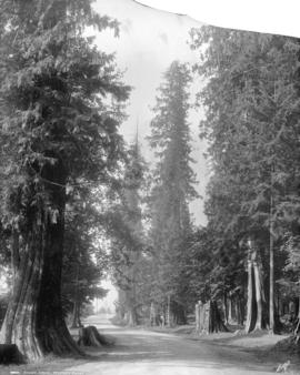
![Vancouver [showing a driveway in Stanley Park]](/uploads/r/null/8/b/8b440c321b4434978cf57cd1089aaac6e7838ca34d7f9b894ae8e5617daca676/0fd94afd-9303-404a-b4b1-bd654dee5c2f-A72270_142.jpg)
![[Kitsilano Point from the balcony of 1982 Ogden Street]](/uploads/r/null/2/e/2ef4ec9f7c6ef7034a5bc5cb5e8fb36a1c892fe1a31c0724f1ea05efd779ee5b/e1f9393e-d4f8-4a2d-9792-f45b2ab33449-A71780_142.jpg)
![[Kitsilano Point from the balcony of 1982 Ogden Street]](/uploads/r/null/9/9/99fde0a90886076f65828dd841c926d91ba635f8feeb587cf4127f77d4c0ff2a/dffdd345-86f3-4baa-bd78-e72dba1c56c6-A71779_142.jpg)
![[Dog on rough plank road through forest]](/uploads/r/null/c/a/ca9cfb69eb4740ae837091685d4dea76ad4062281f10c35af637bda56414a0c5/22caf2c8-af6f-4170-bde8-940043afa09c-A04823_142.jpg)

![View [of] James Bay from Cathedral](/uploads/r/null/f/8/f8a9026b503bc411a11c5923bd34ed706cb7b09fa74b0c113690f17ea694da97/f8b38478-de71-4f6f-a240-a1bfcbbc9e7e-A19772_142.jpg)