Print preview Close

Showing 1835 results

Archival description
City of Vancouver Archives technical and cartographic drawing collection
Print preview View:

1440 results with digital objects Show results with digital objects

Map of the Fraser Valley

Item is a map depicting the entire Greater Vancouver area, from the University of British Columbia campus east to Hope and Chilliwack Lake, south to the international border. Detail other than major roads and municipal boundaries is included for the Fraser Valley municipalities only and includes: municipal boundaries, major roads, railway and streetcar lines, bridges, and ferries.

[False Creek basin]

Item is a map of the False Creek basin and surrounding areas, from Granville Street north of False Creek and Fir Street to the west, Main Street to the east, Davie Street to the north and West 6th Avenue to the south. The map notes legal and descriptions of properties in the area depicted.

Vancouver (B.C.). Engineering Services

Vancouver Harbour [nautical charts]

File consists of three published nautical charts which, collectively, map the entirety of Vancouver Harbour from Point Grey to Port Moody and the southern portions of Indian Arm.

The charts depict shorelines and shoreline development, sounding, underwater cables and pipes, shoals and other impediments to navigation, signals and beacons, land-based transportation infrastructure such as bridges and rail lines, tidal marshes, offshore anchorages and currents.

Powell Lake

Item is a map of southwestern British Columbia from Bute Inlet to Alta Lake and Chilko Lake to northern Gabriola Island showing Crown granted land, surveyed timber leases and licenses, Indian Reserves, government reserves, land district and park boundaries, nautical distances, municipalities, cities and villages, telegraph and telephone lines, pipelines, railways, government agents' offices, mining and sub-mining recording offices, post offices, lighthouses, roads, and elevations of geographical features.

Canadian Pacific Railway. Plan of part of branch line from Port Moody. A point on main line C.P.R. to English Bay, B.C.

Map shows a survey conducted by the Canadian Pacific Railway of English Bay, Burrard Inlet and Coal Harbour, including a rough outline of area and lots. Note on map reads "Certified as a correct plan showing the land required for right of way Burrard Inlet B.C., February 22, 1886. H.J. Cambie, Engineer in Charge." Map is certified as correct and signed by various C.P.R. officials, including W.C. Van Horne.

Plan of the City of Vancouver [BC] Western Terminus of the Canadian Pacific Railway

The map shows the city of Vancouver in 1886. The map displays the CPR Railway tracks throughout Vancouver. The bodies of water - False Creek, Burrard Inlet, and Coal Harbour - are emphasized with approximately 5cm of blue pencil outlining the bodies of water. Additionally, streets, parks, and residential lots are also depicted.
The Northernmost point on the map is the Indian Reserve and the intersection of Capilano River and the First Narrows river, and the Southernmost point is the Due West City Boundary (listed at N 89 05 W). The Easternmost is the City Boundary for the townside of Hastings (listed at 55? E) and the Westernmost road on the map is Campbell Street.
A detailed compass, in the middle of the map, shows Astronomic North.

Scarborough's New Map of British Columbia

Map of British Columbia shows railways, steamship lines, cities, and villages. The map has a detailed inset of Northern British Columbia. The map also has an index of cities, villages, post offices, and station with populations from 1911 Canadian Census. Note on tube: 7F Map of B.C.

The westernmost identifiable point on the map is Graham Island and the easternmost city is Calgary, while the northernmost is Cleveland Peninsula, and the southernmost is the Juan de Fuca Strait.

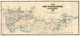
Map of New Westminster District

Item is a commercially printed map depicting the New Westminster Land District, bounded by the Gulf of Georgia in the west, the international border in the south, range 26 of townships 1 to 4 of the Yale District in the east, and the southern half of township 6 in the north.

The map depicts townships and ranges, and district lots in incorporated areas. The map also depict Dominion Timber Berths and various types of land reserves.

Panoramic view of the City of Vancouver, British Columbia, 1898

Item is a map showing an oblique aerial eye view of Vancouver, including Burrard Inlet, Upper False Creek Flats and False Creek. Streets, buildings and businesses are identified. Inset shows location of the Vancouver City foundry, Machine Works and Sugar Refinery. The map includes pictorial representations of buildings, industrial activity around Burrard Inlet, watercraft and vegetation. The perspective view of the map is to the south/south-east.

The map was originally included as a supplement to the Daily World newspaper.

Commercial Map of Greater Vancouver and District [BC]

The map shows the Greater Vancouver Area and its roads, streets, and residential, commercial, and industrial districts in July 1924. In accordance with the legend, the map shows railroads, electric railways, parks, and buildings. The map uniquely depicts the center of Vancouver which is approximately 5400 feet and spans from Water and Railway Street to Prior Street and Abbott Street to Princess Street. The center circle then concentrically expands outwards with other circles marking every mile outward.
Additionally, there are annotations in black, red, yellow, and green. The black annotations mark topography and contour lines with listed elevations. The red annotations mark water gauges. The yellow annotations indicate the best routes through the City and District as suggested by the Automobile Club of BC. The green annotations appear for an unknown reason.
The Westernmost road on the map is Marine Drive and the Easternmost is Columbia Street and North Road while the Northernmost road on the map is Dempsey St. in North Vancouver and the Southernmost point is No. 20 Road.

Commercial map of Greater Vancouver and district [planning]

Item is a printed map of greater Vancouver which has been used as a base map. The base map appears to be the 1929 version of the Commercial Map of Greater Vancouver and District. On this has been added pasted on pictures, arrows and other material that appears to be related to planning activities of some kind.

Map of Vancouver British Columbia

The map of Vancouver shows streets, bus routes, railways, and postal block numbers. The map?s buildings are quite detailed, and it includes depictions of fire halls, libraries, hospitals, and schools. Red and green annotations show the divisional boundaries of wards and polling stations. One mile circles radiate from City Hall. A Street Index appears at the bottom of the map, and this gives the coordinates of different roads.

The westernmost identifiable point on the map is Marine Drive and the easternmost road is Boundary Road while the northernmost is Stanley Park, and the southernmost is Sea Island and Lulu Island.

Commercial Map of Greater Vancouver and District [BC]

Commercial map of Greater Vancouver and District depicts railroads, paved streets, streetcar stops, schools, buildings. Uniquely, the map shows the city divided by Postal Block numbers and half mile circles that radiate from City Hall on the corner of Main and Hastings.
The map has large red arrows and clippings of libraries pasted to it that show six proposed library locations and sketch plans. Also included on the map, is an index of all depicted roads in the Hastings, Point Grey, South Vancouver, and Burnaby areas. A legend and compass rose are located in the bottom left hand corner of the map.
The westernmost is road on the map is Marine Drive and the easternmost is North Road while the northernmost is Dempsey Street, and the southernmost is 20th Road.

Commercial Map of Greater Vancouver and District [BC]

The map shows the Greater Vancouver district, Point Grey, West Vancouver, North Vancouver, South Vancouver, and Burnaby - in 1886. In correspondence, the legend and map display railroads, paved streets, schools, and buildings. Uniquely, the map shows the city divided by Postal Block numbers and half mile circles that radiate from City Hall on the corner of Main and Hastings. The Westernmost road on the map is Marine Drive and the easternmost is Columbia Street. Northernmost road on the map is Dempsey Street, and the Southernmost point is No. 20 Road.

A detailed compass, in the bottom left hand corner of the map, shows Magnetic North. The annotation M.49 appears in the bottom right hand corner and the top left hand corner of the map. Two copies of the map are available, one a blue line the other a linen copy.

Map of New Westminster District, B.C

Item is a map showing District Lots in Vancouver, and township/range designations in other areas. The map also shows False Creek Trail, North Arm Road, False Creek Road, Granville Road from Granville to Hastings, New Westminster and Burrard Inlet Road, North Road, Semiahmoo Road, New Westminster and Yale Wagon Road, and others. Annotated by W. E. Graveley, 1885, to show additional features including Kingsway, Haney, Albion Camp, etc.

Stuart's pocket map of Vancouver, B.C.

Item is an illustrated map of the "old" City of Vancouver. The map shows streets, transportation, and significant businesses (such as C.P.R. wharves, smelter, Hastings Mill, Morse's Mill, C.P.R. Shops, City Hospital, sawmill, slaughter houses, and smallpox hospital). The map includes "Index of Streets, Government Offices, Churches, [etc.], including "Civic and other Principal Buildings", "Places of Amusement or Recreation", "Public Schools", "Principal Mills, Foundries and Manufactories", "Principle Bankers", Principal Hotels", and "Miscellaneous".

The map was designed to be folded into a cover, which is included.

City of Vancouver British Columbia

The map is a positive blueprint of the City of Vancouver with boundaries, streets block numbers & the harbour headline. A detailed compass appears in the top left corner of the map. The legend is also in the top left hand corner depicting City boundaries, Harbour headlines, Postal Blocks, and street numbers. There is a copy of the Map included, Map 71B, and it includes the Geographic Census Tracts.

The westernmost identifiable point on the map is the Straight of Georgia, and the easternmost is Boundary Road. The northernmost point on the map is the Stanley Park, the southernmost is Sea Island and Twiggs Island.

Map of Vancouver Unemployment and Relief [BC]

The map shows relief and elevations of Vancouver. It depicts streets, parks, and railways, and residential and industrial areas.
The annotations in black ink trace parts of the map: names, railways, and the coast line. The amendments also show Cases and Persons of Domiciled Residents in the Vancouver Area, in May 1934. The map also lists statistics of approximate Cases and Persons of Transient Families and Single Women, and Single Homeless Men.
Pensions and Compensation statistics are also compiled for: Mothers Pensions, Old Age Pensions, War Pensions, amd Workmen's Compensation as of the population of Vancouver in 1931.
The westernmost boundary of the map is Boundary Road and the easternmost boundary is the University of British Columbia while the northernmost is the Burrard Inlet and the southernmost is Sea Island and Lulu Island.

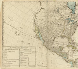
Top left plate

Part is the top left hand quadrant of a map of the Americas, and depicts North America and the north-west portion of South America. The sheet also includes a list of territories and islands in North America and appears to relate to territorial divisions as a result of the Treaty of Paris and the Treaty of Versailles (1783).

Bottom right plate

Part depicts the right-hand side of a map of the lunar surface viewable from Earth, a chart of the Analemma, a chart and accompanying text entitled "the vicissitude of seasons explained", a chart and accompanying text on "the art of dialing by a common globe", and a map of the southern portion of Africa and Asia, as well as Australia.

Dunn, Samuel

Bottom left plate

Part depicts text and accompanying diagram on "the art of dialing by a common globe", a chart of universal scale, a map of the world using Mercator's projection, a map of the southern half of the Americans, descriptions of the various maps and charts, and the left-hand side of a map of the lunar surface viewable from Earth.

Dunn, Samuel

Top right plate

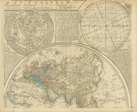
Part depicts a chart of the astronomical latitude & longitude analemma, a table showing values of the place of the sun in the ecliptic & declinatiobn, a chart of the constellations viewable in the southern hemisphere, text on geographical definitions and the cause of the tides, and a map of the northern portion of Africa, Europe and Asia.

Dunn, Samuel

Top left plate

Part depicts the upper left hand quadrant of the map, and includes a diagram of the solar system, a table of dimensions of bodies in the solar system, a chart of constellations viewable in the northern hemisphere, text on geographical definiations and the cause of the tides, and a map of the northern half of the Americas.

Dunn, Samuel

Scientia terrarum et coelorum

Item is a combination terrestrial and astronomical map, with the earth depicted as the eastern and western hemispheres, with corresponding astronomical hemispheres. The map depicts broders of states, geographical features, cities, routes of prominent voyages. The map is bordered with smaller inset maps of the solar system, the north pole, the south pole, analemma, the moon, and a world map in Mercator's projection.

Dunn, Samuel

Plan of Greater Vancouver, British Columbia

Item is a map of Greater Vancouver from Alma Road (Alma Street) to Boundary Road and Burrard Inlet to King Edward Avenue. Map shows district lot, block, and lot numbers, waterfront businesses, rail lines, schools, parks, beaches, and concentric circles indicating distances from a point located approximately at the intersection of Cambie and Hastings Streets.

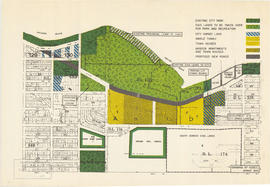
Redevelopment plan for Jericho Department of National Defence lands

Item is a map showing proposed redevelopment of portions of former Department of National Defence lands in the Jericho area. The map shows existing city parks, D.N.D. lands to be taken over for parks and recreation, city owned land, single family land, town houses, garden apartments and town houses and proposed new roads. The map appears to have been removed from a report.

Vancouver (B.C.). Engineering Services

Results 101 to 150 of 1835