Showing 106 results

Archival description
Vancouver (B.C.). Planning Department With digital objects
Print preview View:

Taken from Chilco and Nelson streets looking towards English Bay

Item consists of a photograph depicting a model created by Planning Department staff to study view obstructions which result from various building configurations, based on different options to be included in zoning regulations for the West End.

Vancouver (B.C.). Planning Department

Taken from Comox and Bidwell streets looking towards English Bay

Item consists of a photograph depicting a model created by Planning Department staff to study view obstructions which result from various building configurations, based on different options to be included in zoning regulations for the West End.

Vancouver (B.C.). Planning Department
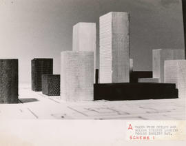
Taken from Comox and Bidwell streets looking towards English Bay

Item consists of a photograph depicting a model created by Planning Department staff to study view obstructions which result from various building configurations, based on different options to be included in zoning regulations for the West End.

Vancouver (B.C.). Planning Department
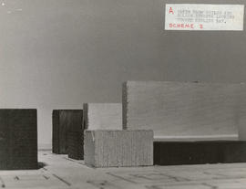
Taken from Comox and Nicola streets looking towards English Bay

Item consists of a photograph depicting a model created by Planning Department staff to study view obstructions which result from various building configurations, based on different options to be included in zoning regulations for the West End.

Vancouver (B.C.). Planning Department

Taken from Comox and Nicola streets looking towards English Bay

Item consists of a photograph depicting a model created by Planning Department staff to study view obstructions which result from various building configurations, based on different options to be included in zoning regulations for the West End.

Vancouver (B.C.). Planning Department

Open Data Catalogue : census local area profiles 2001 : April 2016

File consists of datasets provided by Statistics Canada from the 2001 Census as a custom profile data order for the City of Vancouver, using the City's 22 local planning areas. Datasets contain demographic information by local area. File also contains Open Data Catalogue html pages that described the datasets; pages include data attributes and data accuracy and currency information. Datasets are as they appeared on April 1, 2016.

Vancouver (B.C.). Planning Department
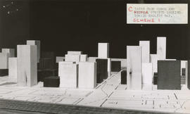
Open Data Catalogue : census local area profiles 2006 : April 2016

File consists of datasets provided by Statistics Canada from the 2006 Census as a custom profile data order for the City of Vancouver, using the City's 22 local planning areas. Datasets contain demographic information by local area. File also contains Open Data Catalogue html pages that described the datasets; pages include data attributes and data accuracy and currency information. Datasets are as they appeared on April 1, 2016.

Vancouver (B.C.). Planning Department

Open Data Catalogue : census local area profiles 2011 : April 2016

File consists of datasets provided by Statistics Canada from the 2011 Census as a custom profile data order for the City of Vancouver, using the City's 22 local planning areas. Datasets contain demographic information by local area. File also contains Open Data Catalogue html pages that described the datasets; pages include data attributes and data accuracy and currency information. Datasets are as they appeared on April 1, 2016.

Vancouver (B.C.). Planning Department

Open Data Catalogue : heritage property data : April 2016

File consists of datasets containing information on properties or sites given heritage status or recognition. File also contains Open Data Catalogue html pages that described the datasets; pages include data attributes and data accuracy and currency information. Datasets are as they appeared on April 1, 2016.

Vancouver (B.C.). Planning Department

Open Data Catalogue : local area boundary : April 2016

File consists of datasets showing boundaries of Vancouver's 22 local areas, also known as local planning areas. File also contains Open Data Catalogue html page that described the datasets; page includes data attributes and data accuracy and currency information. Datasets are as they appeared on April 1, 2016.

Vancouver (B.C.). Information Technology Department

Open Data Catalogue : census local area profiles 2001 : January 2016

File consists of datasets provided by Statistics Canada from the 2001 Census as a custom profile data order for the City of Vancouver, using the City's 22 local planning areas. Datasets contain demographic information by local area. File also contains Open Data Catalogue html pages that described the datasets; pages include data attributes and data accuracy and currency information. Datasets are as they appeared on January 20, 2016.

Vancouver (B.C.). Planning Department

Open Data Catalogue : census local area profiles 2006 : January 2016

File consists of datasets provided by Statistics Canada from the 2006 Census as a custom profile data order for the City of Vancouver, using the City's 22 local planning areas. Datasets contain demographic information by local area. File also contains Open Data Catalogue html pages that described the datasets; pages include data attributes and data accuracy and currency information. Datasets are as they appeared on January 20, 2016.

Vancouver (B.C.). Planning Department

Open Data Catalogue : census local area profiles 2011 : January 2016

File consists of datasets provided by Statistics Canada from the 2011 Census as a custom profile data order for the City of Vancouver, using the City's 22 local planning areas. Datasets contain demographic information by local area. File also contains Open Data Catalogue html pages that described the datasets; pages include data attributes and data accuracy and currency information. Datasets are as they appeared on January 20, 2016.

Vancouver (B.C.). Planning Department

Open Data Catalogue : heritage property data : January 2016

File consists of datasets containing information on properties or sites given heritage status or recognition. File also contains Open Data Catalogue html pages that described the datasets; pages include data attributes and data accuracy and currency information. Datasets are as they appeared on January 20, 2016.

Vancouver (B.C.). Planning Department

Open Data Catalogue : local area boundary : January 2016

File consists of datasets showing boundaries of Vancouver's 22 local areas, also known as local planning areas. File also contains Open Data Catalogue html page that described the datasets; page includes data attributes and data accuracy and currency information. Datasets are as they appeared on January 20, 2016.

Vancouver (B.C.). Information Technology Department

Open Data Catalogue : census local area profiles 2001 : October 2015

File consists of datasets provided by Statistics Canada from the 2001 Census as a custom profile data order for the City of Vancouver, using the City's 22 local planning areas. Datasets contain demographic information by local area. File also contains Open Data Catalogue html pages that described the datasets; pages include data attributes and data accuracy and currency information. Datasets are as they appeared on October 6, 2015.

Vancouver (B.C.). Planning Department

Open Data Catalogue : census local area profiles 2006 : October 2015

File consists of datasets provided by Statistics Canada from the 2006 Census as a custom profile data order for the City of Vancouver, using the City's 22 local planning areas. Datasets contain demographic information by local area. File also contains Open Data Catalogue html pages that described the datasets; pages include data attributes and data accuracy and currency information. Datasets are as they appeared on October 6, 2015.

Vancouver (B.C.). Planning Department

Open Data Catalogue : census local area profiles 2011 : October 2015

File consists of datasets provided by Statistics Canada from the 2011 Census as a custom profile data order for the City of Vancouver, using the City's 22 local planning areas. Datasets contain demographic information by local area. File also contains Open Data Catalogue html pages that described the datasets; pages include data attributes and data accuracy and currency information. Datasets are as they appeared on October 6, 2015.

Vancouver (B.C.). Planning Department

Open Data Catalogue : heritage property data : October 2015

File consists of datasets containing information on properties or sites given heritage status or recognition. File also contains Open Data Catalogue html pages that described the datasets; pages include data attributes and data accuracy and currency information. Datasets are as they appeared on October 6, 2015.

Vancouver (B.C.). Planning Department

Open Data Catalogue : local area boundary : October 2015

File consists of datasets showing boundaries of Vancouver's 22 local areas, also known as local planning areas. File also contains Open Data Catalogue html page that described the datasets; page includes data attributes and data accuracy and currency information. Datasets are as they appeared on October 6, 2015.

Vancouver (B.C.). Information Technology Department

Open Data Catalogue : census local area profiles 2001 : July 2015

File consists of datasets provided by Statistics Canada from the 2001 Census as a custom profile data order for the City of Vancouver, using the City's 22 local planning areas. Datasets contain demographic information by local area. File also contains Open Data Catalogue html pages that described the datasets; pages include data attributes and data accuracy and currency information. Datasets are as they appeared on July 7, 2015.

Vancouver (B.C.). Planning Department

Open Data Catalogue : census local area profiles 2006 : July 2015

File consists of datasets provided by Statistics Canada from the 2006 Census as a custom profile data order for the City of Vancouver, using the City's 22 local planning areas. Datasets contain demographic information by local area. File also contains Open Data Catalogue html pages that described the datasets; pages include data attributes and data accuracy and currency information. Datasets are as they appeared on July 7, 2015.

Vancouver (B.C.). Planning Department

Open Data Catalogue : census local area profiles 2011 : July 2015

File consists of datasets provided by Statistics Canada from the 2011 Census as a custom profile data order for the City of Vancouver, using the City's 22 local planning areas. Datasets contain demographic information by local area. File also contains Open Data Catalogue html pages that described the datasets; pages include data attributes and data accuracy and currency information. Datasets are as they appeared on July 7, 2015.

Vancouver (B.C.). Planning Department

Open Data Catalogue : heritage property data : July 2015

File consists of datasets containing information on properties or sites given heritage status or recognition. File also contains Open Data Catalogue html pages that described the datasets; pages include data attributes and data accuracy and currency information. Datasets are as they appeared on July 7, 2015.

Vancouver (B.C.). Planning Department

Open Data Catalogue : local area boundary : July 2015

File consists of datasets showing boundaries of Vancouver's 22 local areas, also known as local planning areas. File also contains Open Data Catalogue html page that described the datasets; page includes data attributes and data accuracy and currency information. Datasets are as they appeared on July 7, 2015.

Vancouver (B.C.). Information Technology Department

Open Data Catalogue : census local area profiles 2001 : April 2015

File consists of datasets provided by Statistics Canada from the 2001 Census as a custom profile data order for the City of Vancouver, using the City's 22 local planning areas. Datasets contain demographic information by local area. File also contains Open Data Catalogue html pages that described the datasets; pages include data attributes and data accuracy and currency information. Datasets are as they appeared on April 1, 2015.

Vancouver (B.C.). Planning Department

Open Data Catalogue : census local area profiles 2006 : April 2015

File consists of datasets provided by Statistics Canada from the 2006 Census as a custom profile data order for the City of Vancouver, using the City's 22 local planning areas. Datasets contain demographic information by local area. File also contains Open Data Catalogue html pages that described the datasets; pages include data attributes and data accuracy and currency information. Datasets are as they appeared on April 1, 2015.

Vancouver (B.C.). Planning Department

Open Data Catalogue : census local area profiles 2011 : April 2015

File consists of datasets provided by Statistics Canada from the 2011 Census as a custom profile data order for the City of Vancouver, using the City's 22 local planning areas. Datasets contain demographic information by local area. File also contains Open Data Catalogue html pages that described the datasets; pages include data attributes and data accuracy and currency information. Datasets are as they appeared on April 1, 2015.

Vancouver (B.C.). Planning Department

Open Data Catalogue : heritage property data : April 2015

File consists of datasets containing information on properties or sites given heritage status or recognition. File also contains Open Data Catalogue html pages that described the datasets; pages include data attributes and data accuracy and currency information. Datasets are as they appeared on April 1, 2015.

Vancouver (B.C.). Planning Department

Open Data Catalogue : local area boundary : April 2015

File consists of datasets showing boundaries of Vancouver's 22 local areas, also known as local planning areas. File also contains Open Data Catalogue html page that described the datasets; page includes data attributes and data accuracy and currency information. Datasets are as they appeared on April 1, 2015.

Vancouver (B.C.). Information Technology Department

Open Data Catalogue : census local area profiles 2001 : October 2014

File consists of datasets provided by Statistics Canada from the 2001 Census as a custom profile data order for the City of Vancouver, using the City's 22 local planning areas. Datasets contain demographic information by local area. File also contains Open Data Catalogue html pages that described the datasets; pages include data attributes and data accuracy and currency information. Datasets are as they appeared on October 22, 2014.

Vancouver (B.C.). Planning Department

Open Data Catalogue : census local area profiles 2006 : October 2014

File consists of datasets provided by Statistics Canada from the 2006 Census as a custom profile data order for the City of Vancouver, using the City's 22 local planning areas. Datasets contain demographic information by local area. File also contains Open Data Catalogue html pages that described the datasets; pages include data attributes and data accuracy and currency information. Datasets are as they appeared on October 22, 2014.

Vancouver (B.C.). Planning Department

Open Data Catalogue : census local area profiles 2011 : October 2014

File consists of datasets provided by Statistics Canada from the 2011 Census as a custom profile data order for the City of Vancouver, using the City's 22 local planning areas. Datasets contain demographic information by local area. File also contains Open Data Catalogue html pages that described the datasets; pages include data attributes and data accuracy and currency information. Datasets are as they appeared on October 22, 2014.

Vancouver (B.C.). Planning Department

Open Data Catalogue : heritage property data : October 2014

File consists of datasets containing information on properties or sites given heritage status or recognition. File also contains Open Data Catalogue html pages that described the datasets; pages include data attributes and data accuracy and currency information. Datasets are as they appeared on October 22, 2014.

Vancouver (B.C.). Planning Department

Open Data Catalogue : local area boundary : October 2014

File consists of datasets showing boundaries of Vancouver's 22 local areas, also known as local planning areas. File also contains Open Data Catalogue html page that described the datasets; page includes data attributes and data accuracy and currency information. Datasets are as they appeared on October 22, 2014.

Vancouver (B.C.). Information Technology Department

Open Data Catalogue : census local area profiles 2006 : May 2014

File consists of datasets provided by Statistics Canada from the 2006 Census as a custom profile data order for the City of Vancouver, using the City's 22 local planning areas. Datasets contain demographic information by local area. File also contains Open Data Catalogue html pages that described the datasets; pages include data attributes and data accuracy and currency information. Datasets are as they appeared on May 20, 2014.

Vancouver (B.C.). Planning Department

Open Data Catalogue : census local area profiles 2001 : May 2014

File consists of datasets provided by Statistics Canada from the 2001 Census as a custom profile data order for the City of Vancouver, using the City's 22 local planning areas. Datasets contain demographic information by local area. File also contains Open Data Catalogue html pages that described the datasets; pages include data attributes and data accuracy and currency information. Datasets are as they appeared on May 20, 2014.

Vancouver (B.C.). Planning Department

Open Data Catalogue : census local area profiles 2011 : May 2014

File consists of datasets provided by Statistics Canada from the 2011 Census as a custom profile data order for the City of Vancouver, using the City's 22 local planning areas. Datasets contain demographic information by local area. File also contains Open Data Catalogue html pages that described the datasets; pages include data attributes and data accuracy and currency information. Datasets are as they appeared on May 20, 2014.

Vancouver (B.C.). Planning Department

Open Data Catalogue : heritage property data : May 2014

File consists of datasets containing information on properties or sites given heritage status or recognition. File also contains Open Data Catalogue html pages that described the datasets; pages include data attributes and data accuracy and currency information. Datasets are as they appeared on May 20, 2014.

Vancouver (B.C.). Planning Department

Open Data Catalogue : heritage property data : July 2016

File consists of datasets containing information on properties or sites given heritage status or recognition. File also contains Open Data Catalogue html pages that described the datasets; pages include data attributes and data accuracy and currency information. Datasets are as they appeared on July 12, 2016.

Vancouver (B.C.). Planning Department

Open Data Catalogue : local area boundary : July 2016

File consists of datasets showing boundaries of Vancouver's 22 local areas, also known as local planning areas. File also contains Open Data Catalogue html page that described the datasets; page includes data attributes and data accuracy and currency information. Datasets are as they appeared on July 12, 2016.

Vancouver (B.C.). Information Technology Department

Open Data Catalogue : heritage property data : October 2016

File consists of datasets containing information on properties or sites given heritage status or recognition. File also contains Open Data Catalogue html pages that described the datasets; pages include data attributes and data accuracy and currency information. Datasets are as they appeared on October 20, 2016.

Vancouver (B.C.). Planning Department

Open Data Catalogue : local area boundary : October 2016

File consists of datasets showing boundaries of Vancouver's 22 local areas, also known as local planning areas. File also contains Open Data Catalogue html page that described the datasets; page includes data attributes and data accuracy and currency information. Datasets are as they appeared on October 20, 2016.

Vancouver (B.C.). Information Technology Department

Open Data Catalogue : census local area profiles 2001 : February 2014

File consists of datasets provided by Statistics Canada from the 2001 Census as a custom profile data order for the City of Vancouver, using the City's 22 local planning areas. Datasets contain demographic information by local area. Datasets are as they appeared on February 28, 2014.

Vancouver (B.C.). Planning Department

Open Data Catalogue : census local area profiles 2006 : February 2014

File consists of datasets provided by Statistics Canada from the 2006 Census as a custom profile data order for the City of Vancouver, using the City's 22 local planning areas. Datasets contain demographic information by local area. Datasets are as they appeared on February 28, 2014.

Vancouver (B.C.). Planning Department

Results 1 to 50 of 106