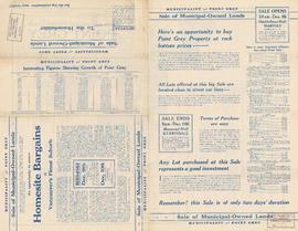
Municipality of Point Grey : sale of municipal-owned lands

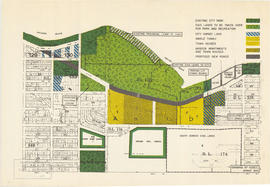
Sale of municipal lands : Point Grey : map showing location of lots to be sold
![Plan of Point Grey Municipality [ward boundaries]](/uploads/r/null/a/c/a/aca691b3d6e49d092070fc230a88f5ca7bd346fc8c5894892d7cdc5a79b535ee/9a14b192-1858-43aa-ab28-d0b03a2304eb-MAP360_142.jpg)
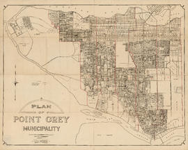
Plan of Point Grey Municipality [ward boundaries]

Plan of government subdivision at Point Grey, B.C.

Lot numbers, boundaries, railway lines and street names in the municipality of Point Grey

Plan of Point Grey Municipality

Plan of sub-division of lot 2027, group 1, New Westminster District, B.C., to be sold by public auction at Vancouver, B.C.

Vancouver, British Columbia : south-westerly portion, formerly Point Grey : major street plan

Rezoning application map (Point Grey Road)

Vancouver Harbour : Sheet 2 (Point Grey to Second Narrows)

Point Grey, B.C. : district map

North Arm of the Fraser River : Ione Island sheet

Redevelopment plan for Jericho Department of National Defence lands

Plan of Point Grey Municipality


![Plan of Point Grey Municipality [ward boundaries]](/uploads/r/null/a/c/a/aca691b3d6e49d092070fc230a88f5ca7bd346fc8c5894892d7cdc5a79b535ee/9a14b192-1858-43aa-ab28-d0b03a2304eb-MAP360_142.jpg)


