Showing 9 results

Archival description
Vancouver (B.C.) Pictorial maps
Print preview View:

4 results with digital objects Show results with digital objects

Vancouver, Canada

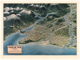
Item is a map of the Lower Mainland from the City of Vancouver east to Port Coquitlam, including the North Shore municipalities, Vancouver, Burnaby, New Westminster, the western portion of Port Coquitlam, Richmond, and the northern portion of Surrey. The pictorial map is in the form of an oblique aerial view oriented to the E/NE.

Vancouver, B.C.

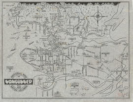
Map shows major roads, parks, landmarks and tourist attractions in Vancouver and parts of West Vancouver, North Vancouver and Burnaby. The map shows the area from Grouse Mountain in the north to Vancouver International Airport in the south and from Burnaby Lake in the east to Lighthouse Park and the University Endowment Lands in the west

Panoramic view of the City of Vancouver, British Columbia, 1898

Item is a map showing an oblique aerial eye view of Vancouver, including Burrard Inlet, Upper False Creek Flats and False Creek. Streets, buildings and businesses are identified. Inset shows location of the Vancouver City foundry, Machine Works and Sugar Refinery. The map includes pictorial representations of buildings, industrial activity around Burrard Inlet, watercraft and vegetation. The perspective view of the map is to the south/south-east.

The map was originally included as a supplement to the Daily World newspaper.