
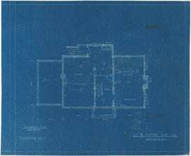
Ground floor plan
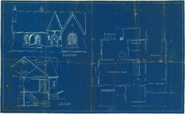
Elevation, section and basement plan
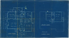
First and second floor plans
![Bungalow for C. [Cline] Singleton, Vancouver, B.C.](/uploads/r/null/0/e/8/0e8f1fe401cffa704dd33be7ad6a0d055f7ec516ba1d63dd924193e18c708652/396919ff-1214-495c-861e-1b7aa2dada84-1987-017_142.jpg)
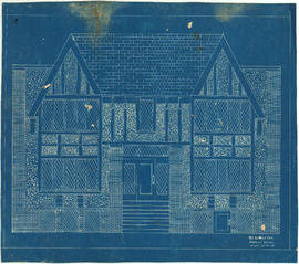
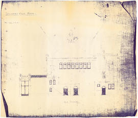
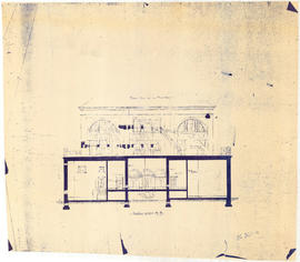
Bungalow for C. [Cline] Singleton, Vancouver, B.C.

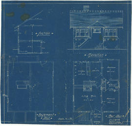
Front elevation and section
Basement plan

Ground floor plan

First floor plan
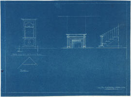
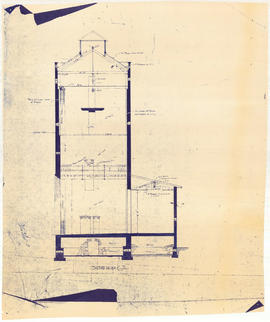
China cabinet, fireplace and staircase elevations
Front elevation : Leyland Apartments 916 West Broadway

Floor plans for unidentified house
![Parsons [?] house, North Vancouver](/uploads/r/null/4/d/1/4d1a653fefee3c4d6bdc3e7b5e7b6a293edde702a9d6ec8cfa2f60164ee137df/f0773310-1258-409a-85b8-b5f79a6a8dc9-1987-017_142.jpg)
Parsons [?] house, North Vancouver
Drawing for unidentified bungalow

Drawing for unidentified bungalow

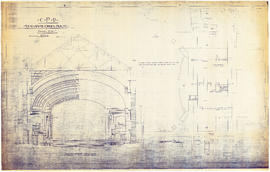
Vancouver Opera House front elevation

Vancouver Opera House half elevation of street front
Vancouver Opera House basement plan
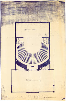
Vancouver Opera House plan of balcony

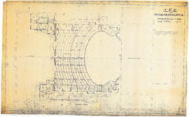
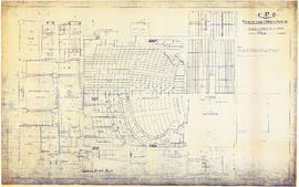
Vancouver Opera House ground floor plan

Vancouver Opera House plan of gallery

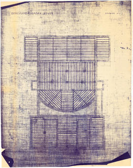
Vancouver Opera House plan of roof timbers

Vancouver Opera House transverse section

Vancouver Opera House longitudinal section
Vancouver Opera House side elevation
Vancouver Opera House section on line A-B
Vancouver Opera House section on line C-D
CPR Vancouver Opera House balcony plan
![CPR Vancouver Opera House elevation to Farrell apartment building [south]](/uploads/r/null/a/5/d/a5d0b51f5ebdb12f52ebe4d7b4789fdeba6d42de6c545267e9cc245f6f760007/f58c68f3-d53f-4433-b4a9-9e9510f429c5-1989-20_142.jpg)
CPR Vancouver Opera House elevation to Farrell apartment building [south]
![CPR Vancouver Opera House elevation to hotel [north]](/uploads/r/null/f/d/3/fd36e9463c257d654596ac0175eda976e793e46e728364441848badc37ba1faf/cd3849c0-8d60-4452-a85c-b4457d6509b1-1989-20_142.jpg)
CPR Vancouver Opera House elevation to hotel [north]
CPR Vancouver Opera House ground floor plan
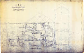
CPR Vancouver Opera House longitudinal section
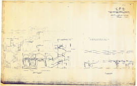
CPR Vancouver Opera House sections A-A and B-B

CPR Vancouver Opera House Gallery plan, ceiling plan and section
CPR Vancouver Opera House transverse section and basement plan

CPR Vancouver Opera House trusses for gallery and balcony

Map and Guide to Vancouver Street Car and Interurban Lines

Vancouver city and suburban lines

False Creek Basin

North-east False Creek Map

Vancouver downtown property map

Plan of the City of Vancouver

Map from the Pacific Ocean across the Rocky Mountain zone

Map to accompany the report on the Exploration Survey of the Canadian Pacific Railway

Sketch plan of the mouth of the Saskatchewan River, from Hinds Exploring Expedition
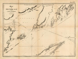
Chart of Thunder Bay. Lake Superior
![Chart of Nepigon [Nipigon] Bay. Lake Superior](/uploads/r/null/e/6/0/e6083525f33c7a6d0dd05f840915433768b0cfaed2c5b564153e3bfb5830f77e/8dd4e8d6-c36f-488f-a1bb-7aea7e098200-LEG1153_142.jpg)
Chart of Nepigon [Nipigon] Bay. Lake Superior

Plan of the Kaminstiquia River and Plan showing survey and soundings of Lake Ellen and Nipigon Bay

Chart of the coast of British Columbia, north of latitude 51 degrees

Top left plate
Top right plate