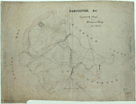
Sketch showing traffic plan for night functions in Stanley Park during Golden Jubilee period
- AM1594-: MAP 623a
- Item
- May 7, 1936
Part of City of Vancouver Archives technical and cartographic drawing collection
Item is a map showing provisions for parking, traffic movement, and pedestrian movement for special events related to the City's Golden Jubilee held in Stanley park. Restricted areas, pedestrian crossings, locations of police traffic officers, ticket collectors and fences and gates to be erected are shown.
Vancouver (B.C.). Engineer's Office
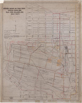
![False Creek development : san [sanitary] sewers tentative layout](/uploads/r/null/c/a/ca111eaa497f59a66ecdad4c91bfb2238f21efb21b91a1172f460ef16667055f/4da08847-7457-4d4c-8938-e4c6c1dc50c3-MAP692_142.jpg)