City of Vancouver, British Columbia [sectional map]
Map of City of Vancouver, British Columbia [index map]
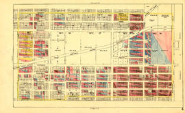
Sheet 23 : Stanley Park to Granville Street and Robson Street to False Creek
Sheet 3 : Slocan Street to Boundary Road and Seventh Avenue to Charles Street
Sheet V and Z : Milton Street to Heather Street and Seventy-second Avenue to Fraser River ; Angus Drive to Granville Street and South West Marine Drive to Fraser River
Sheet 17 : Argyle Street to Vivian Street and Sixty-second Avenue to Kent Street
Sheet 12 : Ontario Street to Clark Drive and Keefer Street to Second Avenue
Sheet 4 : Slocan Street to Boundary Road and Seventh Avenue to Seventeenth Avenue
Sheet 3 : Slocan Street to Boundary Road and Seventh Avenue to Charles Street
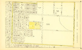
Sheet Q : Churchill Street to Cambie Street and Thirty-eighth Street to Forty-ninth Avenue
Sheet 7 : Cambie Street to St. George Street and Thirty-seventh Avenue to Forty-eighth Avenue
Sheet 14 : Ash Street to St. George Street and Marine Drive to Fraser River
Sheet 12 : Prince Edward Street to Bruce Street and Forty-seventh Avenue to Fifty-eighth Avenue
Sheet 8 : Prince Edward Street to Bruce Street and Thirty-fifth Avenue to Forty-seventh Avenue
Sheet 15 : Ash Street to St. George Street and Fifty-eighth Avenue to Marine Drive
Sheet 16 : St. George Street to Argyle Street and Fifty-eighth Avenue to Fraser River
Sheet 1 : Slocan Street to Boundary Road and Triumph Street to Burrard Inlet
Sheet 4 : Prince Edward Street to Bruce Street and King Edward Avenue to Thirty-sixth Avenue


![Map of City of Vancouver, British Columbia [index map]](/uploads/r/null/b/e/be22a39bcaa01b0f0dd6d2209e1cb4ee3e1df2f15c6c663490403764c2eba017/98bf421f-34d4-4017-9cfd-a46b85bfefa8-MAP343_142.jpg)


![Map of City of Vancouver, British Columbia [index map]](/uploads/r/null/b/4/b4070d13913e90841a24384f7c94ab9f22595ff9bde62429edb46fd5ed60a75a/f4bb676f-1639-4811-82bf-2a0d4defd87e-MAP779_142.jpg)


![City of Vancouver, British Columbia [index map]](/uploads/r/null/d/4/d4fc7ef393680c6515927aa960de863e6fd9e846c3fac12499691549673dc4b7/eed36b0b-2e63-48f2-a7ee-02ed3de937b9-MAP682_142.jpg)


