
Sheet 73 : Quebec Street to Inverness Street and Fifty-seventh Avenue to Forty-seventh Avenue
- AM1594-MAP 341-: MAP 341.71
- Item
- [1962?], with revisions to Mar. 1967
Part of City of Vancouver Archives technical and cartographic drawing collection
Item is a section showing the area from Quebec Street to Inverness Street and Fifty-seventh Avenue to Forty-seventh Avenue. Includes streets, blocks, lots and legal descriptions, and the locations of schools and parks.
Vancouver (B.C.). Engineering Services


![[Sheet 7 : Burrard Street to Main Street and Georgia Viaduct to Burrard Inlet]](/uploads/r/null/c/d/cd235086cbaf81487b8784fb32b6ef913f4fe27305678cd1961adf506324c250/8f72f6bd-1013-48ad-a56c-e6269cb6f5a8-MAP339_142.jpg)
![[Sheet 9 : Main Street to Clark Drive and Prior Street to Burrard Inlet]](/uploads/r/null/c/a/ca4b4713bea0118fec812e6258afe5c1efa039db74073214703001a47b00f122/5e0d243a-99ae-42aa-8bb3-4a1abe9e1209-MAP339_142.jpg)
![[Sheet 24 : Jericho Beach to Balaclava Street and Fourth Avenue to Cameron Avenue]](/uploads/r/null/e/7/e737857a87702a8fbd029d7bdb109697279cac537d45931818415e380dd2867c/67258081-9a3b-44c0-9191-8a3719f6c999-MAP339_142.jpg)

![[Sheet 40 : Inverness Street to Nanaimo Street and Twenty-second Avenue to Thirteenth Avenue]](/uploads/r/null/9/3/9367a0c50f6fa513d717a1972b1bac72acde6d41b002fefcf48ddbd8c8122e8a/c7bfac0b-bf44-441b-b059-fd7bbc0bd4a0-MAP339_142.jpg)
![[Sheet 41 : Ontario Street to Inverness Street and Twenty-eighth Avenue to Sixteenth Avenue]](/uploads/r/null/c/2/c22ca2538905633f64373261ce970df6216075ce4de9e22d491c2e212ce17c1f/616ab944-e39a-4c66-abb4-918b17cc3252-MAP339_142.jpg)
![[Sheet 43 : East Boulevard to Oak Street and Laurier Avenue to Fourteenth Avenue]](/uploads/r/null/8/8/8846e3e6c19438103b656786c264d5dcccc37b59de3cf8fa85bb05f01b65d8f9/9fb3d6cb-93e9-48d0-be52-05cc55ad4ec4-MAP339_142.jpg)

![[Sheet 83 : Fremlin Street to Main Street and Southwest Marine Drive to Fifty-seventh Avenue]](/uploads/r/null/3/e/3efc869894db6ec7c88cf96b10cd2cb7f93db04cae7e1f6f35be1ac51c2bdc14/6323fdeb-3ce2-4794-bc7f-691ce81ee431-MAP339_142.jpg)
![[Sheet 86 : Angus Drive to Laurel Street and Seventy-fifth Avenue to Sixty-seventh Avenue]](/uploads/r/null/6/e/6efd95dacdad7f8976575767597855d90ccaa34e423b1ba76885d33d2dffb725/8167b0a2-0792-4e60-9755-7a4706830df0-MAP339_142.jpg)
![[Sheet 88 : Macdonald Street to Angus Drive and Edgington Avenue to Fifty-seventh Avenue]](/uploads/r/null/5/9/595b991e091f624b5f74507db063dddb150624fbef03fe1d577f8d7a32bb9088/8afa1350-f31b-43bd-a14f-0ea9082c21fe-MAP339_142.jpg)
![[Sheet 6 : Nicola Street to Beatty Street and English Bay Beach to Georgia Street]](/uploads/r/null/f/2/f2effc97084427c0bd73bae3566d3ad910caaa6e7fb3e5ed9f3ece81bd2ac0a1/f2cc48a6-1195-4dd8-8227-71d36d1791bb-MAP339_142.jpg)
![[Sheet 33 : Clark Drive to Nanaimo Street and Thirteenth Avenue to Second Avenue]](/uploads/r/null/5/e/5ef811f96e8c284708c2b73dafde35219a65ddca967ebd7473adfc3e76a171d6/a1b4e29f-54ea-431a-8eff-df608d7e60ff-MAP339_142.jpg)
![[Sheet 39 : Kingsway and Nanaimo Street to Rupert Street and Ward Street to Twenty-second Avenue]](/uploads/r/null/0/4/0409c276b1c046750a9680e1310ce46ec18fce0f1dfc928aab80fbe273730918/665972e9-723b-462b-b30f-95f1484b2c51-MAP339_142.jpg)
![[Sheet 47 : Camosun Street to Blenheim Street and Thirty-third Avenue to King Edward Avenue]](/uploads/r/null/5/9/59c6b01a85dc6051f7cfecf1f33eb7e7017beb24d0dd57b512fcddc2063e3e8f/eabe5a9f-362b-46a4-9efc-275f9b96459b-MAP339_142.jpg)
![[Sheet 53 : Inverness Street to Nanaimo Street and Forty-first Avenue to Thirty-second Avenue]](/uploads/r/null/a/9/a9fdfc1181cd3a36ad078c24a5892d8bfc60c5456733839fa59914d5700e6509/5f8f4fc4-26e4-49f3-b5d4-acced16d8490-MAP339_142.jpg)

![[Sheet 58 : Inverness Street to Nanaimo Street and Forty-ninth Avenue to Forty-first Avenue]](/uploads/r/null/5/5/55825f5529a2ab4a1b9c04e6d086f342c86830cc9828262a5f7b22eab255b346/4ce8baf7-a89b-4c24-bec2-d1a45477ca67-MAP339_142.jpg)
![[Sheet 60 : Oak Street to Quebec Street and Forty-sixth Avenue to Thirty-seventh Avenue]](/uploads/r/null/b/5/b5e1b3fe1dda55eb9d0029fcbe47cb6048a48720c1ad1f7b1897640d35203319/e097b4d6-7a5c-41bc-9ca5-1b9e7b57eccc-MAP339_142.jpg)
![[Sheet 63 : Carnarvon Street to Cypress Street and Forty-first Avenue to Thirty-third Avenue]](/uploads/r/null/4/3/43f21afad72cf7d769c23be0a8b778e288335df1801a3b9d42bace4e74c8ea1a/64b6fa50-ede8-4087-81fc-6b7da9b7dfd1-MAP339_142.jpg)
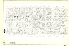
![[Sheet 64 : Balaclava Street to Cypress Street and Forty-ninth Avenue to Forty-first Avenue]](/uploads/r/null/6/d/6d41bb5db0383d13fdc92e51638fb1e2c9ac8e11a664fd9070ee16be3212d8f5/07989ba9-42ff-4d9a-ac56-a25405a93120-MAP339_142.jpg)
![[Sheet 5 : Stanley Park to Nicola Street and English Bay Beach to Robson Street]](/uploads/r/null/1/d/1daf1ff2196704e4e82a6b5c7476ee3e8a46b4e0740f3c37f3f58813f5f8b5f0/ee3a2706-4ebe-4ee8-b4db-da89840c7f89-MAP339_142.jpg)