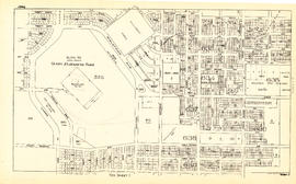
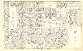
Print preview Close

Showing 216 results

Archival description
City of Vancouver Archives technical and cartographic drawing collection Streets English
Print preview View:

190 results with digital objects Show results with digital objects

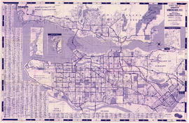
Map of Vancouver, Burnaby, New Westminster, British Columbia : street index and advertisements

Part contains a street index for the main map of Vancouver on the other side of the sheet, advertisements for Bekins Moving and Storage and Allied Van Lines, and three maps showing the companies' service areas in the United States, Canada, and British Columbia and Alberta. An annotation reads: "Oppenheimer collection."

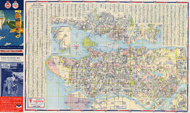
B.C. Electric guide to Greater Vancouver : Richmond transit system, downtown Vancouver transit system, street index, and general information

Part contains maps of the Richmond and downtown Vancouver transit systems, a street index to the Greater Vancouver map on the other side of the sheet, information on B.C. Electric transit routes, and general tourist information.

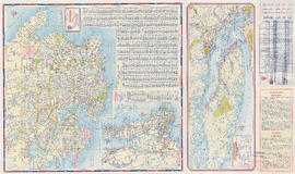
Metropolitan areas of Vancouver and Victoria, B.C. road map

Item is road map designed to be folded into a pamphlet and containing three maps showing streets in Greater Vancouver, major roads from the North Shore to Bellingham, Washington, and major roads in and around Victoria. Item also includes information about traffic rules in Vancouver and the use of the imperial gallon in British Columbia.

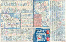
Map of West Vancouver and North Vancouver, street index, real estate information, and list of golf courses

Part contains an illustrated map of West Vancouver and North Vancouver showing major streets, mountains, rivers and creeks, and recreational attractions; a street index to the Greater Vancouver map on the other side of the sheet; a list of golf courses; and real estate information including a description of professional realtors, an amortization table, and calculations showing amounts paid in rent over many years.

Sheet S.V. 4 : Ash Street to St. George Street and Fifty-first Avenue to Sixty-third Avenue

Item is a section showing the area from Ash Street to St. George Street and Fifty-first Avenue to Sixty-third Avenue. Includes streets, roads, blocks, lots, legal descriptions, parks, golf courses, hospitals and schools.

Vancouver (B.C.). Office of the City Engineer

Sheet S.V. 8 : Prince Edward Street to Argyle Street and Forty-seventh to Fifty-eighth Avenue

Item is a section showing the area from Prince Edward Street to Argyle Street and Forty-seventh to Fifty-eighth Avenue. Includes streets, roads, blocks, lots, legal descriptions, parks and schools.

Vancouver (B.C.). Office of the City Engineer

Sheet S.V. 15 : Dawson Street to Boundary Road and Foster Avenue to Fiftieth Avenue

Item is a section showing the area from Dawson Street to Boundary Road and Foster Avenue to Fiftieth Avenue. Includes streets, roads, blocks, lots, legal descriptions, parks and schools. Annotations in pencil.

Vancouver (B.C.). Office of the City Engineer

Sheet S.V. 11 : Fleming Street to Killarney Street and Thirty-seventh Avenue to Forty-eighth Avenue

Item is a section showing the area from Fleming Street to Killarney Street and Thirty-seventh Avenue to Forty-eighth Avenue. Includes streets, roads, blocks, lots, legal descriptions, parks and schools. Annotations in green pencil. Annotations in ink and pencil.

Vancouver (B.C.). Office of the City Engineer

Sheet S.V. 7 : Prince Edward Street to Argyle Street and Thirty-fifth Avenue to Forty-seventh Avenue

Item is a section showing the area from Prince Edward Street to Argyle Street and Thirty-fifth Avenue to Forty-seventh Avenue. Includes streets, roads, blocks, lots, legal descriptions, parks, cemeteries, and schools.

Vancouver (B.C.). Office of the City Engineer

Sheet S.V. 9 : St. George Street to Argyle Street and Fifty-eighth Avenue to Fraser River

Item is a section showing the area from St. George Street to Argyle Street and Fifty-eighth Avenue to Fraser River. Includes streets, roads, blocks, lots, legal descriptions, railway lines, parks and schools.

Vancouver (B.C.). Office of the City Engineer

Sheet S.V. 5 : Ash Street to St. George Street and Sixty-third Avenue to Fraser River

Item is a section showing the area from Ash Street to St. George Street and Sixty-third Avenue to Fraser River. Includes streets, roads, blocks, lots, legal descriptions, parks and railway lines.

Vancouver (B.C.). Office of the City Engineer

Sheet S.V. 2 : Cambie Street to St. George Street and Twenty-eighth Avenue to Thirty-eighth Avenue

Item is a section showing the area from Cambie Street to St. George Street and Twenty-eighth Avenue to Thirty-eighth Avenue. Map shows streets, roads, blocks, lots and legal descriptions and the locations of parks, schools, reservoirs and Mountainview Cemetery. Annotations in pencil.

Vancouver (B.C.). Office of the City Engineer

Sheet S.V. 3 : Cambie Street to Prince Edward Street and Thirty-ninth Avenue to Fiftieth Avenue

Item is a section showing the area from Cambie Street to Prince Edward Street and Thirty-ninth Avenue to Fiftieth Avenue. Map shows streets, roads, blocks, lots and legal descriptions, and the locations of parks, schools, golf courses and Mountainview Cemetery.

Vancouver (B.C.). Office of the City Engineer

City of Vancouver, Vancouver, British Columbia : sectional maps

File consists of three maps of Vancouver: an index to the sectional map sheets, a plan of District Lots in Vancouver, and a sectional map in 62 sheets. The sectional map sheets show streets and roads, blocks, lots, legal descriptions, railways, parks, schools, hospital, cemetery, golf courses, retirement homes, and some businesses.

Vancouver (B.C.). Office of the City Engineer

Sheet S.V. 14 : Duchess Street to Boundary Road and Twenty-ninth Avenue to Fortieth Avenue

Item is a section showing the area from Duchess Street to Boundary Road and Twenty-ninth Avenue to Fortieth Avenue. Includes streets, roads, blocks, lots, legal descriptions, parks, schools and B.C. Electric Railway lines. Annotations in pencil.

Vancouver (B.C.). Office of the City Engineer

Sheet S.V. 6 : Prince Edward Street to Bruce Street and King Edward to Thirty-fifth Avenue

Item is a section showing the area from Prince Edward Street to Bruce Street and King Edward to Thirty-fifth Avenue. Includes streets, roads, blocks, lots, legal descriptions, parks, cemeteries, and schools. Annotations in ink and pencil.

Vancouver (B.C.). Office of the City Engineer

Sheet S.V. 10 : Dumfries Street to Fairmont Street and Twenty-seventh Avenue to Thirty-seventh Avenue

Item is a section showing the area from Dumfries Street to Fairmont Street and Twenty-seventh Avenue to Thirty-seventh Avenue. Includes streets, roads, blocks, lots, legal descriptions, railway lines, parks and schools. Annotations in green pencil.

Vancouver (B.C.). Office of the City Engineer

Sheet S.V. 1 : Cambie Street to Carolina Street and Sixteenth Avenue to Twenty-eighth Avenue

Item is a section showing the area from Cambie Street to Carolina Street and Sixteenth Avenue to Twenty-eighth Avenue. Includes streets, roads, blocks, lots, legal descriptions, parks, nurseries and schools.

Vancouver (B.C.). Office of the City Engineer

Sheet B : Discovery Street to Trutch Street and waterfront to Fourth Avenue

Item is a section showing the area from Discovery Street to Trutch Street and waterfront to Fourth Avenue. Includes streets, roads and sewers; blocks, lots and legal descriptions; and parks and schools. Map shows Jericho Air Station and crown leases.

Vancouver (B.C.). Office of the City Engineer

Sheet S.V. 12 : Fleming Street to Raleigh Street and Forty-eighth Avenue to Newport Avenue

Item is a section showing the area from Fleming Street to Raleigh Street and Forty-eighth Avenue to Newport Avenue. Includes streets, roads, blocks, lots, legal descriptions, parks, golf courses and schools. Annotations in pencil.

Vancouver (B.C.). Office of the City Engineer

Sheet S.V. 13 : Borden Street to Jellicoe Street and Sixtieth Avenue to Fraser River

Item is a section showing the area from Borden Street to Jellicoe Street and Sixtieth Avenue to Fraser River. Includes streets, roads, railway lines, blocks, lots, legal descriptions, parks, golf courses and schools. Annotations in pencil.

Vancouver (B.C.). Office of the City Engineer

Sheet K : Wallace Street to Trafalgar Street and Twenty-seventh Street to Thirty-eighth Avenue

Item is a section showing the area from Wallace Street to Trafalgar Street and Twenty-seventh Street to Thirty-eighth Avenue. Includes streets, roads and sewers; blocks, lots and legal descriptions; and parks and schools.

Vancouver (B.C.). Office of the City Engineer

Sheet C : University Endowment Lands to Discovery Street and Fourth Avenue to Sixteenth Avenue

Item is a section showing the area from the University Endowment Lands to Discovery Street and Fourth Avenue to Sixteenth Avenue. Includes streets and roads; blocks, lots and legal descriptions; and parks and schools. Annotations in ink.

Vancouver (B.C.). Office of the City Engineer

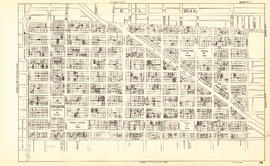
Sheet 14 : Main Street to Knight Street and Fifteenth Avenue to King Edward Street

Item is a section showing the area from Main Street to Knight Street and Fifteenth Avenue to King Edward Street. Includes streets and roads, blocks, lots, legal descriptions, parks, schools and businesses.

Vancouver (B.C.). Office of the City Engineer

Results 1 to 50 of 216