Showing 23 results

Archival description
Cleveland, Ernest Albert Surveys
Print preview View:

23 results with digital objects Show results with digital objects

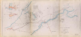
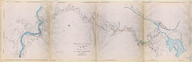
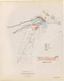
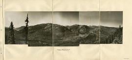
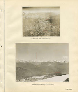
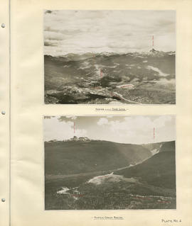
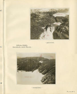
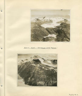
Cheakamus power survey for City of Vancouver 1930-1931. Plan showing proposed development for McGuire & Brandywine [Creek]

Item is a map sheet containing three topographical maps, depicting the Cheakamus River and Brandywine Creek, the dam site at Brandywine Creek ,and the proposed dam site near McGuire. The sheet also includes sectional drawing of the McGuire dam site, as well as charts of pondage at McGuire and Brandywine.

Topographical map of Garibaldi Park

Item is a copy of a Government of British Columbia Lands Department map which has been used as a base map to depict elements of the proposed development. Annotations depict routes of pipleines and tunnels; locations of powerhouses, dams and shafts; and acreages of affected areas.

Cheakamus River valley with possible dam location

Item is a sheet with three maps depicting a possible dam site on the Cheakamus River: a topographical map of the site with the dam location annotated, a cross-section depicting the geology of the dam site, and a profile of the tentative location of a tunnel.

Cheakamus River with proposed dam site at McGuire

Item is a sheet with three maps depicting a possible dam site on the Cheakamus River near McGuire: a topographical map of the site with the dam location annotated, and a cross-section depicting the geology of the dam site.

Topography of proposed dam site

Item is a sheet with two maps depicting a possible dam site on the Cheakamus River: a topographical map of the site with the dam location annotated, and a cross-section depicting the geology of the dam site.

Garibaldi Lake, Daisy Lake and Cheakamus River

Item is a sheet containing the following survey photographs: Stillwater below Daisy Lake; Looking up Cheakamus River from canyon dam site; Leakage from Garibaldi Lake through lava into Garibaldi Creek; Looking up-stream from near Cheakamus Canyon power station; Looking up Cheakamus River from P.G.E. Rlwy. bridge Mile 19.1; Looking up Cheakamus River to Daisy Lake dam site; Looking down Cheakamus river from canyon dam site.