
Indexed guide map of the city of Vancouver and suburbs : map booklet front cover
- AM1594-: MAP 70-: LEG1276.2
- Part
- 1914
Part of City of Vancouver Archives technical and cartographic drawing collection
Indexed guide map of the city of Vancouver and suburbs : map booklet front cover
Part of City of Vancouver Archives technical and cartographic drawing collection

Part of City of Vancouver Archives technical and cartographic drawing collection
Part is a page from the booklet accompanying a guide map of Greater Vancouver, and contains a list of hotels in Vancouver.

District lot index and street index (1st Avenue to Campbell Avenue)
Part of City of Vancouver Archives technical and cartographic drawing collection
Part contains two pages from the booklet accompanying a guide map of Greater Vancouver.

Street index (Campbell Street to Rosser Avenue)
Part of City of Vancouver Archives technical and cartographic drawing collection
Part contains two pages from the booklet accompanying a guide map of Greater Vancouver.

Street index (Royal Oak Avenue, Vancouver to Frederick Road, North Vancouver)
Part of City of Vancouver Archives technical and cartographic drawing collection
Part contains two pages from the booklet accompanying a guide map of Greater Vancouver. Pages include the last portion of the Vancouver and Burnaby street index, the New Westminster street index, and the North Vancouver street index from 1st Street to Frederick Road.

Street index (Gibson Street to William Street) and tram stations
Part of City of Vancouver Archives technical and cartographic drawing collection
Part is a page from the booklet accompanying a guide map of Greater Vancouver, and contains the last portion of the North Vancouver street index, the West Vancouver street index, and a list of Vancouver tram stations.
Indexed guide map of the city of Vancouver and suburbs : map booklet back cover
Part of City of Vancouver Archives technical and cartographic drawing collection
Map of West Vancouver and vicinity : verso
Part of City of Vancouver Archives technical and cartographic drawing collection
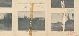
Part contains promotional images of West Vancouver and an advertisement for R.P. Matheson Advertising Service.

Indexed guide map of the city of Vancouver and suburbs
Part of City of Vancouver Archives technical and cartographic drawing collection
Part is a map showing district lots, blocks, and boundaries between the City of Vancouver, Point Grey, South Vancouver, Burnaby, New Westminster, and parts of Richmond, North Vancouver and West Vancouver. Concentric circles indicate the distance in miles from the intersection of Main Street and Hastings Street in intervals of 1/2 mile.

Map of West Vancouver and vicinity
Part of City of Vancouver Archives technical and cartographic drawing collection
Part contains a map of West Vancouver, North Vancouver, and the northern parts of Vancouver and Burnaby. Map shows district lot and block numbers, streets, and distances from City Hall.

Part of City of Vancouver Archives technical and cartographic drawing collection
Item is a map of Greater Vancouver annotated to show ward boundaries. Base map shows streets, some district lot numbers, and distances from City Hall. A smaller detail map shows Granville Island.

Plan of the City of Vancouver, B.C.
Part of City of Vancouver Archives technical and cartographic drawing collection
Item is a map of the old City of Vancouver south to 16th Avenue. The map depicts District Lots and blocks, railway lines, street car lines, industrial areas, parks, postal information, schools, property boundaries.

Plan of Point Grey Municipality
Part of City of Vancouver Archives technical and cartographic drawing collection
Item is a map showing streets, district lot, and block numbers and has been annotated to show locations of American elm trees along streets. Further annotations identify locations of trees that have been sprayed or are to be sprayed.

Plan of West Vancouver Municipality
Part of City of Vancouver Archives technical and cartographic drawing collection
Item is a map showing land subdivisions in West Vancouver, and annotated by J. S. Matthews with historic names and locations. A small key map shows the location covered by the primary map in relation to the rest of the Lower Mainland.
![Plan of Point Grey Municipality [ward boundaries]](/uploads/r/null/a/c/a/aca691b3d6e49d092070fc230a88f5ca7bd346fc8c5894892d7cdc5a79b535ee/9a14b192-1858-43aa-ab28-d0b03a2304eb-MAP360_142.jpg)
Plan of Point Grey Municipality [ward boundaries]
Part of City of Vancouver Archives technical and cartographic drawing collection
Item is a copy of a commercially published map of Point Grey which has been used as a base map to depict existing and proposed new ward boundaries for Point Grey municipality.

Plan of the City of Vancouver, B.C.
Part of City of Vancouver Archives technical and cartographic drawing collection
Item is a map which shows city lots and blocks, with street car lines, postal block numbers, and district names shown in red.

Perspective of Greater Vancouver from Grouse Mountain (elevation 4000 ft.)
Part of City of Vancouver Archives technical and cartographic drawing collection
item is an illustrated, map-like pictorial view of Greater Vancouver. Locations of districts, waterways, beaches, golf courses, principal parks and significant buildings are identified by matching an index list to corresponding letters and numbers on the vertical and horizontal axes along the border of the map.

Municipality of South Vancouver
Part of City of Vancouver Archives technical and cartographic drawing collection
Item is a map showing legal addresses, streets and schools in South Vancouver. A small key plan shows the location of the area covered by the primary map in relation to the rest of the Lower Mainland.

Plan of Point Grey Municipality
Part of City of Vancouver Archives technical and cartographic drawing collection
Item is map of the Municipality of Point Grey and parts of the City of Vancouver showing street car lines, district lot boundaries, postal block numbers and some street names. Map has been annotated with red dots in four locations, but the significance of the dots is unknown.

Municipality of South Vancouver
Part of City of Vancouver Archives technical and cartographic drawing collection
Item is a map sheet; the main map shows District Lots, blocks and lots, street addresses, schools, and a cemetery. The inset map shows electric streetcar lines in from Vancouver to New Westminster.

Indexed guide map of Greater Vancouver and district
Part of City of Vancouver Archives technical and cartographic drawing collection

Commercial map of Greater Vancouver and district
Part of City of Vancouver Archives technical and cartographic drawing collection
Item is a map sheet containing two maps. The principal map depicts greater Vancouver, including portions of North and West Vancouver, Richmond and Surrey. The information depicted on the map includes streets, postal blocks, streetcar and railway lines, parks and golf courses, and schools. The map includes 1/2 mile distance circles centred on old City Hall at Main and Hastings.
The sheet includes an inset map of Granville Island. Depth of water given along shorelines of Burrard Inlet, English Bay, and along the West Vancouver coast from First Narrows to Howe Sound. The sheet includes an index of streets.

Plan of Point Grey Municipality
Part of City of Vancouver Archives technical and cartographic drawing collection
The map is a street map of the Municipality of Point Grey and parts of the City of Vancouver. It shows street car lines, district lot boundaries, postal block numbers and some street names