Print preview Close

Showing 2 results

Archival description
City of Vancouver Archives technical and cartographic drawing collection Garden, Hermon and Burwell, Provincial Land Surveyors Land subdivision
Print preview View:

2 results with digital objects Show results with digital objects

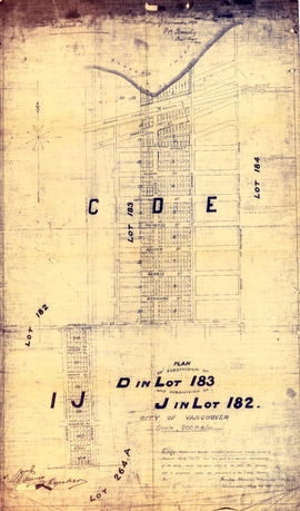
Plan of subdivision of D in lot 183 and subdivision of J in lot 182, City of Vancouver

Item is a subdivision map showing block and lot numbers of subdivisions D and J in lots 183 and 182 respectively. These areas are situated roughly between Burrard Inlet in the north and First Avenue in the south and between Victoria Drive in the east and Clark in the west.

Garden, Hermon and Burwell, Provincial Land Surveyors

Map of part of the New Westminster District shewing the proposed new municipality of Burnaby

Item is a map showing boundaries of a proposed new municipality of Burnaby, which would include all land outside the "old" City of Vancouver between Burrard Inlet and the Fraser River and west of North Road. The map also shows the boundaries of District Lots in this area.

Garden, Hermon and Burwell, Provincial Land Surveyors