![City of Vancouver, British Columbia [index map]](/uploads/r/null/d/4/d4fc7ef393680c6515927aa960de863e6fd9e846c3fac12499691549673dc4b7/eed36b0b-2e63-48f2-a7ee-02ed3de937b9-MAP682_142.jpg)
City of Vancouver, British Columbia [index map]
City of Vancouver, British Columbia [sectional map]
City of Vancouver, British Columbia [sectional map]
City of Vancouver, Vancouver, British Columbia : sectional maps
City of Vancouver, Vancouver, British Columbia : sectional maps

Map of City of Vancouver. British Columbia
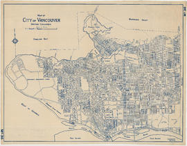
Map of City of Vancouver. British Columbia
![Map of City of Vancouver, British Columbia [index map]](/uploads/r/null/b/4/b4070d13913e90841a24384f7c94ab9f22595ff9bde62429edb46fd5ed60a75a/f4bb676f-1639-4811-82bf-2a0d4defd87e-MAP779_142.jpg)
Map of City of Vancouver, British Columbia [index map]

Plan of a 9.783 acre portion of Kitsilano Indian Reserve, District Lot 3610, Group one, New Westminster District

Plan of a 9.783 acre portion of Kitsilano Indian Reserve, District Lot 3610, Group one, New Westminster District [annotated]

Plan of a 9.783 acre portion of Kitsilano Indian Reserve, District Lot 3610, Group one, New Westminster District [annotated]

Plan of a 9.783 acre portion of Kitsilano Indian Reserve, District Lot 3610, Group one, New Westminster District [annotated]

Plan of district lot boundaries, City of Vancouver, B.C.
![Plan of district lot boundaries, City of Vancouver, B.C. [index map]](/uploads/r/null/9/4/9469805f0ad98fa8c476e2fa1bd641a165448bbfe6840da2ca337894637001a4/9199ff56-1884-4c1f-8d1c-1a513de71a3d-MAP779_142.jpg)
Plan of district lot boundaries, City of Vancouver, B.C. [index map]

Sheet 1 : Cambie Street to Carolina Street and Sixteenth Avenue to Twenty-eighth Avenue

Sheet 1 : Slocan Street to Boundary Road and Triumph Street to Burrard Inlet

Sheet 1: Slocan Street to Boundary Road and Triumph Street to Burrard Inlet

Sheet 10 : Carlton Street to Boundary Road and Fortieth Avenue to Fiftieth Avenue

Sheet 10 : Clark Drive to Slocan Street and waterfront to Triumph Street

Sheet 10 : Clark Drive to Slocan Street and waterfront to Triumph Street

Sheet 11 : Cambie Street to St. George Street and Forty-seventh Avenue to Fifty-eighth Avenue

Sheet 11 : Carrall Street to Clark Drive and waterfront to Keefer Street

Sheet 11 : Carrall Street to Clark Drive and waterfront to Keefer Street

Sheet 12 : Prince Edward Street to Bruce Street and Forty-seventh Avenue to Fifty-eighth Avenue

Sheet 12 : Ontario Street to Clark Drive and Keefer Street to Second Avenue

Sheet 12 : Ontario Street to Clark Drive and Keefer Street to Second Avenue

Sheet 13 : Fleming Street to Carlton Street and Forty-seventh Avenue to Fifty-ninth Avenue

Sheet 13 : Ontario Street to Clark Drive and First Avenue to Sixteenth Avenue

Sheet 13 : Ontario Street to Clark Drive and First Avenue to Sixteenth Avenue

Sheet 14 : Ash Street to St. George Street and Marine Drive to Fraser River

Sheet 14 : Main Street to Knight Street and Fifteenth Avenue to King Edward Street

Sheet 14 : Main Street to Knight Street and Fifteenth Avenue to King Edward Street

Sheet 15 : Ash Street to St. George Street and Fifty-eighth Avenue to Marine Drive

Sheet 15 : Oak Street to Main Street and False Creek to Sixteenth Avenue

Sheet 15 : Oak Street to Main Street and False Creek to Sixteenth Avenue

Sheet 16 : Maple Street to Oak Street and False Creek to Sixteenth Avenue

Sheet 16 : Maple Street to Oak Street and False Creek to Sixteenth Avenue

Sheet 16 : St. George Street to Argyle Street and Fifty-eighth Avenue to Fraser River

Sheet 17 : Argyle Street to Vivian Street and Sixty-second Avenue to Kent Street

Sheet 17 : Trutch Street to Maple Street and Fourth Avenue to Sixteenth Avenue

Sheet 18 : Trutch Street to Maple Street and English Bay to Third Avenue

Sheet 18 : Vivian Street to Boundary Road and Sixty-fifth Avenue to Fraser River

Sheet 19 : Maple Street to Richards Street and Drake Street to Third Avenue

Sheet 2 : Slocan Street to Boundary Road and Charles Street to Triumph Street

Sheet 2: Slocan Street to Boundary Road and Charles Street to Triumph Street

Sheet 20 : Granville Street to Ontario Street and Robson Street to Sixth Avenue

Sheet 21 : Burrard Street to False Creek and waterfront to Robson Street

Sheet 22 : Stanley Park to Burrard Street and waterfront to Robson Street

Sheet 22 : Stanley Park to Burrard Street and waterfront to Robson Street

Sheet 23 : Stanley Park to Granville Street and Robson Street to False Creek

Sheet 23 : Stanley Park to Granville Street and Robson Street to False Creek

Sheet 3 : Slocan Street to Boundary Road and Seventh Avenue to Charles Street