A pic-tour map of Vancouver, B.C., Canada
Add to clipboard
A pic-tour map of Vancouver, B.C., Canada
A souvenir and correct map of the location of all the fair buildings of the Vancouver Exhibition
Add to clipboard
A souvenir and correct map of the location of all the fair buildings of the Vancouver Exhibition
A student to-day, a citizen tomorrow
Add to clipboard
A student to-day, a citizen tomorrow
Add to clipboard
An Indian map. Vancouver
B.C. Electric guide to Greater Vancouver
Add to clipboard
B.C. Electric guide to Greater Vancouver
B.C. Electric guide to Greater Vancouver
Add to clipboard
B.C. Electric guide to Greater Vancouver
Add to clipboard
B.C. Electric plan showing bus stops in Vancouver
B.C. Electric Railway lines completed and under construction
Add to clipboard
B.C. Electric Railway lines completed and under construction
B.C. Electric Rly. Co. Ltd. plan showing transit services in Vancouver city as at end of 1951
Add to clipboard
B.C. Electric Rly. Co. Ltd. plan showing transit services in Vancouver city as at end of 1951
Bird's eye view of Vancouver, B.C.
Add to clipboard
Bird's eye view of Vancouver, B.C.
British Columbia Electric Railway Company systems : Vancouver Island, Lower Mainland, Vancouver and New Westminster; Alouette-Stave development, present and projected
Add to clipboard
British Columbia Electric Railway Company systems : Vancouver Island, Lower Mainland, Vancouver and New Westminster; Alouette-Stave development, present and projected
Bus routes, city of Vancouver, November 26th, 1937
Add to clipboard
Bus routes, city of Vancouver, November 26th, 1937
Canadian National Railways mountain region : Vancouver, B.C.
Add to clipboard
Canadian National Railways mountain region : Vancouver, B.C.
Add to clipboard
Canadian Pacific Railway. Plan of part of branch line from Port Moody. A point on main line C.P.R. to English Bay, B.C.
Add to clipboard
Chinatown existing
Add to clipboard
Chinatown existing
Circulation map of Greater Vancouver by telephone exchange areas
Add to clipboard
Circulation map of Greater Vancouver by telephone exchange areas
Add to clipboard
City of Vancouver
Add to clipboard
City of Vancouver
Add to clipboard
City of Vancouver
Add to clipboard
City of Vancouver
City of Vancouver
Add to clipboard
City of Vancouver
Add to clipboard
City of Vancouver
City of Vancouver : Canadian Pacific town site
Add to clipboard
City of Vancouver : Canadian Pacific town site
Add to clipboard
City of Vancouver : east half
City of Vancouver : Residential lots, Area B, Champlain Heights
Add to clipboard
City of Vancouver : Residential lots, Area B, Champlain Heights
Add to clipboard
City of Vancouver : west half
City of Vancouver; British Columbia;
Add to clipboard
City of Vancouver; British Columbia;
Add to clipboard
City of Vancouver [park sites June/80]
City of Vancouver, B.C., Canada, 1908
Add to clipboard
City of Vancouver, B.C., Canada, 1908
Add to clipboard
City of Vancouver, British Columbia
Add to clipboard
City of Vancouver, British Columbia
Add to clipboard
City of Vancouver, British Columbia
Add to clipboard
City of Vancouver, British Columbia : co-ordinate street index map 12
Add to clipboard
City of Vancouver, British Columbia [index map]
Add to clipboard
City of Vancouver, Canadian Pacific Town Site
Cityscape: A map of downtown Vancouver
Add to clipboard
Cityscape: A map of downtown Vancouver
Commercial Map of Greater Vancouver and District [BC]
Add to clipboard
Commercial Map of Greater Vancouver and District [BC]
Add to clipboard
Composite aerial mosaic of metropolitan Vancouver
Composite industrial map of the metropolitan area, Lower Mainland, British Columbia
Add to clipboard
Composite industrial map of the metropolitan area, Lower Mainland, British Columbia
Corporation of Point Grey : topographical plan of ABCDE D.L. 317 and HIJK D.L. 318 : Marine Drive & Vancouver & Lulu Railway to Fraser River between Angus St. [Drive] & Milton St
Add to clipboard
Corporation of Point Grey : topographical plan of ABCDE D.L. 317 and HIJK D.L. 318 : Marine Drive & Vancouver & Lulu Railway to Fraser River between Angus St. [Drive] & Milton St
Devonshire Block 41
Add to clipboard
Devonshire Block 41
Dial map of the city of Vancouver including the adjacent municipalities
Add to clipboard
Dial map of the city of Vancouver including the adjacent municipalities
Add to clipboard
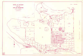
District lot boundaries with the City of Vancouver, British Columbia
Add to clipboard
District lot boundaries with the City of Vancouver, British Columbia, D.L. map 40
Add to clipboard
D.L. 301 - Ward 8 [location of water pipes and hydrants]
D.L. 301 - Ward 8 [water pipes and hydrants]
Add to clipboard
D.L. 301 - Ward 8 [water pipes and hydrants]
Downtown Peninsula; Vancouver, B.C. Canada; Lines at 100 Foot Intervals; Datum Line 100
Add to clipboard
Downtown Peninsula; Vancouver, B.C. Canada; Lines at 100 Foot Intervals; Datum Line 100
Existing service stations, retail shopping centres and commercial zoning
Add to clipboard
Existing service stations, retail shopping centres and commercial zoning
Fairview
Add to clipboard
Fairview


![City of Vancouver [park sites June/80]](/uploads/r/null/9/4/9484add7c4684ea3838e4d00ee8add3ecf85d78d5aa8fe2780cae273e59556a5/bd2464d8-2aa9-4501-aba6-8b3f7d130a42-MAP1032_142.jpg)


![City of Vancouver, British Columbia [index map]](/uploads/r/null/d/4/d4fc7ef393680c6515927aa960de863e6fd9e846c3fac12499691549673dc4b7/eed36b0b-2e63-48f2-a7ee-02ed3de937b9-MAP682_142.jpg)


![D.L. 301 - Ward 8 [location of water pipes and hydrants]](/uploads/r/null/7/b/7b8914ef9132a2e20fa03008daf1a70f3de861b767043aaf338abaeeb42423d7/ce1965c6-6a58-454c-9630-0fcba30688bf-MAP72_142.jpg)